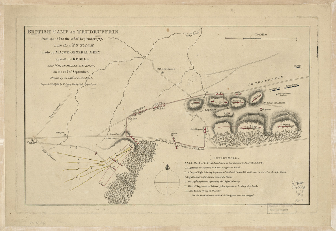
British camp at Trudruffrin from the 18th. to the 21st. of September 1777 : with the attack made by Major General Grey against the rebels near White Horse Tavern on the 20th. of September
This map is also available in American Revolutionary Geographies Online (ARGO), a collections portal especially built for material relating to the American Revolutionary War Era. Visit ARGO to learn more about this item and explore the historical geography of North America in the late eighteenth century.
Item Information
- Title:
- British camp at Trudruffrin from the 18th. to the 21st. of September 1777 : with the attack made by Major General Grey against the rebels near White Horse Tavern on the 20th. of September
- Title (alt.):
-
Trudruffrin
- Name on Item:
-
Drawn by an officer on the spot
- Date:
-
1778
- Format:
-
Maps/Atlases
- Location:
- Library of Congress Geography and Map Division
- Collection (local):
-
Library of Congress Collection
- Subjects:
-
Paoli massacre, 1777--Maps--Early works to 1800
Tredyffrin (Pa. : Township)--History--Maps--Early works to 1800
- Places:
-
Township of Tredyffrin
- Extent:
- 1 map : hand color 26 x 41 cm.
- Terms of Use:
-
No known copyright restrictions.
This work is licensed for use under a Creative Commons Attribution Non-Commercial Share Alike License (CC BY-NC-SA).

- Publisher:
-
[London] :
W. Faden
- Scale:
-
Scale ca. 1:31,680
- Language:
-
English
- Catalog Record:
-
https://lccn.loc.gov/gm71000676
- Notes:
-
Relief shown by hachures.
Includes references.
- Notes (citation):
-
LC Maps of North America, 1750-1789, 1342
- Identifier:
-
ar134200


