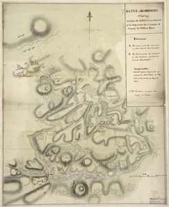
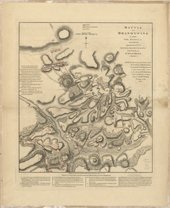
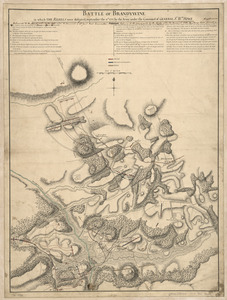
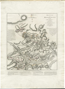
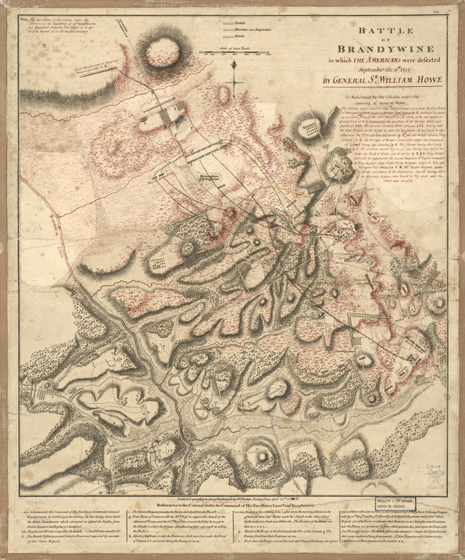
Battle of Brandywine in which the Americans were defeated : September the 11th, 1777 by General Sr. William Howe
This map is also available in American Revolutionary Geographies Online (ARGO), a collections portal especially built for material relating to the American Revolutionary War Era. Visit ARGO to learn more about this item and explore the historical geography of North America in the late eighteenth century.
Item Information
- Title:
- Battle of Brandywine in which the Americans were defeated : September the 11th, 1777 by General Sr. William Howe
- Creator:
- Faden, William, 1749-1836
- Contributor:
- Werner, S. W.
- Date:
-
1784
- Format:
-
Maps/Atlases
- Location:
- Library of Congress Geography and Map Division
- Collection (local):
-
Library of Congress Collection
- Subjects:
-
Chadds Ford Region (Pa.)--Maps--Early works to 1800
Brandywine, Battle of, Pa., 1777--Maps--Early works to 1800
- Places:
-
Delaware (county)Chadds Ford
- Extent:
- 1 map : hand color ; 50 x 44 cm.
- Terms of Use:
-
No known copyright restrictions.
This work is licensed for use under a Creative Commons Attribution Non-Commercial Share Alike License (CC BY-NC-SA).

- Place of origin:
-
London
- Scale:
-
Scale ca. 1:15,300
- Language:
-
English
- Catalog Record:
-
https://lccn.loc.gov/gm71000671
- Notes:
-
Hand colored.
Annotated in red ink on the author's Battle of Brandywine, 1778. Other changes have been made by erasure or by excision of parts and replacement of new paper. Prepared as engraver's copy for a new edition.
"Note: The operations of the column under the command of His Excellency Lt. Gal. Knyphausen are engraved from the plan drawn on the spot by S. W. Werner, Lt. of the Hessian artillery."
- Notes (citation):
-
LC Maps of North America, 1750-1789, 1338
- Identifier:
-
ar133800