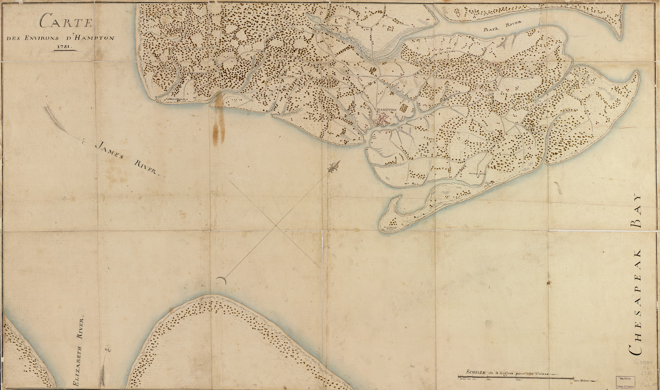
Carte des environs d'Hampton
This map is also available in American Revolutionary Geographies Online (ARGO), a collections portal especially built for material relating to the American Revolutionary War Era. Visit ARGO to learn more about this item and explore the historical geography of North America in the late eighteenth century.
Item Information
- Title:
- Carte des environs d'Hampton
- Date:
-
1781
- Format:
-
Maps/Atlases
Manuscripts
- Location:
- Library of Congress Geography and Map Division
- Collection (local):
-
Library of Congress Collection
- Subjects:
-
Hampton (Va.)--Maps, Manuscript--Early works to 1800
Hampton Roads (Va.)--Maps, Manuscript--Early works to 1800
Newport News (Va.)--Maps, Manuscript--Early works to 1800
- Places:
-
Hampton
Hampton Roads
Newport News
- Extent:
- 1 manuscript map : hand color 56 x 93 cm.
- Terms of Use:
-
No known copyright restrictions.
This work is licensed for use under a Creative Commons Attribution Non-Commercial Share Alike License (CC BY-NC-SA).

- Scale:
-
Scale ca. 1:28,800
- Language:
-
French
- Catalog Record:
-
https://lccn.loc.gov/gm71002167
- Notes:
-
Manuscript, pen-and-ink and watercolor.
Watermark: Fleur de lis surmounting a scroll crossed with three bars.
Oriented with north toward the right.
Relief shown by hachures.
- Notes (citation):
-
LC Maps of North America, 1750-1789, 1450
- Identifier:
-
ar145000


