Toggle navigation
LMEC Home
Exhibitions
Georeferencing
Tools for Teachers
Collections
My Favorites
Sign Up / Log In
Search
Search the map portal
Map Collection
Map Collection
Map Sets
Search
Search
Search for
Search In
All Fields
Creator
Title
Subject
Place
Search All Digital Collections
Advanced Search
544 Results
My Search
Start Over
More Like
commonwealth:q524ng34t
Remove constraint More Like: commonwealth:q524ng34t
Filter your Search
Place
North and Central America
475
United States
351
New York
40
Florida
19
Canada
18
Alabama
15
Chatham (county)
15
Savannah
13
more
Place
»
Topic
Manuscript maps--Early works to 1800
92
Manuscript maps
84
Gulf Coast (U.S.)--Maps, Manuscript--Early works to 1800
12
Fortification--New York (State)--New York--Maps--Early works to 1800
11
New York (N.Y.)--Buildings, structures, etc--Maps, Manuscript--Early works to 1800
9
New York (N.Y.)--Maps, Manuscript--Early works to 1800
8
Saratoga Campaign, N.Y., 1777--Maps, Manuscript--Early works to 1800
8
Coasts--Florida--Maps--Early works to 1800
7
more
Topic
»
Date
Date range begin
–
Date range end
Current results range from
1620
to
1900
View distribution
Creator
Hills, John, (Surveyor)
18
Montrésor, John, 1736-1799
17
Bingham, William, 1752-1804
11
Washington, George, 1732-1799
11
Adlum, John, 1759-1836
10
Faden, William, 1749-1836
7
Morgan, Benjamin, (Draftsman)
7
Wangenheim, Friedrich Adam Julius von
7
more
Creator
»
Format
Maps/Atlases
542
Manuscripts
539
Objects/Artifacts
2
Georeferenced
Yes
6
No
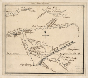
538
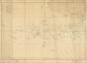
Collection
American Revolutionary War-Era Maps
483
Library of Congress Collection
481
Norman B. Leventhal Map Center Collection
63
Maritime Charts and Atlases
33
Urban Maps
16
Boston and New England Maps
7
Available to use
Creative Commons license
484
No known restrictions
60
Search Constraints
Sort by relevance
relevance
title
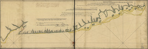
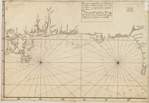
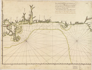
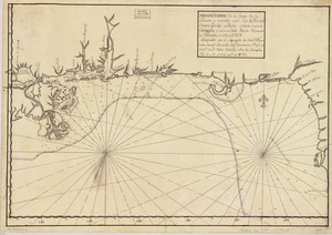
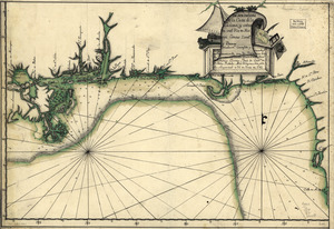
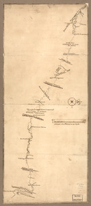
date (asc)
date (desc)
Number of results to display per page
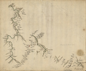
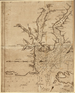
100 per page
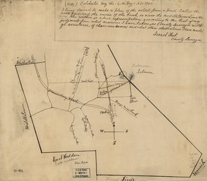
10
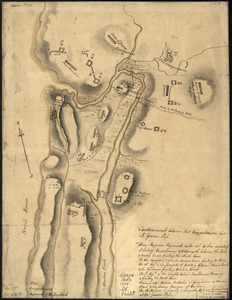
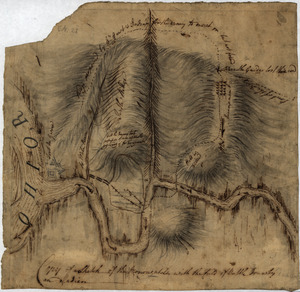
per page
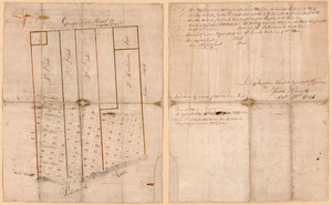
20
per page
50
per page
100
per page
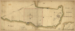
View results as:
grid view
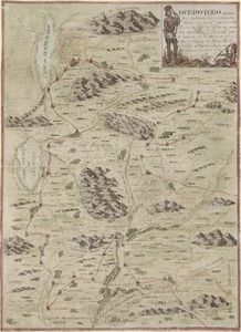
map view
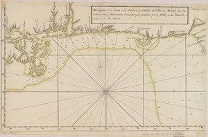
Search Results
101.
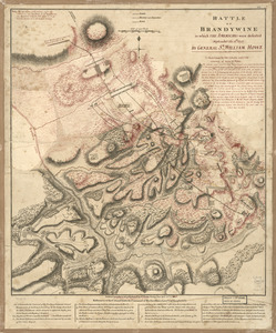
Battle of Brandywine in which the Americans were defeated : September the 11th, 1777 by General Sr. William Howe
102.
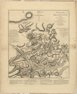
Battle of Brandywine in which the rebels were defeated : September the 11th. 1777, by the army under the command of General Sr....
103.
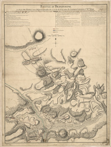
Battle of Brandywine, in which the rebels were defeated : September the 11th 1777, by the army under the command of General Sr....
104.
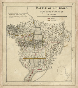
Battle of Guildford fought on the 15 of March 1781
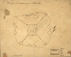
105.
Battle of Guildford fought on the 15th of March 1781
106.
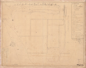
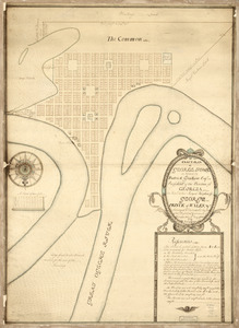
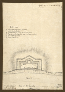
Bay of Pensacola, fortification
107.
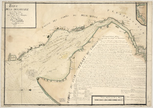
Baye de la Delaware avec les ports, sondes, dangers, bancs, &c. depuis les caps jusqu'a Philadelphie : d'après la carte de...
108.
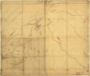
Bend of the Missouri River
109.
Boston & harbour
110.
Boston Harbor, Massachusetts
111.
Braddock's route, 1755, Fort Cumberland to Fort Pitt
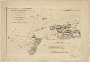
112.
British camp at Trudruffrin from [sic] : with the attack made by Major General Grey against the rebels near White Horse Tavern
113.
British camp at Trudruffrin from the 18th. to the 21st. of September 1777 : with the attack made by Major General Grey against...
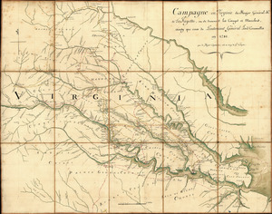
114.
Campagne en Virginie du Major Général M'is de LaFayette : ou se trouvent les camps et marches, ainsy que ceux du Lieutenant...
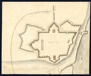
115.
Cantonment of His Majesty's forces in N. America : according to the disposition now made & to be compleated as soon as...
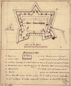
116.
Cantonment of the forces in North America 11th. Octr. 1765
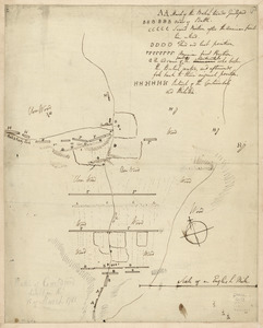
117.
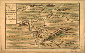
Captain Snow's scetch of the country by himself, and the best accounts he could receive from the Indian traders
118.
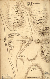
Captain Snow's sketch
119.
Carta esférica de la canal entre Puerto Rico y Santo Domingo
120.
Carta esférica de la Ysla de la Granada
121.
Carta esférica de la Ysla de Tabago
122.
Carta esférica de las yslas de Sn. Martin, Sn. Bartolome y Anguila
123.
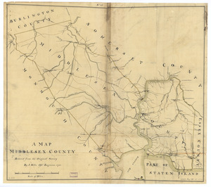
Carta esférica de las Yslas Virgenes
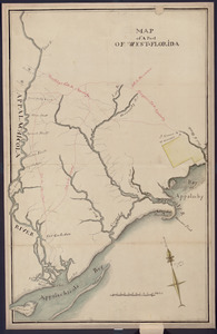
124.
Carta esférica de las Yslas Virgenes
125.
Carta esférica que comprehende la Ysla de Trinidad con sus adyacentes, bajos, sondas y veriles
126.
Carte de la coste de la province de la Louisiane et des bouches du Micissipy ou fleuve St. Louis
127.
Carte de l'affaire de Montmouth : ou le G'al Washington commandon l'armée américaine et le G'l Clinton l'armée angloise le...
128.
Carte de l'entrée du port et rade de Pensacola
129.
Carte des environs d'Hampton
130.
Carte des positions occupeés par les trouppes Américaines apres leur retraite de Rhode Island le 30 Aout 1778
131.
Carte detaillée de West Point sur la rivière d'York au confluent des Rivières de Pamunkey et Matapony
132.
Carte générale de la partie française de l'isle de St. Domingue
133.
Cawanesque
134.
Chart of the sea coast from latitude 27⁰00ʹ00ʺ to 27⁰20ʹ00ʺ, with Little Inlet & River into Hillsborough River ; Chart of the...
135.
Chart of the sea coast from lattde. 26⁰20ʹ00ʺ to 26⁰ & 40ʹ00ʺ with the head of Sharkshead River ; Chart of New Inlet ; Chart of...
136.
Chart showing the depth of the James and York rivers as they enter Chesapeake Bay, with towns adjacent
137.
The coast of Florida from the Dry Tortugas to the old Cape
138.
Colchester, May the: 6:th: Day: A.D.: 1765
139.
Copy of a sketch of the Monongahela, with the field of battle
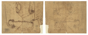
140.
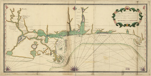
Copy of a survey return'd by Mr. Sam Lewis, surveyor of Botetourt Coun[t]y : Surveyed for George Washington 2950 acres of land...
141.
Costa de Cuba desde Cabo de San Antonio a la bahía de Cardenas
142.
Costa desde la Mobila asta la Bahía de Sn. Josef
143.
Côte de York-town à Boston: Marches de l'armée
144.
Country between North River and Croton River
145.
The course of Delaware River from Philadelphia to Chester, exhibiting the several works erected by the rebels to defend its...
146.
Crown Point & part of Lake Champlain
147.
Cuba, ciudad capittal de la ysla del mismo nombre y su famoso puerto sittuado en la costa del sur de gra. ysla, los 20 grados y...
148.
Derrotero hecho por Antonia Vélez y Escalante, misionero para mejor conocimiento de las misiones, pueblos de indios y...
149.
Descripción de la costa de la Luciana y entrada en el Río de Micisipi con sus sondas y bajos, nuebamente correjido y...
150.
Descripción de la costa de la Luciana y entrada en el Río de Micisipi con sus sondas y bajos nuebamte. corregido y enmendado...
151.
Descripción de la costa de la Luciana y entrada en el Río de Micisipi con sus sondas y bajos, nuebamte. correjido y enmendado...
152.
Descripcion de la costa de Tierra Firme desde el Cavo de la Agusa hasta la Barra de Palmas diga de la Trinidad : Con todas las...
153.
Descripcion de la costa de Tierra Firme desde el Rio de la Empalizada hasta Cavo de Clara : Por las latitudes y longitudes de...
154.
Descripcion de las costas, islas placeres, i bajos delas, Indias Occidentales
155.
Descripción ychonográfica de la ciudad, puerto y bahía de Santiago de Cuba situado en 20⁰6ʹ de latitud norte y en longd. de...
156.
Descripsión de la costa de la Luciana y entrada en el Río de Micisipi con sus zondas y bajos, nuebamente corregidos y...
157.
Descripsión de la costa de la Luciana y entrada en el Río de Micisipi con sus zonds. y baxos, nuebamte. correjido y enmendo...
158.
Design for Governor's Island
159.
Disposition of British troops, with fortifications north of Fort Knipehausen, i.e. Fort Washington to Fort Independence
160.
Done by order of His excellency Montagu Wilmot, Esq. Governor and Commander in Chief of Nova Scotia, &c., &., &
161.
Dotted line map of Washington, D.C., 1791, before Aug. 19th
162.
Draft of roads in New Jersey
163.
Draft of the lands disputed by Philipse Patent against Beekmans & Rambaults
164.
A draught of Delaware Bay
165.
A draught of Lake George, and part of Hudson's River taken September 1756
166.
E. Sugar Creek, Bradford Co
167.
Eight survey tracts along the Kanawha River, W.Va : showing land granted to George Washington and others
168.
The encampment & position of the army under His Excy. Lt. Gl: Burgoyne : at Swords's and Freeman's Farms on Hudsons River near...
169.
The encampment & position of the army under His Excy. Lt. Gl: Burgoyne : at Swords's and Freeman's Farms on Hudsons River near...
170.
The encampment & position of the army under His Excy. Lt. Gl: Burgoyne : at Swords's and Freeman's Farms on Hudsons River near...
171.
The encampment & position of the army under His Excy. Lt. Gl: Burgoyne : at Swords's and Freeman's Farms on Hudsons River near...
172.
L'escadre françoise entrant dans Newport sous le feu des batteries et forcant le passage le 8 Aoust 1778 : jour que les...
173.
Esquisse du plan de la ville du Mole à St. Domingue
174.
An exact-plan of George-Town : so named by Patrick Graham, Esqr., President of the Province of Georgia, in honr. to His Royal...
175.
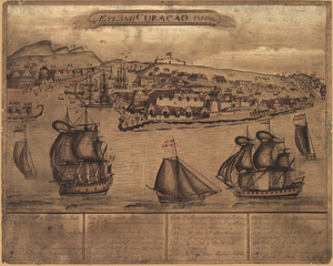
't Eÿland Curacao, anno 1800
176.
Fort Edward to Crown Point
177.
Fort La Fayette on Verplancks Point, with British and Hessian troop positions
178.
Fort Provost in 1782
179.
Fort Washington & vicinity
180.
Fort-Griswold
181.
Frog's Point avec batteries de Partie de Longue Island
182.
From Battle of Brandywine
183.
Ft. Provost in 1781
184.
A general plan of Annapolis Royal
185.
Gov. Tryon's expedition to Danbury, 1777
186.
El Guarico, alias, el cavo Frances, es una de las colonias y puertos qe. poseen los Franceses en la parte occidental de la Ysla...
187.
Havana : Vera Cruz
188.
Indiana Fort Wayne : ms. map of Fort Wayne said to have been made on July 18, 1795, for General Anthony Wayne
189.
The Investiture of Charleston, S.C. by the English army, in 1780 : With the position of each corps
190.
Lake Champlain and Lake George, and the country between the Hudson and the lakes on the west, and Connecticut River on the east
191.
Land ownership map of the William Bingham estate in Potter County, Pennsylvania
192.
Lines run in the Jersies for determining boundaries between that Province & New York
193.
Lord Cornwallis surrender, 1781
194.
A map containing part of the Provinces of New York and New Jersey
195.
A map, Middlesex County
196.
Map of a part of west-Florida : overlay down
197.
Map of a part of west-Florida : overlay up
198.
Map of a route through south west Pennsylvania from Fort Loudon, Franklin Co. to Fort Pitt, Pittsburgh
199.
Map of Alexandria, Virginia
200.
Map of British outposts between Burlington and New Bridge, New Jersey, December 1776
‹ Prev
Next ›
1
2
3
4
5
6


![British camp at Trudruffrin from [sic]](https://bpldcassets.blob.core.windows.net/derivatives/images/commonwealth:q524nb58k/image_thumbnail_300.jpg)


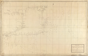


![Chart of the sea coast from latitude 27⁰00ʹ00ʺ to 27⁰20ʹ00ʺ, with Little Inlet & River into Hillsborough River ; Chart of the sea coast from latitude 26⁰40ʹ00ʺ to [27⁰]00ʹ00ʺ, the Leech Shoal & Hillsborough River](https://bpldcassets.blob.core.windows.net/derivatives/images/commonwealth:q524nd97p/image_thumbnail_300.jpg)


![Copy of a survey return'd by Mr. Sam Lewis, surveyor of Botetourt Coun[t]y](https://bpldcassets.blob.core.windows.net/derivatives/images/commonwealth:q524nf40r/image_thumbnail_300.jpg)