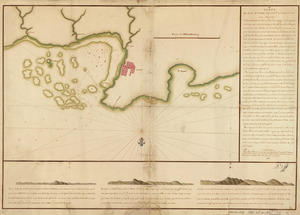
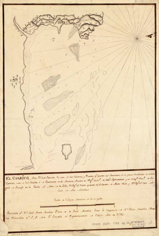
El Guarico, alias, el cavo Frances, es una de las colonias y puertos qe. poseen los Franceses en la parte occidental de la Ysla Española una de la Caribes u de Varlovento en la América, situada en 19 gs. 44 ms. de lattd. septentrional y en 303 gs. 57 ms. de longitud de Tenerife en la vanda del norte de la ysla, 17 legs. al oeste quarta al sudoeste de Monte Chriti y 25 legs. al este del Cavo de San Nicolas
This map is also available in American Revolutionary Geographies Online (ARGO), a collections portal especially built for material relating to the American Revolutionary War Era. Visit ARGO to learn more about this item and explore the historical geography of North America in the late eighteenth century.
Item Information
- Title:
- El Guarico, alias, el cavo Frances, es una de las colonias y puertos qe. poseen los Franceses en la parte occidental de la Ysla Española una de la Caribes u de Varlovento en la América, situada en 19 gs. 44 ms. de lattd. septentrional y en 303 gs. 57 ms. de longitud de Tenerife en la vanda del norte de la ysla, 17 legs. al oeste quarta al sudoeste de Monte Chriti y 25 legs. al este del Cavo de San Nicolas
- Creator:
- Sánchez, Josef María
- Contributor:
- Real Escuela de Navegación (Cádiz, Spain)
- Name on Item:
-
Delineado pr. Dn. Josef María Sánchez, pilotin de la Real Armada, vaxo la corrección de Dn. Pedro Revelles, maestro delineador pr. S. M. de la Rl. Escuela del Departamento de Cádiz, año de 1783
- Date:
-
1783
- Format:
-
Maps/Atlases
Manuscripts
- Location:
- Library of Congress Geography and Map Division
- Collection (local):
-
Library of Congress Collection
- Subjects:
-
Cap-Haïtien Region (Haiti)--Maps, Manuscript--Early works to 1800
Coasts--Haiti--Cap-Haïtien Region--Maps--Early works to 1800
Atlantic Coast (Haiti)--Maps, Manuscript--Early works to 1800
- Places:
-
NordCap-Haïtien
- Extent:
- 1 manuscript map : hand color 38 x 34 cm.
- Terms of Use:
-
No known copyright restrictions.
This work is licensed for use under a Creative Commons Attribution Non-Commercial Share Alike License (CC BY-NC-SA).

- Scale:
-
Scale ca. 1:18,880
- Language:
-
Spanish
- Catalog Record:
-
https://lccn.loc.gov/74692139
- Notes:
-
Manuscript, pen-and-ink.
Watermark: IV.
Prime meridian: Tenerife.
Oriented with north toward the upper right.
Mounted on cloth backing.
Maggs number annotated in pencil in lower right corner: 46.
Relief shown pictorially. Depths shown by soundings.
- Notes (citation):
-
LC Luso-Hispanic World, 462
LC Maps of North America, 1750-1789, 1880
- Identifier:
-
lh000462