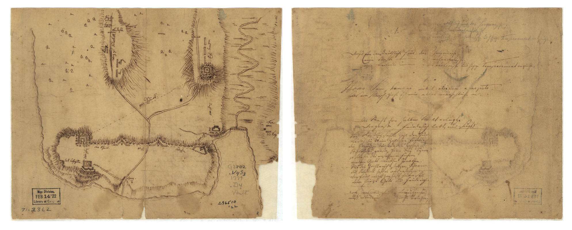
Fort La Fayette on Verplancks Point, with British and Hessian troop positions
This map is also available in American Revolutionary Geographies Online (ARGO), a collections portal especially built for material relating to the American Revolutionary War Era. Visit ARGO to learn more about this item and explore the historical geography of North America in the late eighteenth century.
Item Information
- Title:
- Fort La Fayette on Verplancks Point, with British and Hessian troop positions
- Title (alt.):
-
Fort La Fayette on Verplancks Point
- Creator:
- Krafft, Johann Carl Philipp von, 1752-1804
- Date:
-
[1779?]
- Format:
-
Maps/Atlases
Manuscripts
- Location:
- Library of Congress Geography and Map Division
- Collection (local):
-
Library of Congress Collection
- Subjects:
-
Verplanck Point, N.Y--Maps, Manuscript--Early works to 1800
- Places:
-
Westchester (county)Verplanck Point (cape)
- Extent:
- 1 manuscript map, on sheet 20 x 25 cm.
- Terms of Use:
-
No known copyright restrictions.
This work is licensed for use under a Creative Commons Attribution Non-Commercial Share Alike License (CC BY-NC-SA).

- Scale:
-
Scale ca. 1:2,500
- Language:
-
English
German
- Catalog Record:
-
https://lccn.loc.gov/gm71002362
- Notes:
-
Manuscript, pen-and-ink; with writing partly in German script and partly in English.
Has watermark.
Ascription of authorship through label on old folder.
Proverbs in German and Latin on verso.
- Notes (citation):
-
LC Maps of North America, 1750-1789, 1197
- Identifier:
-
ar119700z


