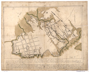
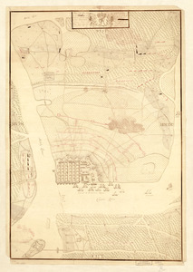
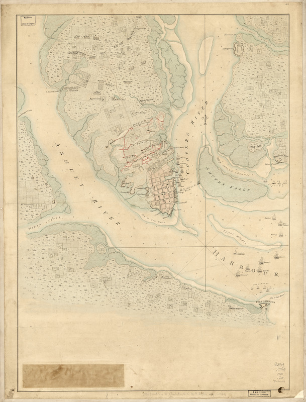
The Investiture of Charleston, S.C. by the English army, in 1780 : With the position of each corps
This map is also available in American Revolutionary Geographies Online (ARGO), a collections portal especially built for material relating to the American Revolutionary War Era. Visit ARGO to learn more about this item and explore the historical geography of North America in the late eighteenth century.
Item Information
- Title:
- The Investiture of Charleston, S.C. by the English army, in 1780 : With the position of each corps
- Date:
-
[1780?]
- Format:
-
Maps/Atlases
Manuscripts
- Location:
- Library of Congress Geography and Map Division
- Collection (local):
-
Library of Congress Collection
- Subjects:
-
Charleston (S.C.)--History--Siege, 1780--Maps, Manuscript--Early works to 1800
- Places:
-
Charleston (county)Charleston
- Extent:
- 1 manuscript map : hand color 70 x 51 cm.
- Terms of Use:
-
No known copyright restrictions.
This work is licensed for use under a Creative Commons Attribution Non-Commercial Share Alike License (CC BY-NC-SA).

- Scale:
-
Scale ca. 1:17,500
- Language:
-
English
- Catalog Record:
-
https://lccn.loc.gov/gm71000638
- Notes:
-
Title from William Faden's Catalogue of a curious and valuable collection of original maps and plans. 1862.
Manuscript, pen-and-ink and watercolor.
- Notes (citation):
-
LC Maps of North America, 1750-1789, 1559
- Identifier:
-
ar155900