Toggle navigation
LMEC Home
Exhibitions
Georeferencing
Tools for Teachers
Collections
My Favorites
Sign Up / Log In
Search
Search the map portal
Map Collection
Map Collection
Map Sets
Search
Search
Search for
Search In
All Fields
Creator
Title
Subject
Place
Search All Digital Collections
Advanced Search
337 Results
My Search
Start Over
More Like
commonwealth:js957749v
Remove constraint More Like: commonwealth:js957749v
Filter your Search
Place
North and Central America
323
United States
321
Canada
25
North America
16
Mexico
10
West Indies
7
Louisiana
4
Massachusetts
4
more
Place
»
Topic
United States--Maps
314
Elections--United States--Maps
36
Railroads--United States--Maps
34
Canada--Maps
22
North America--Maps
15
Population density--United States--Maps
14
Mexico--Maps
10
Indians of North America--Maps
8
more
Topic
»
Date
Date range begin
–
Date range end
Current results range from
1750
to
2020
View distribution
Creator
Paullin, Charles Oscar, 1868 or 1869-1944
70
Wright, John Kirtland, 1891-1969
70
Geological Survey (U.S.)
16
Rand McNally and Company
7
Chase, Ernest Dudley, 1878-1966
5
United States. Office of Indian Affairs
5
Carleton, Osgood, 1742-1816
4
Colton, G. Woolworth (George Woolworth), 1827-1901
4
more
Creator
»
Format
Maps/Atlases
332
Prints
5
Manuscripts
4
Books
1
Objects/Artifacts
1
Posters
1
Georeferenced
Yes
72
No
265
Collection
Norman B. Leventhal Map & Education Center Collection
297
American Revolutionary War-Era Maps
40
American Antiquarian Society Collection
20
William L. Clements Library Collection
15
MacLean Collection Map Library
3
David Judkins Weaver Papers
2
Mapping Boston Collection
2
New York Public Library Collection
2
more
Collection
»
Available to use
No known restrictions
220
Creative Commons license
8
Search Constraints
Sort by relevance
relevance
title
date (asc)
date (desc)
Number of results to display per page
50 per page
10
per page
20
per page
50
per page
100
per page
View results as:
grid view
map view
Search Results
1.
Map of North America from 20 to 80 degrees north latitude : exhibiting the recent discoveries, geographical and nautical; drawn...
2.
Indians of the U.S.A.
3.
Map showing distribution of indian stocks and tribes, between 1710-1720
4.
Map showing Indian reservations within the limits of the United States, 1901
5.
Map showing Indian reservations within the limits of the United States, 1903
6.
Map showing Indian reservations within the limits of the United States, 1904
7.
Map showing Indian reservations within the limits of the United States, 1905
8.
Map showing Indian reservations within the limits of the United States, 1906
9.
A map of North America, denoting the boundaries of the yearly meetings of Friends and the locations of the various Indian tribes
10.
Map of the United States and their territory
11.
North America
12.
Nouveau Mexique, Louisiane, Canada, et les Etats Unis
13.
Proposed redoubt at Canoe Place
14.
National forests, state forests, national parks, national monuments and Indian reservations
15.
United States, including territories and insular possessions, showing the extent of public surveys, Indian, military and forest...
16.
Chicago
17.
Distribution of goods to the Assiniboines
18.
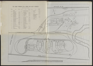
The Edgar Thomson Steel Works and Blast Furnaces
19.
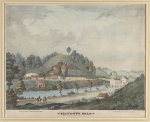
Ellicott's Mills
20.
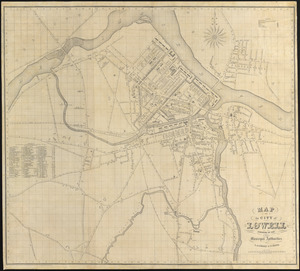
Map of the city of Lowell : surveyed in 1841 by order of the principal authorities
21.
Map of the Hudson River Rail Road from New York to Albany
22.
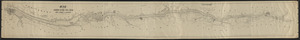
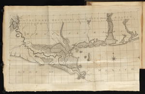
Map of the Lower Mississippi River
23.
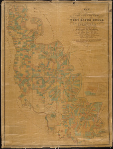
Map of the parishes of Pointe Coupee, West Baton Rouge and Iberville : including parts of the parishes of St. Martins and...
24.
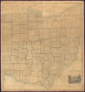
A map of the state of Ohio : from actual survey
25.
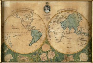
Map of the world
26.
Milk River, near junction of Missouri
27.
A new map and profile of the proposed canal from Lake Erie to Hudson River in the state of New York
28.
Plat of the common field and town tract of Kaskaskia
29.
The world
30.
The world with all the modern discoveries
31.
19th annual convention of the National Association of Real Estate Boards : at Tulsa, June 7 to June 11 in 1926
32.
2005 significant U.S. hurricane strikes
33.
The 2100 project : an atlas for the Green New Deal
34.
38,000,000 escaped -- 10,000,000 died
35.
Abolition of Slavery, 1863
36.
Aboriginal map of North America, denoting the boundaries and the locations of various Indian tribes
37.
An Accurate map of the United States of America. : According to the Treaty of Peace of 1783
38.
The adventures of Mark Twain
39.
Alden's pictorial map of the United States of North America
40.
Alien and Sedition Acts, February 25, 1799, Votes on resolutions for repeal
41.
America : beauty, wonders, inspiration, progress, without end
42.
America Septentrionalis : a Domino d'Anville in Galliis edita nune in Anglia Coloniss in Interiorem Virginiam deductis nec non...
43.
America the wonderland : a pictorial map of the United States
44.
American explorations in the West, 1803-1852
45.
Amérique Septentrionale
46.
Amplissima regionis Mississipi : seu provinciae Ludoviciana à R.P. Ludovico Hennepin Francise Miss. in America Septentrionali...
47.
Appletons' railway map of the United States and Canada
48.
Appletons' railway map of the United States and the Canadas : representing railways in actual operation, and those in the...
49.
Armour food source map
50.
Base-map of the United States
‹ Prev
Next ›
1
2
3
4
5
6
7