A map of North America, denoting the boundaries of the yearly meetings of Friends and the locations of the various Indian tribes
Item Information
- Title:
- A map of North America, denoting the boundaries of the yearly meetings of Friends and the locations of the various Indian tribes
- Description:
-
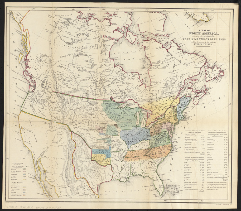
America Transformed: From the earliest European settlements in North America through the 19th century, Catholic and Protestant missionaries took part in evangelizing missionary expeditions to Native communities. One particularly active religious group was the Society of Friends, or Quakers. Besides detailing the missionary activities of the various regional Yearly Meetings, their 1844 annual report included this map which shows the extent of each Yearly Meeting as well as the lands in the Great Plains allotted to eastern tribes. It also depicts the distribution of Indigenous communities in the western half of the country.
- Cartographer:
- Bowden, James, 1811-
- Name on Item:
-
James Bowden, del.
- Date:
-
[1844]
- Format:
-
Maps/Atlases
- Location:
-
Boston Public Library
Norman B. Leventhal Map & Education Center - Collection (local):
-
Norman B. Leventhal Map & Education Center Collection
- Subjects:
-
Indians of North America--Maps
Society of Friends--North America--Maps
Indians of North America--Population--Statistics
North America--Maps
- Places:
-
North America (area)
- Extent:
- 1 map : color ; 45 x 53 cm
- Terms of Use:
-
No known copyright restrictions.
No known restrictions on use.
- Publisher:
-
[London] :
[E. Marsh]
- Scale:
-
Scale approximately 1:11,200,000
- Language:
-
English
- Notes:
-
Relief shown by hachures.
Indexed with color key for "Indian nations" and yearly meetings.
Includes population statistics for Indian tribes.
From: Some account of the conduct of the Religious Society of Friends towards the Indian tribes ... London : E. Marsh, 1844.
- Notes (date):
-
This date is inferred.
- Notes (exhibitions):
-
Exhibited: "America transformed. Part 1: the United States expands westward," organized by the Norman B. Leventhal Map & Education Center at the Boston Public Library, 2019.
- Identifier:
-
06_01_016081
- Call #:
-
G3301.E1 1844 .B69
- Barcode:
-
39999085942652


