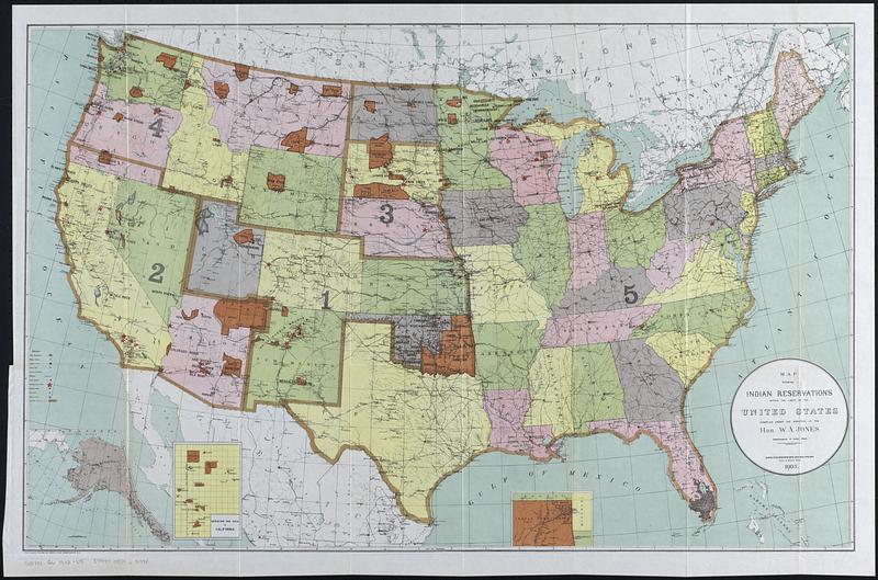
Map showing Indian reservations within the limits of the United States, 1903
Item Information
- Title:
- Map showing Indian reservations within the limits of the United States, 1903
- Cartographer:
- United States. Office of Indian Affairs
- Lithographer:
- Norris Peters Co.
- Name on Item:
-
compiled under the direction of the Hon. W.A. Jones, Commissioner of Indian Affairs
- Date:
-
[1904]
- Format:
-
Maps/Atlases
- Location:
-
Boston Public Library
Norman B. Leventhal Map & Education Center - Collection (local):
-
Norman B. Leventhal Map & Education Center Collection
- Subjects:
-
United States--Maps
Indian reservations--United States--Maps
Indians of North America--Land tenure--Maps
- Places:
-
United States
- Extent:
- 1 map : color ; 53 x 84 cm
- Terms of Use:
-
No known copyright restrictions.
No known restrictions on use.
- Publisher:
-
[Washington, D.C.] :
[Government Printing Office]
- Scale:
-
Scale approximately 1:6,000,000
- Language:
-
English
- Notes:
-
Includes 3 insets: [Alaska] -- Mission Ind. Res. in California -- [Indian Territory].
Detached from Annual reports of the Department of the Interior, 1903, Indian Affairs (Washington, D.C. : Government Printing Office, 1904).
Prime meridians: Washington and Greenwich.
- Notes (date):
-
This date is inferred.
- Identifier:
-
06_01_018338
- Call #:
-
G3701.G6 1903 .U5
- Barcode:
-
39999085965398


