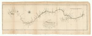
Map of the Lower Mississippi River
Item Information
- Title:
- Map of the Lower Mississippi River
- Description:
-
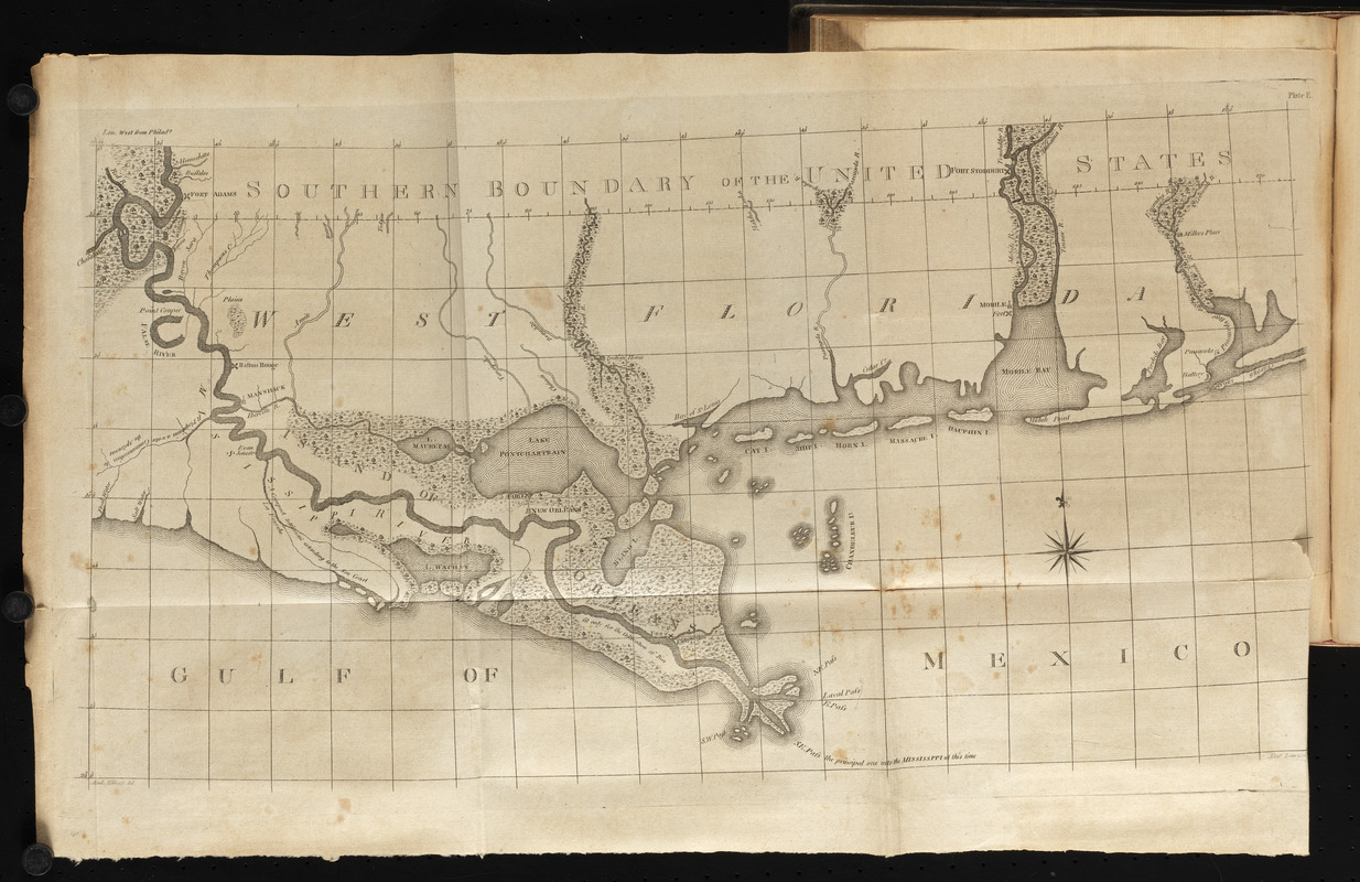
America Transformed: This map showing the meandering course of the Lower Mississippi River and seven other maps of the Mississippi and Ohio Rivers prepared by Andrew Ellicott highlight the significance of the two rivers for travel in the interior part of the United States. Ellicott, best known for surveying the boundaries of the District of Columbia and completing the plan for the new capital city in 1791–1792, was commissioned by President George Washington to survey the nation’s southwestern boundary with Spanish West Florida. Ellicott’s observations from 1796–1800 were published in 1803, when interest in the geography of the newly acquired Louisiana Territory gained national attention.
- Cartographer:
- Ellicott, Andrew, 1754-1820
- Engraver:
- Lawson, Alexander, 1773-1846
- Printer:
- Fry, William, 1777-1855
- Name on Item:
-
And. Ellicott del. ; Alexr. Lawson
- Date:
-
1814
- Format:
-
Maps/Atlases
- Location:
- Private Collection
- Collection (local):
-
Private Collection
- Subjects:
-
Mississippi River--Maps
- Places:
-
Mississippi River
- Extent:
- 1 map ; 54 x 33 cm
- Terms of Use:
-
No known copyright restrictions.
No known restrictions on use.
- Publisher:
-
Philadelphia :
Printed by William Fry
- Scale:
-
Scale approximately 1:950,000
- Language:
-
English
- Notes:
-
In The journal of Andrew Ellicott (Philadelphia : Printed by William Fry, 1814), facing page 203.
Prime meridian: Philada.
In upper right corner: Plate E.
- Notes (citation):
-
Sabin, 22217
- Notes (exhibitions):
-
Exhibited: "America transformed. Part 1: the United States expands westward," organized by the Norman B. Leventhal Map & Education Center at the Boston Public Library, 2019.
- Identifier:
-
06_01_016728