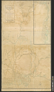
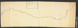
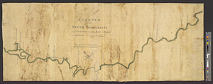
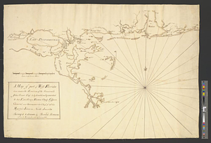
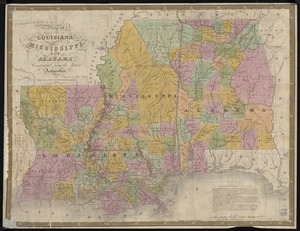
Carte composée des differens ouvrages de messieurs les ingenieurs qui ont eté à Louisiane, avec les renvois alphabetiques de chaque partie : scavoir du point A jusqu'à B par Monsieur Broutin at Duvergé. La rivière des Chikachas par Monsieur Broutin. La rivière Rouge par la même. La rivière des Argues tirée d'aprés differentes cartes et mémoires trouvés dans les papiers de feu Mr. Broutin. La rivière de Alibamons par mr. De Vince. La rivière Noire par Mr. Gonichon. La côte depuis la Baye St. Rose jusqu'à l'isle au Chas par Monsr. Duvergé. Depuis B jusqu'à aux Illinois par Mr. Laussié. Du point B jusqu'en C par le même. La côte depuis l'isle aux Chats jusqu'à la Balize par le Sieur de Mandeville. Les trois lacs Borgne, Pont chartrain et Maurepas er du point A jusqu'en E avec les lacs et rivières, le tout reunien un corps avec leurs latitudes par le même et toutes les rivières qui tombent dans les lacs Borgne Pontchartrain et Maurepas, avec la rivière d'Iberville par le même ...
This map is also available in American Revolutionary Geographies Online (ARGO), a collections portal especially built for material relating to the American Revolutionary War Era. Visit ARGO to learn more about this item and explore the historical geography of North America in the late eighteenth century.
Item Information
- Title:
- Carte composée des differens ouvrages de messieurs les ingenieurs qui ont eté à Louisiane, avec les renvois alphabetiques de chaque partie : scavoir du point A jusqu'à B par Monsieur Broutin at Duvergé. La rivière des Chikachas par Monsieur Broutin. La rivière Rouge par la même. La rivière des Argues tirée d'aprés differentes cartes et mémoires trouvés dans les papiers de feu Mr. Broutin. La rivière de Alibamons par mr. De Vince. La rivière Noire par Mr. Gonichon. La côte depuis la Baye St. Rose jusqu'à l'isle au Chas par Monsr. Duvergé. Depuis B jusqu'à aux Illinois par Mr. Laussié. Du point B jusqu'en C par le même. La côte depuis l'isle aux Chats jusqu'à la Balize par le Sieur de Mandeville. Les trois lacs Borgne, Pont chartrain et Maurepas er du point A jusqu'en E avec les lacs et rivières, le tout reunien un corps avec leurs latitudes par le même et toutes les rivières qui tombent dans les lacs Borgne Pontchartrain et Maurepas, avec la rivière d'Iberville par le même ...
- Title (alt.):
-
Partie de la carte à Grands Points
- Contributor:
- Broutin, J. F.
- Contributor:
- Duvergé, cartographer
- Contributor:
- Vince, de, cartographer
- Contributor:
- Gonichon, cartographer
- Contributor:
- Laussié, cartographer
- Creator:
- Mandeville, Antoine Philippe de Marigny, 1722-1779
- Name on Item:
-
par Philippe de Mandeville
- Date:
-
[1763]
- Format:
-
Maps/Atlases
- Genre:
-
Manuscript maps
- Location:
- William L. Clements Library
- Collection (local):
-
William L. Clements Library Collection
- Subjects:
-
Mississippi River--Maps
Louisiana--Maps
Mississippi--Maps
Alabama--Maps
Arkansas--Maps
Tennessee--Maps
Kentucky--Maps
Missouri--Maps
Illinois--Maps
- Places:
-
Mississippi River
Louisiana
Mississippi
Alabama
Arkansas
Tennessee
Kentucky
Missouri
Illinois
- Extent:
- 1 ms. map : col. ; 139.5 x 81.5 cm.
- Terms of Use:
-
The University of Michigan Library provides access to these materials for educational and research purposes. These materials may be under copyright. If you decide to use any of these materials, you are responsible for making your own legal assessment and securing any necessary permission. If you have questions about the collection, please contact the William L. Clements Library.
Contact host institution for more information.
- Scale:
-
Scale 1:930,000.
- Language:
-
French
- Catalog Record:
-
Catalog record
- Notes:
-
Finished, colored topographical map showing the Mississippi Valley from Fort de Chartes to the delta and the settlements north and northeast of Mobile along with the Gulf coast of Louisiana as an inset.
Dedicated to the Duc de Choiseul.
- Notes (date):
-
This date is inferred.
- Identifier:
-
8215
- Barcode:
-
B3311252
 IIIF Manifest