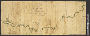
A map of part of West Florida done under the direction of the honourable John Stuart esqr: & by him humbly inscribed to his excellency Thomas Gage esquire general and commander in chief of all his majesty's forces in North-America

This map is also available in American Revolutionary Geographies Online (ARGO), a collections portal especially built for material relating to the American Revolutionary War Era. Visit ARGO to learn more about this item and explore the historical geography of North America in the late eighteenth century.
Item Information
- Title:
- A map of part of West Florida done under the direction of the honourable John Stuart esqr: & by him humbly inscribed to his excellency Thomas Gage esquire general and commander in chief of all his majesty's forces in North-America
- Contributor:
- Stuart, John, 1718-1779
- Creator:
- Romans, Bernard, 1741?-approximately 1784
- Name on Item:
-
survey'd & drawn by Bernard Romans beteen the month of June 1772 & January 1773
- Date:
-
[1773]
- Format:
-
Maps/Atlases
- Genre:
-
Manuscript maps
- Location:
- William L. Clements Library
- Collection (local):
-
William L. Clements Library Collection
- Subjects:
-
Gulf Coast (U.S.)--Maps
Louisiana--Maps
Mississippi--Maps
Alabama--Maps
Florida--Maps
Gage, Thomas, 1721-1787
- Places:
-
Louisiana
Mississippi
Alabama
Florida
- Extent:
- 1 ms. map ; 54.5 x 76.1 cm.
- Terms of Use:
-
The University of Michigan Library provides access to these materials for educational and research purposes. These materials may be under copyright. If you decide to use any of these materials, you are responsible for making your own legal assessment and securing any necessary permission. If you have questions about the collection, please contact the William L. Clements Library.
Contact host institution for more information.
- Scale:
-
Scale 1:300,000.
- Language:
-
English
- Catalog Record:
-
Catalog record
- Notes:
-
Finished, pen and ink chart showing in detail the coastline from the Mississippi Delta to Pensacola.
This map and the large map of West Florida (Brun 663) were taken to General Gage by Romans, and both were prepared under the supervision of John Stuart.
Stuart mentions this particular map in his letter to Gage from Charleston of April 22, 1773, Gage Papers (Clements Library).
- Notes (date):
-
This date is inferred.
- Identifier:
-
883
- Barcode:
-
B2500733