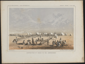
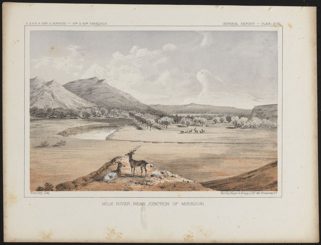
Milk River, near junction of Missouri
Item Information
- Title:
- Milk River, near junction of Missouri
- Description:
-
America Transformed: The results of the Pacific Railroad Surveys were documented in numerous topographic maps and 12 volumes of reports describing the geography, flora and fauna, and Native peoples. These volumes included numerous illustrations depicting Native people and natural landscapes, such as this view prepared by John Mix Stanley while serving with the Northern Pacific Railroad Survey party. It depicts Montana’s Milk River Valley with a pair of antelope in the foreground.
- Artist:
- Stanley, John Mix, 1814-1872
- Lithographer:
- Sarony, Major & Knapp Lith.
- Name on Item:
-
Stanley del.
- Date:
-
[1860]
- Format:
-
Prints
- Location:
- Private Collection
- Collection (local):
-
Private Collection
- Subjects:
-
Milk River (Mont. and Alta.)--Pictorial works
Pacific railroads--Explorations and surveys
United States Pacific Railroad Expeditions and Surveys
- Places:
-
Milk River (river)
- Extent:
- 1 print : color ; 22 x 29 cm
- Terms of Use:
-
No known copyright restrictions.
No known restrictions on use.
- Publisher:
-
N.Y. :
Sarony, Major & Knapp, Liths.
- Language:
-
English
- Notes:
-
From Reports of Explorations and Surveys, to ascertain the most practicable and economical route for a railroad from the Mississippi River to the Pacific Ocean ..., volume 12, opposite page 90.
"U.S.P.R.R. Exp. & Surveys - 47th & 49th parallels"--upper left.
"General report - plate XVIII"--upper right.
- Notes (date):
-
This date is inferred.
- Notes (exhibitions):
-
Exhibited: "America transformed. Part 1: the United States expands westward," organized by the Norman B. Leventhal Map & Education Center at the Boston Public Library, 2019.
- Identifier:
-
06_01_016724