Toggle navigation
LMEC Home
Exhibitions
Georeferencing
Tools for Teachers
Collections
My Favorites
Sign Up / Log In
Search
Search the map portal
Map Collection
Map Collection
Map Sets
Search
Search
Search for
Search In
All Fields
Creator
Title
Subject
Place
Search All Digital Collections
Advanced Search
377 Results
My Search
Start Over
More Like
commonwealth:hx11z343v
Remove constraint More Like: commonwealth:hx11z343v
Filter your Search
Place
North and Central America
336
United States
210
Canada
103
Essex (county)
23
Louisbourg
21
Saint Lawrence River
19
Fort Edward
16
Suffolk (county)
16
more
Place
»
Topic
United States--History--French and Indian War, 1754-1763--Maps, Manuscript--Early works to 1800
57
Louisbourg (N.S.)--Maps, Manuscript--Early works to 1800
18
Fort Edward (N.Y.)--Maps, Manuscript--Early works to 1800
16
Saint Lawrence River--Maps, Manuscript--Early works to 1800
15
Fort Ticonderoga (N.Y.)--Maps, Manuscript--Early works to 1800
14
Louisbourg (N.S.)--History--Siege, 1745--Maps, Manuscript--Early works to 1800
14
Fortification--New York (State)--Fort Edward--Maps, Manuscript--Early works to 1800
13
Fortification--New York (State)--Maps, Manuscript--Early works to 1800
13
more
Topic
»
Date
Date range begin
–
Date range end
Current results range from
1664
to
1816
View distribution
Creator
Royal United Services Institute for Defence and Security Studies
160
George, III, King of Great Britain, 1738-1820
151
George, IV, King of Great Britain, 1762-1830
150
Amherst, Jeffery Amherst, Baron, 1717-1797
128
Skinner, Monier
28
Skinner, William, 1700-1780
28
Brasier, William
16
Bastide, John Henry, approximately 1700-1770
15
more
Creator
»
Format
Maps/Atlases
360
Manuscripts
150
Drawings/Illustrations
15
Georeferenced
Yes
7
No
370
Collection
British Library Collection
376
American Revolutionary War-Era Maps
353
Boston and New England Maps
21
Urban Maps
5
Maritime Charts and Atlases
2
Library of Congress Collection
1
Available to use
Creative Commons license
377
Search Constraints
Sort by relevance
relevance
title
date (asc)
date (desc)
Number of results to display per page
100 per page
10
per page
20
per page
50
per page
100
per page
View results as:
grid view
map view
Search Results
301.
PLAN of the Position w:ch the Army under L.t Gen:l Burgoyne took at Saratoga on the 10th Sept.r 1777 and in which it remained...
302.
A PLAN OF THE RIVER KENNEBECK AS IT WAS SVRVEYED BY ORDER OF THE GOVERNMENT OF MASSACHUSETS BAY IN THE YEAR MDCCLXI From the...
303.
A Plan Of the River of Chibenaccadie from its Source To its Discharge into the Bay of Mines Surveyed in August 1754 : The...
304.
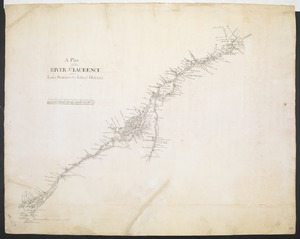
A Plan of the RIVER S.T LAURENCE from Lake Ontario to the Island Orleans
305.
A PLAN of the Rivers and Boundary Lines referr'd to in ye Proceedings & Judgment of ye Commissioners for adjusting the Bounds...
306.
A Plan of the Road, Harbour and Town of Placentia in the Island of Newfoundland From an Actual Survey shewing the Situation of...
307.
A PLAN of the SEA COAST from CAPE ELIZABETH to the ENTRANCE of SAGADAHOCK or KENNEBECK RIVER Including Casco Bay with all it's...
308.
Plan of the Settlement on the Bay of Quinte
309.
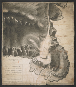
PLAN of the SOUTH HEAD of the Entrance into the Harbour of St IOHNS NEWFOUNDLAND Shewing the BATTERIES to be Erected theron for...
310.
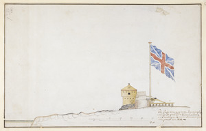
PLAN of the TOWER at POINT PLEASANT for the protection of the Sea Batteries at that place and for the defence of the Harbour of...
311.
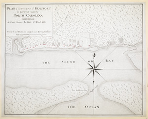
PLAN of the Town & Port of BEAUFORT in Carteret County NORTH CAROLINA
312.
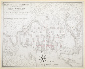
PLAN of the Town & Port of EDENTON in Chowan County NORTH CAROLINA
313.
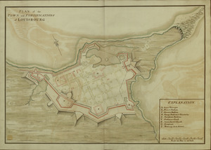
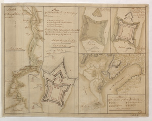
PLAN of the TOWN and FORTIFICATIONS of LOUISBOURG
314.
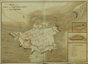
PLAN of the TOWN and FORTIFICATIONS of LOUISBOURG
315.
PLAN of the TOWN and FORTRESS of LOUISBOURG on the ISLAND CAPE BRETON : Surrender'd ye 16th June 1745 after a Seige of 12 days...
316.
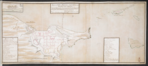
Plan of the Town and Harbour of Louisbourg
317.
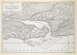
PLAN of the TOWN and HARBOUR of S.T AUGUSTIN
318.
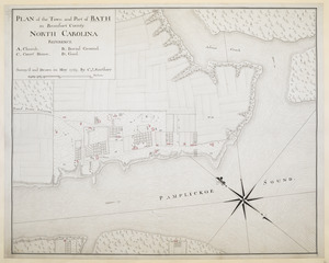
PLAN of the Town and Port of BATH in Beaufort County NORTH CAROLINA
319.
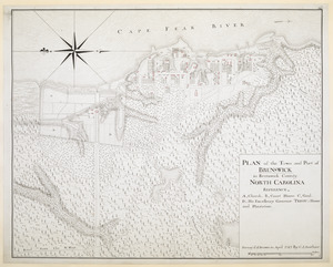
PLAN of the Town and Port of BRUNSWICK in Brunswick County. NORTH CAROLINA
320.
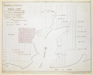
PLAN of the TOWN of BELLE VIEU situated on the East side Beaver Harbour in the District of Passamaquoddy
321.
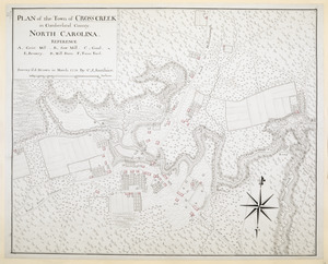
PLAN of the Town of CROSS CREEK in Cumberland County. NORTH CAROLINA
322.
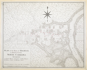
PLAN of the Town of HALIFAX in Halifax County. NORTH CAROLINA
323.
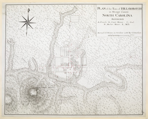
PLAN of the Town of HILLSBOROUGH in Orange County NORTH CAROLINA
324.
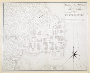
PLAN of the Town of NEWBERN in Craven County NORTH CAROLINA
325.
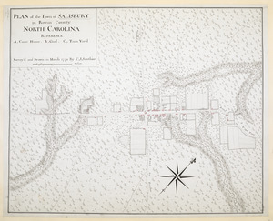
PLAN of the Town of SALISBURY in Rowan County. NORTH CAROLINA
326.
PLAN Of the Town of SAVANNAH, Showing the Works Constructed for its Defence; also, The Approaches and Batteries of the Enemy:...
327.
PLAN of The TOWN of SHELBURNE projected and laid out By Order of his Excell,y IOHN PARR Esqr Capt,n Gen,l Governor & Commander...
328.
A PLAN of the TOWN of St ANDREWS Situated at the Head of Passamaquoddy Bay-laid out for the Accomodation of Loyal Emigrants &...
329.
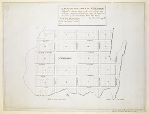
A PLAN OF THE TOWN OF ST. GEORGE Situated in Harbor Etang on the North side the Bay of Fundy, projected and laid out under the...
330.
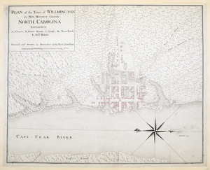
PLAN of the Town of WILLMINGTON in New Hanover County NORTH CAROLINA
331.
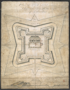
Plan of York Fort erected at Chateaux bay on the Coast of Labradore 1766
332.
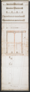
Plans & Sections of Houses for Officers & Barracks for Soldiers near the City of Philadelphia
333.
Plans & Sections of Houses for Officers & Barracks for Soldiers near the City of Philadelphia
334.
Plans & Sections of Houses for Officers & Barracks for Soldiers near the City of Philadelphia
335.
The Profil belonging to the Iconographycal Draft of the Fort William & Mary on Piscataqua River in America
336.
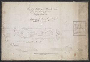
Project for Fortifying the Admiralls Point going into Trinity Harbour Newfoundland Octob.r 1745
337.
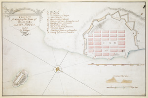
PROJECT for Fortifying the Town of HALLIFAX ; in NOVA SCOTIA
338.
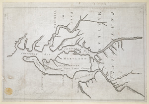
Proposed Maryland / Pennsylvania Boundary
339.
A Prospect of LOUISBOURG taken from ye NE Harbour
340.
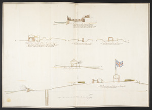
The Respective Profiles belonging to the great Iconografical Draughts of Castle Island in the Bay of Boston
341.
THE RIVER S.T LAURENCE
342.
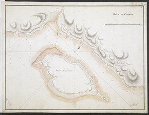
ROAD OF COUDRE
343.
SCETCH of the CITY and Environs of S.T AUGUSTINE
344.
Section of the Citadel-Hill at Halifax : Showing the Progress made by the troops in leveling the same upon the line of 40 feet...
345.
Section taken from the nearest Commanding Ground thro' the Center of the TOWER to High Water Mark
346.
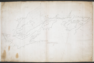
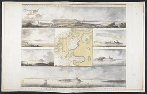
[Six sectional drawings of the Harbour of Saint John, Newfoundland]
347.
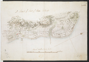
[Sketch map of an unidentified fort]
348.
[Sketch map of the St Lawrence River at River Toniata]
349.
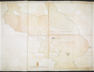
[Sketch map of the St Lawrence River from the Fort de la Présentation to Lake Ontario]
350.
A SKETCH of FORT DU QUESNE how it was before the Enemy abandont and distryd it taken from a survey of Cap.t Gordon's
351.
SKETCH of FORTS CLINTON & MONTGOMERY Stormed 6.th October 1777 by the Troops under the Command of Sir Henry Clinton K.B. L.t...
352.
A SKETCH of LAKE ONTARO between OSWEGO and NIAGARA and from thence up the River to the upper End of the Carrying Place
353.
Sketch Of Part of S.t John's Harbour and River= Plan of Fort Frederick with the Necessary Alterations= Plan of the Ramainder of...
354.
A Sketch of Part of Staten Island
355.
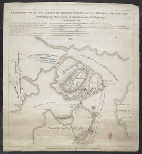
A SKETCH OF THE ACTION BETWEEN THE BRITISH FORCES AND THE AMERICAN PROVINCIALS, on the Heights of the Peninsula of Charlestown,...
356.
SKETCH OF THE CHEROKEE COUNTRY And March of the Troops Under the Command of Luet. Col. Grant to the Middle & Back Settlem:ts. 1761
357.
Sketch of the Isthmus to the NE of Crown Point
358.
SKETCH of the MARCH of the BRITISH ARMY, under GENERAL ROSS, from the 19th to the 29th Aug.t
359.
A SKETCH of the Ouabache &c from Post Vincent to the Ohio
360.
A SKETCH of the RIVER MISSISIPPI from New Orleans to the Rock of Davion
361.
SKETCH OF THE RIVER S.T LAWRENCE From LAKE ONTARIO to MONTREAL by AN ONONDAGA INDIAN
362.
A SMALL MAP of the SEA COAST of NEW ENGLAND Together with the out Lines of Several of the Provinces Lying theron. 1738
363.
Superficial Sketch of an advantagious Fortification for LOUISBOURG
364.
A Survey of the Coast from FORT WILLIAM near S.t Iuans River to Mosquito River
365.
This discription and [?] of the South Line of the Massachusetts Province which divides between the said Province and the Colony...
366.
To his Excellency Gen.l Washington Commander in Chief of the Armies of the United States of America This Plan of the investment...
367.
To the Rt. Honble. the Earl of Hillsborough & the rest of the Lords, Commissioners for Trade & Plantations. This Plan is most...
368.
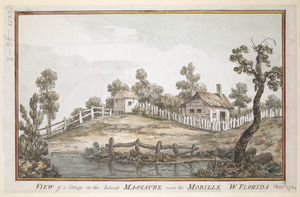
VIEW of a Cottage on the Island MASSACRE near the MOBILLE W. FLORIDA. Oct.r 1764
369.
VIEW of BOSTON the Capital of NEW ENGLAND from Col. HATCH's House on the Road to DORCHESTER = VIEW FROM DORCHESTER NECK = VIEW...
370.
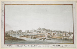
VIEW of HARLAEM from MORISANIA in the PROVINCE of NEW YORK Septem.r 1765
371.
A View of the country round Boston taken from Beacon hill : shewing the Lines, Ridouts & Different Encampments of the Rebels...
372.
[View of the country round Boston taken from Beacon hill]
373.
[View of the country round Boston taken from Beacon hill]
374.
[View of the country round Boston taken from Beacon hill]
375.
[View of the country round Boston taken from Beacon hill]
376.
[View of the country round Boston taken from Beacon hill]
377.
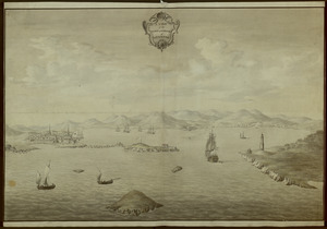
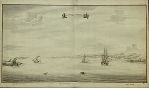
A VIEW of the TOWN & HARBOUR of LOUISBOURG
‹ Prev
Next ›
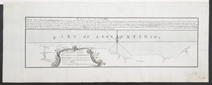
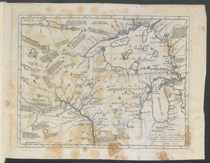
1
2
3
4


![[Six sectional drawings of the Harbour of Saint John, Newfoundland]](https://bpldcassets.blob.core.windows.net/derivatives/images/commonwealth:6108vv37h/image_thumbnail_300.jpg)
![[Sketch map of an unidentified fort]](https://bpldcassets.blob.core.windows.net/derivatives/images/commonwealth:hx11z101x/image_thumbnail_300.jpg)
![[Sketch map of the St Lawrence River at River Toniata]](https://bpldcassets.blob.core.windows.net/derivatives/images/commonwealth:hx11z103g/image_thumbnail_300.jpg)
![[Sketch map of the St Lawrence River from the Fort de la Présentation to Lake Ontario]](https://bpldcassets.blob.core.windows.net/derivatives/images/commonwealth:hx11z1051/image_thumbnail_300.jpg)


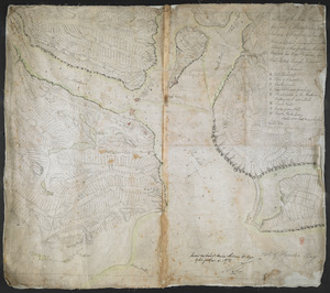
![This discription and [?] of the South Line of the Massachusetts Province which divides between the said Province and the Colony of Connecticut was made and Taken the Twenty Sixth day of October 1713 In Presence of Col. Samuel Partridge, Col. John Pynchon and [?] William Dudley Commissioners for the Massachusetts, and William Pithkin and William Whiting Esqrs for Connecticut wherein is discribed and Set down the Sain Line from Woodward and Saffery Station [?] to Connecticut River with the Several Towns farms and grants adjacent and Lying near the Same](https://bpldcassets.blob.core.windows.net/derivatives/images/commonwealth:hx11z566k/image_thumbnail_300.jpg)
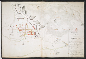
![[View of the country round Boston taken from Beacon hill]](https://bpldcassets.blob.core.windows.net/derivatives/images/commonwealth:6108vv93v/image_thumbnail_300.jpg)
![[View of the country round Boston taken from Beacon hill]](https://bpldcassets.blob.core.windows.net/derivatives/images/commonwealth:6108vv97z/image_thumbnail_300.jpg)
![[View of the country round Boston taken from Beacon hill]](https://bpldcassets.blob.core.windows.net/derivatives/images/commonwealth:6108vv95d/image_thumbnail_300.jpg)
![[View of the country round Boston taken from Beacon hill]](https://bpldcassets.blob.core.windows.net/derivatives/images/commonwealth:6108vv99h/image_thumbnail_300.jpg)
![[View of the country round Boston taken from Beacon hill]](https://bpldcassets.blob.core.windows.net/derivatives/images/commonwealth:6108vw01b/image_thumbnail_300.jpg)