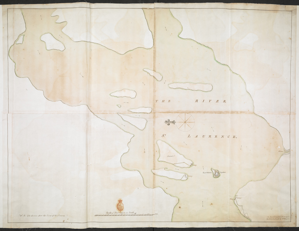
THE RIVER S.T LAURENCE
This map is also available in American Revolutionary Geographies Online (ARGO), a collections portal especially built for material relating to the American Revolutionary War Era. Visit ARGO to learn more about this item and explore the historical geography of North America in the late eighteenth century.
Item Information
- Title:
- THE RIVER S.T LAURENCE
- Description:
-
Fort William Augustus on Chimney Island in the Saint Lawrence River, close to present-day Ogdensburg, New York.
- Cartographer:
- Brasier, William
- Associated name:
- Ratzer, Bernard
- Former owner:
- Amherst, Jeffery Amherst, Baron, 1717-1797
- Former owner:
- Royal United Services Institute for Defence and Security Studies
- Date:
-
[ca. 1760]
- Format:
-
Maps/Atlases
- Location:
- British Library
- Collection (local):
-
British Library Collection
- Subjects:
-
Fortification--New York (State)--Fort William Augustus--Maps, Manuscript--Early works to 1800
Saint Lawrence River--Maps, Manuscript--Early works to 1800
Fort William Augustus (N.Y.)--Maps, Manuscript--Early works to 1800
- Places:
-
Saint Lawrence (county)Chimney Island (island)
Saint Lawrence River
- Extent:
- 1 map on 6 sheets : joined, manuscript pen and ink with watercolour ; 70 x 91 cm
- Terms of Use:
-
No known copyright restrictions.
This work is licensed for use under a Creative Commons Attribution Non-Commercial Share Alike License (CC BY-NC-SA).

- Publisher:
-
[Place of production not identified] :
[William Brasier]
- Scale:
-
Scale approximately 1:7,200
- Language:
-
English
- Catalog Record:
-
http://searcharchives.bl.uk/IAMS_VU2:IAMS040-001999740
- Notes:
-
North is oriented to the left of the map, indicated by a decorative compass shown centrally.
Shows arrows indicating the river's direction of flow.
Shows batteries on islands and river banks adjacent to Fort William Augustus.
Shows scale bar at lower centre, "Scale of Feet, 600 to an Inch".
Shows note at lower right, "The fort Survey'd by L.t Ratzer. The River & Islands by W.m Brasier".
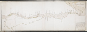
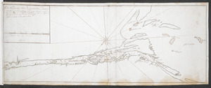
See Add Ms 57,709.1-3. for other parts of this map.
Copy at Add Ms 57,710.1. In a solander box, R.U.S.I. Vol LXXV and LXXVIII. Comprises 6 (partial) sheets, joined and laid on linen. Red stamp of R.U.S.I. at lower centre. Green circular label to verso showing "32". White label to verso showing "DRAWER 28 SECTION 2". Blue label to verso showing "A 28/26".
- Notes (date):
-
9999

![[Chart of the Saint Lawrence River]](https://bpldcassets.blob.core.windows.net/derivatives/images/commonwealth:hx11z0594/image_thumbnail_300.jpg)
