Toggle navigation
LMEC Home
Exhibitions
Georeferencing
Tools for Teachers
Collections
My Favorites
Sign Up / Log In
Search
Search the map portal
Map Collection
Map Collection
Map Sets
Search
Search
Search for
Search In
All Fields
Creator
Title
Subject
Place
Search All Digital Collections
Advanced Search
8188 Results
My Search
Start Over
More Like
commonwealth:9g54z489d
Remove constraint More Like: commonwealth:9g54z489d
Filter your Search
Place
North and Central America
4,937
United States
3,627
Suffolk (county)
1,051
Boston
1,024
Europe
963
Canada
427
France
269
Massachusetts
249
more
Place
»
Topic
Boston (Mass.)--Maps
575
United States--Maps
270
Real property--Massachusetts--Boston--Maps
177
Massachusetts--Maps
160
Landowners--Massachusetts--Boston--Maps
135
North America--Maps--Early works to 1800
103
New England--Maps
99
City planning--Massachusetts--Boston--Maps
83
more
Topic
»
Date
Date range begin
–
Date range end
Current results range from
1482
to
2023
View distribution
Creator
United States. Hydrographic Office
357
O.H. Bailey & Co
148
Des Barres, Joseph F. W. (Joseph Frederick Wallet), 1722-1824
123
United States. Post Office Dept
120
Ptolemy, 2nd cent
100
Walling, Henry Francis, 1825-1888
94
Boston Redevelopment Authority
88
Jefferys, Thomas, -1771
84
more
Creator
»
Format
Maps/Atlases
8,129
Manuscripts
215
Prints
51
Books
36
Objects/Artifacts
10
Drawings/Illustrations
8
Posters
4
Georeferenced
Yes
870
No
7,318
Collection
Norman B. Leventhal Map Center Collection
8,164
Boston and New England Maps
2,206
Urban Maps
1,947
Maritime Charts and Atlases
750
American Revolutionary War-Era Maps
616
Boston Redevelopment Authority Collection
107
Massachusetts Real Estate Atlases
3
Mapping Boston Collection
1
Available to use
No known restrictions
8,043
Creative Commons license
47
Search Constraints
Sort by relevance
relevance
title
date (asc)
date (desc)
Number of results to display per page
100 per page
10
per page
20
per page
50
per page
100
per page
View results as:
grid view
map view
Search Results
1.
Atlas of the city of Boston : Roxbury, Mass. : volume four : from actual surveys and official records
2.
Atlas of the city of Boston : South & East Boston : volume four
3.
Atlas of the city of Boston : South Boston : from actual surveys and official plans
4.
Atlas of the city of Boston : South Boston : from actual surveys and official plans
5.
Atlas of the city of Boston : South Boston : from actual surveys and official plans
6.
Atlas of the city of Boston, volume eight, South Boston, Mass. : from actual surveys and official plans
7.
Atlas of the county of Suffolk, Massachusetts : vol. 2nd late city of Roxbury, now wards 13-14 and 15, city of Boston
8.
Atlas of the county of Suffolk, Massachusetts : vol. 3rd including Boston and Dorchester : from actual surveys and official...
9.
General plan for Columbus Park, Strandway, South Boston
10.
Insurance map of Boston : volume 2
11.
Insurance map of Boston : volume 2
12.
Insurance map of Boston vol. 3 (South & East Boston)
13.
Plan for the occupation of flats owned by the Commonwealth in Boston Harbor
14.
[Plan of channels and flats as they were before the 200 feet outside of the Mill Dam was filled up]
15.
Plan of South Boston
16.
Plan of the proposed docks at South Boston
17.
Plan of two lots of valuable land in Washington Village, South Boston : to be sold at Public Auction, on Wednesday April 22d...
18.
Plan showing approximate location of Eastern Avenue : Sept. 18th 1861
19.
South Boston
20.
Atlas of the city of Boston : South Boston
21.
Atlas of the city of Boston : South Boston
22.
Atlas of the county of Suffolk, Massachusetts, vol. 3 : including South Boston and Dorchester
23.
Food distribution center study : Food distribution site study
24.
Metropolitan District Commission combined sewer overflow project Dorchester Bay area
25.
Plan for the occupation of flats owned by the Commonwealth in Boston Harbor
26.
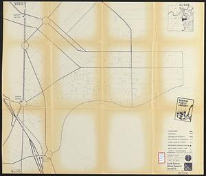
South Boston urban renewal area R-51 : existing population density
27.
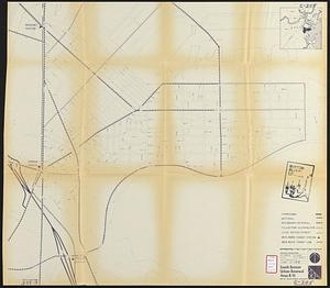
South Boston urban renewal area R-51
28.
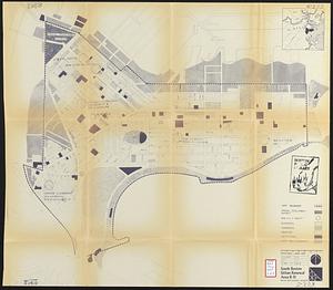
South Boston urban renewal area r-51 : proposed circulation
29.
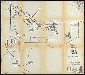
South Boston urban renewal area r-51 : existing and proposed community facilities
30.
South Boston urban renewal area r-51 : existing circulation
31.
South Boston urban renewal area r-51 : proposed land use
32.
South Boston urban renewal area r-51 : existing land use
33.
South Boston urban renewal area r-51 : building conditions
34.
South Boston urban renewal area r-51 : existing population density
35.
South Boston urban renewal area r-51 : proposed treatment and title I projects
36.
South Boston urban renewal area r-51 : existing land use
37.
South Boston urban renewal area r-51 : existing and proposed public facilities
38.
South Boston urban renewal area r-51 : proposed circulation
39.
South Boston urban renewal area r-51 : existing circulation
40.
South Boston urban renewal area r-51 : proposed land use
41.
South Boston urban renewal area r-51 : existing zoning
42.
South Boston urban renewal area r-51 : proposed zoning
43.
South Boston urban renewal area r-51 : existing building condition
44.
South Boston urban renewal area r-51 : proposed treatment and title I project
45.
The 100th anniversary map of Abraham Lincoln's visit to Massachusetts, September 11-23, 1848
46.
1630 shoreline
47.
1879. Progress map of the U.S. Geographical Surveys west of the 100th Meridian : prepared under the direction of 1st Lieut....
48.
1903 Map of Salem and surrounding places
49.
19th annual convention of the National Association of Real Estate Boards : at Tulsa, June 7 to June 11 in 1926
50.
2005 significant U.S. hurricane strikes
51.
The 2100 project : an atlas for the Green New Deal
52.
227 Harzgerode
53.
305 Glatz
54.
38,000,000 escaped -- 10,000,000 died
55.
4 Kinten
56.
660 Wakulah St., Roxbury
57.
[A chart of Boston Bay and vicinity]
58.
[A chart of New York Island & North River : East River, passage through Hell Gate, Flushing Bay, Hampstead Bay, Oyster,...
59.
The A.A.A. key road map of continental Europe
60.
Aaron Bohrod's America, its history
61.
ABC pathfinder railway guide map : eastern division
62.
Abolition of Slavery, 1863
63.
Aboriginal map of North America, denoting the boundaries and the locations of various Indian tribes
64.
Acapulco, México
65.
Accurata delineatio Castrorum Suecicorum, ut et Haffniae, Regni Daniae Metropolis
66.
Accurata delineatio oppugnatae a faederatis, Caesareis, Polonicis, Danicis, et Brandeburgicis copijs sub-ductu Seren: Electoris...
67.
Accurata delineatio regionis circa Nieburgum Fioniæ cum prælio ibi commisso inter Danorum et fæderatorum exercitum ab una et...
68.
Accurata Scaniae, Blekingiae et Hallandiae descriptio
69.
An accurate map of Cuba, and the adjacent islands
70.
An accurate map of Dorset Shire divided into hundreds
71.
An accurate map of Dorset Shire, divided into its hundreds
72.
An accurate map of England and Wales with the principal roads from the best authorities
73.
An accurate map of England and Wales with the principal roads from the best authorities
74.
An accurate map of Europe from the best authorities
75.
An accurate map of Hindostan or India, from the best authorities
76.
An accurate map of His Majesty's province of New-Hampshire in New England : taken from actual surveys of all the inhabited...
77.
An Accurate map of New Hampshire in New England, from a late survey
78.
An Accurate map of New York in North America, from a late survey
79.
An accurate map of North America : describing and distinguishing the British and Spanish dominions on this great continent :...
80.
An accurate map of North America : describing and distinguishing the British and Spanish dominions of this great continent;...
81.
An accurate map of North America : describing and distinguishing the British, Spanish and French dominions on this great...
82.
An accurate map of North and South Carolina with their Indian frontiers, shewing in a distinct manner all the mountains,...
83.
An accurate map of Rhode Island, part of Connecticut and Massachusets, shewing Admiral Arbuthnot's station in blocking up...
84.
An accurate map of the coast of Cape de Verde
85.
An accurate map of the Commonwealth of Massachusetts exclusive of the district of Maine : compiled pursuant to an Act of the...
86.
An accurate map of the country round Boston in New England from the best authorities
87.
An accurate map of the county of Essex, divided into its hundreds
88.
An accurate map of the district of Maine being part of the Commonwealth of Massachusetts : compiled pursuant to an act of the...
89.
An accurate map of the United States of America, with part of the surrounding provinces agreeable to the Treaty of Peace of 1783
90.
Accuratissima Brasiliae tabula
91.
Accuratissima Circuli Saxoniae tabula quae est pars septentrionalis Germaniae
92.
Accuratissima Dominii Veneti in Italia, Ducatus Parmae, Placentiae, Modenae Regii Et Mantuae, Episcopatus Tridentini Tabula...
93.
Accuratissima et maxima totius Turcici Imperii tabula cum omnibus suis regionibus novissima delineatio
94.
Accuratissima principatus Cataloniae, et comitatuum Ruscinonis, et Cerretaniae descriptio
95.
An actual survey of the sea coast from New York to the I. Cape Briton : with tables of the direct and thwart courses &...
96.
Adams, Mass : 1882
97.
Adriatic
98.
The adventures of Mark Twain
99.
Aegyptus Antiqua
100.
Aerial photograph of South Boston
‹ Prev
Next ›
1
2
3
4
5
…
81
82


![[Plan of channels and flats as they were before the 200 feet outside of the Mill Dam was filled up]](https://bpldcassets.blob.core.windows.net/derivatives/images/commonwealth:b8516207x/image_thumbnail_300.jpg)


![[A chart of Boston Bay and vicinity]](https://bpldcassets.blob.core.windows.net/derivatives/images/commonwealth:cj82m2976/image_thumbnail_300.jpg)


