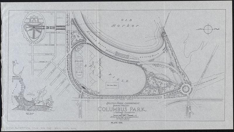
General plan for Columbus Park, Strandway, South Boston
Item Information
- Title:
- General plan for Columbus Park, Strandway, South Boston
- Publisher:
- Boston (Mass.). Department of Parks
- Cartographer:
- Shurcliff, Arthur A. (Arthur Asahel), 1870-1957
- Name on Item:
-
Arthur A. Shurtleff, landscape architect
- Date:
-
[1925]
- Format:
-
Maps/Atlases
- Location:
-
Boston Public Library
Norman B. Leventhal Map & Education Center - Collection (local):
-
Norman B. Leventhal Map & Education Center Collection
- Subjects:
-
Columbus Park (Boston, Mass.)--Maps
Columbus Park (Boston, Mass.)--Planning--Maps
South Boston (Boston, Mass.)--Maps
South Boston (Boston, Mass.)--Planning--Maps
- Places:
-
MassachusettsSuffolk (county)BostonSouth Boston
- Extent:
- 1 map ; 26 x 50 cm
- Terms of Use:
-
No known copyright restrictions.
No known restrictions on use.
- Publisher:
-
[Boston] :
[Park Department]
- Edition:
- Revised to April, 1922
- Scale:
-
Scale approximately 1:3,500
- Language:
-
English
- Notes:
-
Oriented with north to the left.
Inset: Key plan.
"Plate XIII."
From Special report 1925 / City of Boston Park Department.
- Notes (date):
-
This date is inferred.
- Identifier:
-
06_01_017817
- Call #:
-
G3764.B6:2S5G52 1922 .S58 1925
- Barcode:
-
39999085963245


