Toggle navigation
LMEC Home
Exhibitions
Georeferencing
Tools for Teachers
Collections
My Favorites
Sign Up / Log In
Search
Search the map portal
Map Collection
Map Collection
Map Sets
Search
Search
Search for
Search In
All Fields
Creator
Title
Subject
Place
Search All Digital Collections
Advanced Search
2843 Results
My Search
Start Over
atlas
Remove constraint atlas
Filter your Search
Place
North and Central America
1,401
United States
874
Europe
351
Canada
271
Suffolk (county)
163
Boston
157
Asia
136
South America
101
more
Place
»
Topic
Landowners--Massachusetts--Boston--Maps
115
Real property--Massachusetts--Boston--Maps
106
United States--Maps
87
Boston (Mass.)--Maps
63
United States--History--French and Indian War, 1754-1763--Maps
63
Saint Lawrence River--Maps
41
Nautical charts--Early works to 1800
39
North America--Maps--Early works to 1800
36
more
Topic
»
Date
Date range begin
–
Date range end
Current results range from
1482
to
2023
View distribution
Creator
United States. Hydrographic Office
582
Des Barres, Joseph F. W. (Joseph Frederick Wallet), 1722-1824
118
Ptolemy, 2nd cent
100
Bromley, George Washington
99
Bromley, Walter Scott
97
G.W. Bromley & Co.
75
Carey, Mathew, 1760-1839
74
Paullin, Charles Oscar, 1868 or 1869-1944
70
more
Creator
»
Format
Maps/Atlases
2,827
Manuscripts
58
Books
37
Prints
8
Documents
5
Drawings/Illustrations
1
Georeferenced
Yes
142
No
2,701
Collection
Norman B. Leventhal Map Center Collection
2,386
Maritime Charts and Atlases
1,150
American Revolutionary War-Era Maps
504
Boston and New England Maps
374
Urban Maps
250
Massachusetts Real Estate Atlases
144
William L. Clements Library Collection
92
Mapping Boston Collection
61
more
Collection
»
Available to use
No known restrictions
2,292
Creative Commons license
158
Search Constraints
Sort by title
relevance
title
date (asc)
date (desc)
Number of results to display per page
100 per page
10
per page
20
per page
50
per page
100
per page
View results as:
grid view
map view
Search Results
1.
The 2100 project : an atlas for the Green New Deal
2.
[A chart of Boston Bay and vicinity]
3.
Abolition of Slavery, 1863
4.
Accurata Scaniae, Blekingiae et Hallandiae descriptio
5.
An accurate map of Dorset Shire, divided into its hundreds
6.
An accurate map of England and Wales with the principal roads from the best authorities
7.
An accurate map of England and Wales with the principal roads from the best authorities
8.
An accurate map of Europe from the best authorities
9.
An accurate map of Hindostan or India, from the best authorities
10.
An accurate map of North America : Describing and distinguishing the British and Spanish dominions of this great continent;...
11.
An accurate map of North America : describing and distinguishing the British and Spanish dominions of this great continent;...
12.
An accurate map of the British Empire in Nth. America as settled by the preliminaries in 1762
13.
An accurate map of the county of Essex, divided into its hundreds
14.
An Accurate map of the United States of America. : According to the Treaty of Peace of 1783
15.
An accurate map of the West Indies
16.
An Accurate map of the West Indies with the adjacent coast of America. 1796
17.
Accuratissima Circuli Saxoniae tabula quae est pars septentrionalis Germaniae
18.
Accuratissima Dominii Veneti in Italia, Ducatus Parmae, Placentiae, Modenae Regii Et Mantuae, Episcopatus Tridentini Tabula...
19.
Accuratissima et maxima totius Turcici Imperii tabula cum omnibus suis regionibus novissima delineatio
20.
Accuratissima principatus Cataloniae, et comitatuum Ruscinonis, et Cerretaniae descriptio
21.
An actual survey of the sea coast from New York to the I. Cape Brition : with tables of the direct and thwart courses &...
22.
An actual survey of the sea coast from New York to the I. Cape Briton : with tables of the direct and thwart courses &...
23.
Aegyptus Antiqua
24.
Aethiopia inferior, vel exterior : partes magis septentrionales, quae hic desiderantur, vide in tabula Ethiopiae superioris
25.
Aethiopia superior vel interior : vulgo Abissinorum, sive Presbiteri Ioannis imperium
26.
Affrice Tabule Quatuor : Prima Libie tabula continet ambas Mauritanias
27.
Africa
28.
Africa
29.
Africa according to the best authorities
30.
Africa, east coast, Brava Harbor
31.
Africa, including the Mediterranean
32.
Africa January rainfall -- Africa July rainfall
33.
Africa, north coast, Strait of Gibraltar, Ceuta anchorages and approaches : from the French surveys 1855, corrected to 1876
34.
Africa vegetation
35.
Africae nova descriptio
36.
Africae nova tabula
37.
Africae tabula nova
38.
Africa--east coast, coast of Zanzibar, Kiswere Harbor : from a British survey by the officers of H.M.S. Nassau, 1874 :...
39.
Africa--east coast, coast of Zanzibar, Mchinga Bay (Port Nungwa) : from a British survey by the officers of H.M.S. Nassau, 1874...
40.
Africa--east coast, coast of Zanzibar, Mikindani Bay with Mto Mtwara and Mikindani Harbrs : from a British survey by the...
41.
Africa--east coast, harbors on the coast of Zanzibar : from a British survey by the officers of H.M.S. Nassau, 1874 :...
42.
Africa--north coast, Strait of Gibraltar, Tangier Bay : from a French survey in 1855 ; republication of the Brit. Admty. chart...
43.
Afrika
44.
Afrika
45.
L'Afrique : dressée, sur les relations les plus recentes, et assujettie aux observations astronomiques
46.
L'Afrique, colle tracce degli antichi e recenti viaggi si marittimi che terrestri degli Europei in essa
47.
L'Afrique divisée en ses principaux états
48.
Age of the Caliphs
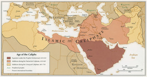
49.
Ahii and Manhii or Peacock and Wilsons Islands
50.
Ahii and Manhii or Peacock and Wilsons Islands
51.
Aleutian Archipelago
52.
Aleutian Archipelago
53.
Aleutian Archipelago
54.
Alien and Sedition Acts, February 25, 1799, Votes on resolutions for repeal
55.
Alla serma. sigra. principsa. d'Vrbino Grandvchessa di Toscana sva sigra. d: Roberto Dvdleo Dvca di Northumbria
56.
[Alleen de Caribische Eilanden, vervat in 't groot]
57.
An alphabetical table of all the cities, towns, villages and all other places of merit in the Kingdom of France, & circumjacent...
58.
America
59.
America
60.
America
61.
America
62.
America
63.
America : nach Arrowsmith, Brué und Lapie mit Benutzung der neuesten-Vermessungen
64.
America : Nach Arrowsmith, Brué und Lapie mit Benutzung der neuesten Vermessungen
65.
America Meridionalis concinata juxta observationes Dun Acad. Regalis Scientiarum et nonnullorum aliorum
66.
America noviter delineata
67.
America septentrionalis
68.
America Septentrionalis
69.
Americae
70.
Americae nova descriptio
71.
Americae nova tabula
72.
Americae nova tabula
73.
Americae pars meridionalis
74.
Americae pars meridionalis
75.
Americae siue noui orbis, noua descriptio
76.
Americae siue noui orbis, noua descriptio
77.
Americae siue noui orbis, noua descriptio
78.
Americae sive Indiae Occidentalis : tabula generalis
79.
Americae tam septentrionalis quam meridionalis in mappa geographica delineatio
80.
The American Atlas or, A Geographical Description of the whole continent of America : wherein are delineated at large, its...
81.
American explorations in the West, 1803-1852
82.
The American pilot : containing the navigation of the sea coat of North America . . .
83.
The American Pilot [title page]
84.
L'Amérique divisée en ses principaux états
85.
L'Amerique Meridionale : dressée sur les observations de Mrs. de L'Academie Royale des Sciences & quelques autres, & sur les...
86.
Amérique méridionale : publiée sous les auspices de Monseigneur le Duc d'Orleans prémier prince du Sang
87.
Amerique meridionale divisée en ses principales parties ou sont distingués les vns des autres les estats suivant qu'ils...
88.
[Amerique septentrionale]
89.
Amérique Septentrionale : dressée sur les relations les plus modernes des voyageurs et navigateurs, et divisée suivant les...
90.
L'Amérique septentrionale
91.
Amérique septentrionale
92.
Amerique septentrionale divisée en ses principales parties
93.
Amerique septentrionale divisée en ses principales parties
94.
L'Amérique Septentrionale divisée en ses principaux états
95.
Amérique Septentrionale publiée sous les auspices de Monseigneur le Duc d'Orleans prémier prince du sang
96.
Amplissima regionis Mississipi : seu provinciae Ludoviciana à R.P. Ludovico Hennepin Francise Miss. in America Septentrionali...
97.
Anchorages in the Fiji Group : from British surveys ; corrected to 1872
98.
Anchorages on the east coast of the Korea
99.
The Ancient Tegesta, now promontory of East Florida
100.
Andaluzia continens Sevillam et Cordubam
‹ Prev
Next ›
1
2
3
4
5
…
28
29

![[A chart of Boston Bay and vicinity]](https://bpldcassets.blob.core.windows.net/derivatives/images/commonwealth:cj82m2976/image_thumbnail_300.jpg)


![[Alleen de Caribische Eilanden, vervat in 't groot]](https://bpldcassets.blob.core.windows.net/derivatives/images/commonwealth:st74cw59p/image_thumbnail_300.jpg)


![The American Pilot [title page]](https://bpldcassets.blob.core.windows.net/derivatives/images/commonwealth:3f462z36r/image_thumbnail_300.jpg)


![[Amerique septentrionale]](https://bpldcassets.blob.core.windows.net/derivatives/images/commonwealth:8336h2955/image_thumbnail_300.jpg)


