Search Constraints
Search Results

![Glendale Elastic Fabrics Co., Easthampton, Mass. [insurance map]](https://bpldcassets.blob.core.windows.net/derivatives/images/commonwealth:2r36vc46x/image_thumbnail_300.jpg)

![Hoosac Cotton Mills "Nos. 1 & 2 Mills," North Adams, Mass. [insurance map]](https://bpldcassets.blob.core.windows.net/derivatives/images/commonwealth:2r36vc60r/image_thumbnail_300.jpg)

11810. Map of Bath, Maine

11812. Map of the city of Boston
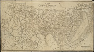
11813. Map of the city of Cambridge


![Textile Warehouse Co. Inc., Beacon Mfg. Company, Tenant, New Bedford, Mass. [insurance map]](https://bpldcassets.blob.core.windows.net/derivatives/images/commonwealth:ww72bz341/image_thumbnail_300.jpg)


![Androscoggin Mills (Cotton Mill), Lewiston, Me. [insurance map]](https://bpldcassets.blob.core.windows.net/derivatives/images/commonwealth:4j03df194/image_thumbnail_300.jpg)

11831. Boston Harbor


![Frank W. Smith Co. (Silver Ware), Gardner, Mass. [insurance map]](https://bpldcassets.blob.core.windows.net/derivatives/images/commonwealth:ww72bx96t/image_thumbnail_300.jpg)

11835. Greater Macon

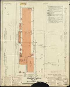
![Nashawena Mills (Cotton Mill), New Bedford, Mass. [insurance map]](https://bpldcassets.blob.core.windows.net/derivatives/images/commonwealth:ww72bz669/image_thumbnail_300.jpg)
![New Bedford Storage Warehouse Co. "Union Stores," New Bedford, Mass. [insurance map]](https://bpldcassets.blob.core.windows.net/derivatives/images/commonwealth:ww72bz72f/image_thumbnail_300.jpg)


11845. Southern Railway system

11846. State of Maine

11847. United States of America
![Ward 1 [of Boston]](https://bpldcassets.blob.core.windows.net/derivatives/images/commonwealth:jh343z28f/image_thumbnail_300.jpg)
11848. Ward 1 [of Boston]
![Winslow & McKenzie "Warehouse," New Bedford, Mass. [insurance map]](https://bpldcassets.blob.core.windows.net/derivatives/images/commonwealth:ww72c0067/image_thumbnail_300.jpg)

11850. Ziron 1920 political map

11851. The Alaska Railroad


11855. Base map of Illinois
![Central Warehouse Co., North Adams, Mass. [insurance map]](https://bpldcassets.blob.core.windows.net/derivatives/images/commonwealth:9880vw923/image_thumbnail_300.jpg)

11861. China
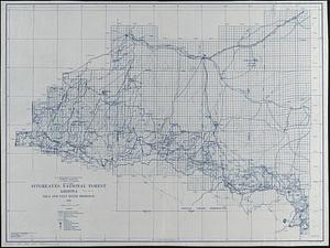
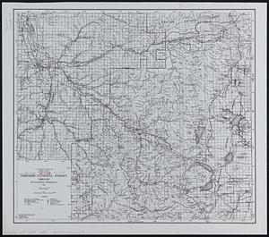
![[Chippewa] National Forest, Minnesota](https://bpldcassets.blob.core.windows.net/derivatives/images/commonwealth:th83pg40d/image_thumbnail_300.jpg)

11863. City of Boston zoning map


11873. North America


![Riverside & Dan River Cotton Mills, Inc. "Dan River Division," Schoolfield, Va. [insurance map]](https://bpldcassets.blob.core.windows.net/derivatives/images/commonwealth:2r36vc39h/image_thumbnail_300.jpg)
![Riverside & Dan River Cotton Mills, Inc. "Riverside Division, Mill No. 8" (Cotton Mill), Danville, Va. [insurance map]](https://bpldcassets.blob.core.windows.net/derivatives/images/commonwealth:2r36vc37z/image_thumbnail_300.jpg)

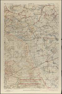
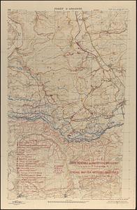
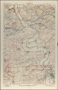
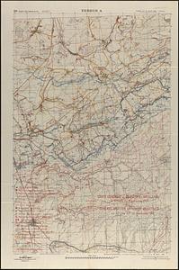
11886. St. Mihiel - B
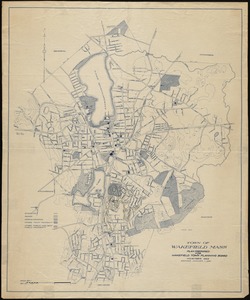
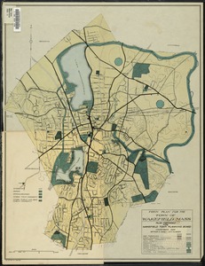
11887. Town of Wakefield, Mass.
![Webster Loom Harness Co. (Wood Working), Fall River, Mass. [insurance map]](https://bpldcassets.blob.core.windows.net/derivatives/images/commonwealth:ww72bx506/image_thumbnail_300.jpg)


11891. City of Boston zoning map


![Durfee Mills "Nos. 1, 2 & 3 Mills" (Cotton Mill), Fall River, Mass. [insurance map]](https://bpldcassets.blob.core.windows.net/derivatives/images/commonwealth:4j03df593/image_thumbnail_300.jpg)