Ethnographical map of Hungary based on the density of population
Item Information
- Title:
- Ethnographical map of Hungary based on the density of population
- Cartographer:
- Teleki, Pál, gróf, 1879-1941
- Name on Item:
-
by Count Paul Teleki, professor of geography
- Date:
-
[1922]
- Format:
-
Maps/Atlases
- Location:
-
Boston Public Library
Norman B. Leventhal Map & Education Center - Collection (local):
-
Norman B. Leventhal Map & Education Center Collection
- Subjects:
-
Population density--Hungary--Maps
Ethnology--Hungary--Maps
Ethnology--Romania--Maps
Ethnology--Slovakia--Maps
Hungary--Maps
- Places:
-
Hungary
Romania
Slovakia
- Extent:
- 1 map : color ; 58 x 81 cm
- Terms of Use:
-
No known copyright restrictions.
No known restrictions on use.
- Publisher:
-
Budapest :
Magyar Foldrajzi Intézet R.T. Nyomása
- Scale:
-
Scale 1:1,000,000
- Language:
-
English
- Notes:
-
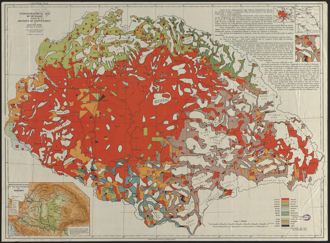
Covers Hungary and parts of Slovakia, Romania, and surrounding countries.
"According to the census of 1910."
Insets: Mountains and plains of the old kingdom of Hungary -- A. [Ethnographical map of Budapest] -- B. [Lugos and surrounding area] -- C. [Ethnographical map of Lugos and surrounding area].
Includes text.
In lower left: 1922.
- Notes (date):
-
This date is inferred.
- Identifier:
-
06_01_015067
- Call #:
-
G6501.E1 1910 .T45
- Barcode:
-
39999085931127


