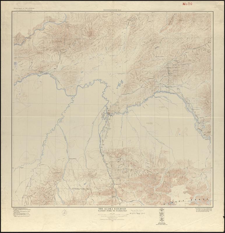
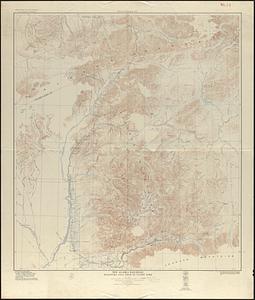
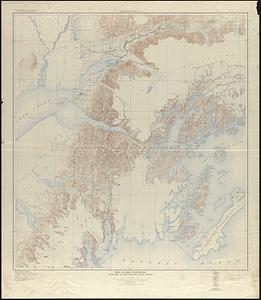
The Alaska Railroad

Item Information
- Title:
- The Alaska Railroad
- Title (alt.):
-
Reconnaissance map
- Cartographer:
- Geological Survey (U.S.)
- Cartographer:
- Bagley, James Warren, 1881-1947
- Name on Item:
-
Department of the Interior, U.S. Geological Survey ; topography by J.W. Bagley ... [et al.]
- Date:
-
1924
- Format:
-
Maps/Atlases
- Genre:
-
Topographic maps
- Location:
-
Boston Public Library
Norman B. Leventhal Map & Education Center - Collection (local):
-
Norman B. Leventhal Map & Education Center Collection
- Subjects:
-
Alaska--Maps
Denali National Park and Preserve (Alaska)--Maps
Railroads--Alaska--Maps
Alaska Railroad
- Places:
-
Alaska
AlaskaDenali (area)Denali National Park
- Extent:
- 1 map on 3 sheets : color ; 104 x 92 cm or smaller
- Terms of Use:
-
No known copyright restrictions.
No known restrictions on use.
- Publisher:
-
[Washington, D.C.] :
The Survey
- Scale:
-
Scale 1:250,000
- Language:
-
English
- Table of Contents:
-
Yanert Fork to Fairbanks
Matanuska coal field to Yanert Fork
Seward to Matanuska coal field
- Notes:
-
Relief shown by contours and spot heights.
Extends from Seward to Fairbanks and includes most of Mount McKinley National Park.
- Identifier:
-
06_01_017008B
06_01_017008A
06_01_017008C
- Call #:
-
G4371.P3 1924 .G46
- Barcode:
-
39999065684092


