St. Mihiel - B
Item Information
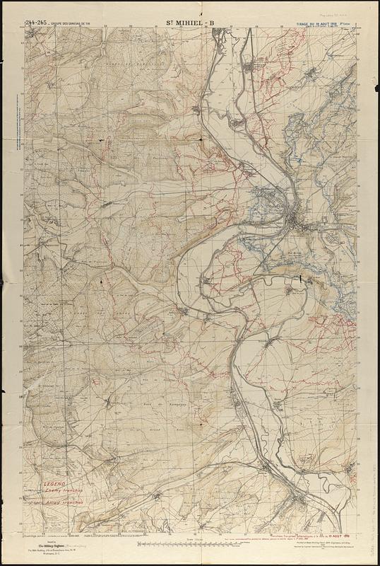
- Title:
- St. Mihiel - B
- Title (alt.):
-
Carte générale des objectifs d'artillerie
General map for artillery objectives
- Cartographer:
- France. Armée. Groupe de canevas de tir
- Cartographer:
- United States. Army. Army, 2nd
- Printer:
- United States. Army. Engineer Reproduction Plant
- Date:
-
1924
- Format:
-
Maps/Atlases
- Genre:
-
Military maps
- Location:
-
Boston Public Library
Norman B. Leventhal Map & Education Center - Collection (local):
-
Norman B. Leventhal Map & Education Center Collection
- Subjects:
-
Saint-Mihiel (France)--Maps
World War, 1914-1918--France--Saint-Mihiel--Maps
Intrenchments--France--Saint-Mihiel--Maps
- Places:
-
FranceGrand Est (region)Saint-Mihiel
- Extent:
- 1 map : color ; 100 x 66 cm
- Terms of Use:
-
No known copyright restrictions.
No known restrictions on use.
- Publisher:
-
Washington, D.C. :
Engineer Reproduction Plant ; issued by the Military Engineer
- Edition:
- 9e edition
- Scale:
-
Scale 1:20,000
- Language:
-
French
English
- Notes:
-
Relief shown by contours and spot heights.
"244-245 Groupe des Canevas de tir."
"Tirage du 19 Aout 1918."
"Tranchées françaises schématiques à la date du 19 Aout 1918."
- Notes (language):
-
In French and English.
- Identifier:
-
06_01_014828
- Call #:
-
G5831.S65 s20 .F7 St. Mihiel B
- Barcode:
-
30000004749371


