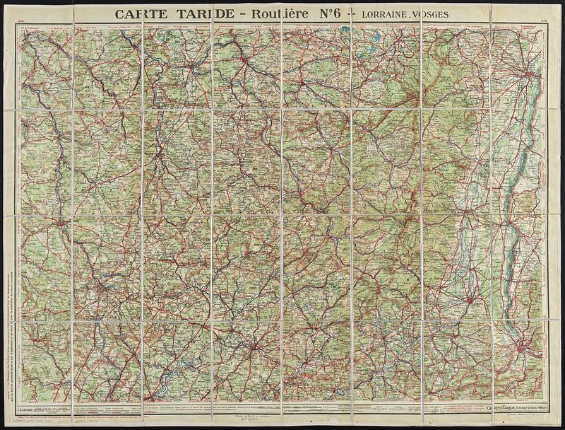
Carte Taride - routière no. 6 - Lorraine, Vosges
Item Information
- Title:
- Carte Taride - routière no. 6 - Lorraine, Vosges
- Publisher:
- Cartes Taride (Firm)
- Date:
-
[1925]
- Format:
-
Maps/Atlases
- Location:
-
Boston Public Library
Norman B. Leventhal Map & Education Center - Collection (local):
-
Norman B. Leventhal Map & Education Center Collection
- Subjects:
-
Lorraine (France)--Maps
Vosges (France)--Maps
- Places:
-
FranceLorraine (former administrative division)
FranceGrand Est (region)Département des Vosges
- Extent:
- 1 map : color ; 63 x 88 cm, folded to 18 x 12 cm
- Terms of Use:
-
No known copyright restrictions.
No known restrictions on use.
- Publisher:
-
Paris :
Cartes Taride
- Scale:
-
Scale 1:250,000
- Language:
-
French
- Notes:
-
Relief shown by shading and spot heights.
Date from: "2-25"--Bottom right
- Notes (date):
-
This date is inferred.
- Identifier:
-
06_01_018787
- Call #:
-
G5833.L65 1925 .C37
- Barcode:
-
39999085970786