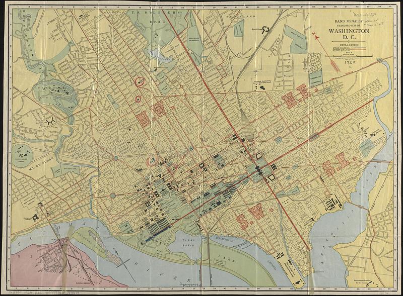
Rand McNally standard map of Washington D.C.
Item Information
- Title:
- Rand McNally standard map of Washington D.C.
- Title (alt.):
-
Washington, D.C., Rand McNally vest pocket map showing streets, transportation lines, parks, public buildings, etc.
- Cartographer:
- Rand McNally and Company
- Name on Item:
-
Rand McNally and Company
- Date:
-
[1924]
- Format:
-
Maps/Atlases
- Location:
-
Boston Public Library
Norman B. Leventhal Map & Education Center - Collection (local):
-
Norman B. Leventhal Map & Education Center Collection
- Subjects:
-
Washington (D.C.)--Maps
- Places:
-
District of Columbia
- Extent:
- 1 map : color ; 47 x 64 cm, folded in cover 16 x 10 cm
- Terms of Use:
-
No known copyright restrictions.
No known restrictions on use.
- Publisher:
-
Chicago :
Rand McNally & Co.
- Scale:
-
Scale approximately 1:15,375
- Language:
-
English
- Notes:
-
Oriented with north to the upper left.
Index on verso.
"11R24."
Boston Public Library copy lacking cover. Map has some manuscript markings.
- Notes (date):
-
This date is inferred.
- Identifier:
-
06_01_017017
- Call #:
-
G3850 1924 .R36
- Barcode:
-
39999065678474


