Toggle navigation
LMEC Home
Exhibitions
Georeferencing
Tools for Teachers
Collections
My Favorites
Sign Up / Log In
Search
Search the map portal
Map Collection
Map Collection
Map Sets
Search
Search
Search for
Search In
All Fields
Creator
Title
Subject
Place
Search All Digital Collections
Advanced Search
433 Results
My Search
Start Over
More Like
commonwealth:z603vh06v
Remove constraint More Like: commonwealth:z603vh06v
Filter your Search
Place
United States
336
North and Central America
145
Canada
36
North America
29
West Indies
23
New York
12
Boston
11
New England
11
more
Place
»
Topic
United States--Maps
314
Elections--United States--Maps
36
Railroads--United States--Maps
34
North America--Maps
28
Canada--Maps
25
West Indies--Maps
24
Population density--United States--Maps
14
New England--Maps
11
more
Topic
»
Date
Date range begin
–
Date range end
Current results range from
1750
to
2020
View distribution
Creator
Paullin, Charles Oscar, 1868 or 1869-1944
70
Wright, John Kirtland, 1891-1969
70
Geological Survey (U.S.)
15
Reid, John, 1764?-1828
11
Carleton, Osgood, 1742-1816
9
Farwell, John Whittemore, 1843-1929
9
Bellin, Jacques Nicolas, 1703-1772
8
Kitchin, Thomas, 1718-1784
8
more
Creator
»
Format
Maps/Atlases
431
Manuscripts
13
Prints
2
Books
1
Objects/Artifacts
1
Posters
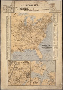
1
Georeferenced
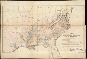
Yes
75
No
358
Collection
Norman B. Leventhal Map Center Collection
278
American Revolutionary War-Era Maps
154
American Antiquarian Society Collection
138
William L. Clements Library Collection
13
MacLean Collection Map Library
3
David Judkins Weaver Papers
2
Mapping Boston Collection
2
Boston and New England Maps
1
more
Collection
»
Available to use
No known restrictions
204
Creative Commons license
5
Search Constraints
Sort by relevance
relevance
title
date (asc)
date (desc)
Number of results to display per page
100 per page
10
per page
20
per page
50
per page
100
per page
View results as:
grid view
map view
Search Results
101.
Lloyd's American railroad map
102.
Lloyd's American railroad map
103.
Lloyd's military maps : showing the principal places of interest
104.
Lloyd's new county map of the United States and Canadas showing battle fields, railroads, &c., compiled from the latest...
105.
Lloyd's new map of the United States, the Canadas, and New Brunswick, from the latest surveys showing every railroad & station...
106.
Makers of the U.S.A. : a friendship map
107.
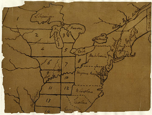
Manuscript map of the United States
108.
A Map exhibiting the frontiers of Canada and the United States : intended to illustrate the operations of the British &...
109.
Map in commemoration of the travels of Charles A. Lindbergh
110.
Map of all the railroads in the United States in operation and progress
111.
Map of North America : showing all routes to Alaska and Klondike country
112.
Map of the Atlantic States, showing distances from Washington (in bee line) by 50 mile circles
113.
A map of the British Empire in America with the French and Spanish settlements adjacent throughout
114.
A map of the cotton kingdom and its dependencies in America
115.
A map of the eclipse of Feby. 12th in its passage across the United States
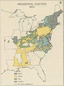
116.
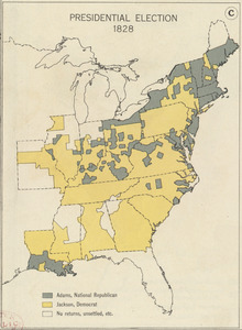
Map of the Mexican National Railway : showing also its relative position to the railway system of the United States, both as to...
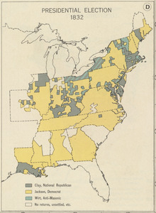
117.
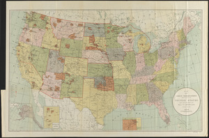
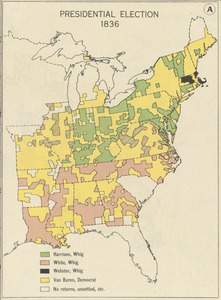
Map of the public land states and territories : constructed from the Public Surveys and other official sources in the General...
118.
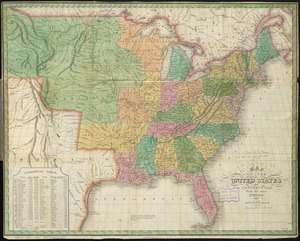
Map of the United States
119.
Map of the United States
120.
Map of the United States
121.
Map of the United States : intending chiefly to exhibit the post roads & distances
122.
Map of the United States
123.
A map of the United States
124.
A map of the United States : compiled chiefly from the state maps, and other authentic information
125.
A map of the United States
126.
A map of the United States and Canada, New-Scotland, New-Brunswick and New-Foundland = Carte des Etats-Unis avec le Canada, la...
127.
Map of the United States and territories, showing the extent of public surveys and other details constructed from the plats and...
128.
Map of the United States and territories with adjacent parts of Canada and Mexico, also part of the West India Islands :...
129.
Map of the United States, British & Central America : from state documents & unpublished materials
130.
Map of the United States, constructed from the latest authorities
131.
Map of the United States, constructed from the latest authorities
132.
A map of the United States east of the Mississippi River in which the land ceded by the Treaty of Paris is divided by parallels...
133.
A map of the United States east of the Mississippi River in which the land ceded by the Treaty of Paris is divided by parallels...
134.
Map of the United States exhibiting the several collection districts
135.
Map of the United States, from the latest surveys : with the heights of mountains and length of the principle rivers
136.
Map of the United States including Oregon, Texas and the Californias
137.
Map of the United States of America : including Canada and a large portion of Texas showing the base meridian and township...
138.
Map of the United States of America
139.
Map of the United States of America
140.
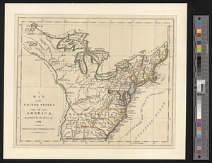
A map of the United States of America as settled by the peace of 1783
141.
Map of the United States of America, Mexico, Central America, and the West India Islands
142.
Map of the United States of America, the British provinces, Mexico, the West Indies and Central America, with part of New...
143.
Map of the United States of America, the British Provinces, Mexico, the West Indies and Central America, with part of New...
144.
A map of the United States of North America : drawn from a number of critical researches
145.
Map of the United States of North America
146.
Map of the United States of North America, upper & lower Canada, New Brunswick, Nova Scotia & British Columbia, Mexico, Cuba,...
147.
Map of the United States, showing by colors the area of freedom and slavery, and the territories whose destiny is yet to be...
148.
Map of the United States showing principal cities, rivers, and mountain ranges
149.
Map of the United States, the British provinces, Mexico, &c : showing the routes of the U.S. Mail steam packets to California,...
150.
Map of United States showing drainage areas and index numbers
151.
Map showing distribution of indian stocks and tribes, between 1710-1720
152.
Map showing in five degrees of density the distribution of woodland within the territory of the United States, 1873
153.
Map showing Indian reservations within the limits of the United States
154.
Map showing Indian reservations within the limits of the United States, 1901
155.
Map showing Indian reservations within the limits of the United States, 1903
156.
Map showing Indian reservations within the limits of the United States, 1904
157.
Map showing Indian reservations within the limits of the United States, 1905
158.
Map showing Indian reservations within the limits of the United States, 1906
159.
Map showing lines of the Bell telephone companies in the United States and Canada : July 1st, 1904
160.
Maps showing the range, and, within the range, the degree of cultivation of certain principal crops
161.
Mean monthly average temperature
162.
Military map of the United States
163.
Military map of the United States of America showing location of all forces in training
164.
Missouri Compromise, March 20, 1820, Vote on striking out provisions restricting slavery
165.
Mitchell's national map of the American Republic or United States of North America : together with maps of the vicinities of...
166.
A nation of immigrants
167.
National map of the United States
168.
New Hampshire by recent survey : made under the supreme authority and published according to law
169.
New map of the American overland route showing its connections, and land grants of 30,000,000 acres
170.
A new map of the United States including part of Louisiana : from the best authorities
171.
A new map of the United States of America
172.
A new map of the United States of America : drawn from the latest authorities
173.
A new map of the United States of America including part of Louisiana : part of Canada & of East Florida and the whole of West...
174.
Nuclear America
175.
The nuclear weapons complex transportation routes
176.
Oil in America : a pictorial story of the petroleum industry in the United States
177.
Paul Sample's America, its soil
178.
Phelps & Ensign's travellers' guide, and map of the United States, containing the roads, distances, steam boat and canal routes &c
179.
Phelps & Ensign's travellers' guide, and map of the United States, containing the roads, distances, steam boat and canal routes &c
180.
Phelps & Watson's new map of the United States
181.
A pictorial map of the United States
182.
Pictorial map of the United States, 1849
183.
The pictorial map, stamps of America
184.
The pictorial map, stamps of the U.S.A.
185.
The pictorial map, United States stamps
186.
Portugal is not a small country
187.
Presidential and other elections, 1800
188.
Presidential and other elections, 1804
189.
Presidential and other elections, 1808
190.
Presidential and other elections, 1812
191.
Presidential and other elections, 1816
192.
Presidential election 1820
193.
Presidential election 1824
194.
Presidential election 1828
195.
Presidential election 1832
196.
Presidential election 1836
197.
Presidential election 1840
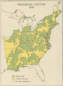
198.
Presidential election 1844
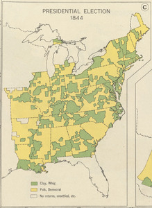
199.
Presidential election 1848
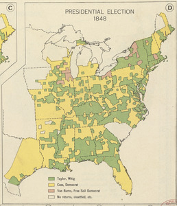
200.
Presidential election 1852
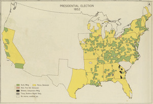
‹ Prev
Next ›
1
2
3
4
5