Map of the United States of America : including Canada and a large portion of Texas showing the base meridian and township lines of the U.S. surveys, the lands alloted to the Indian tribes west of the Mississippi
Item Information
- Title:
- Map of the United States of America : including Canada and a large portion of Texas showing the base meridian and township lines of the U.S. surveys, the lands alloted to the Indian tribes west of the Mississippi
- Description:
-
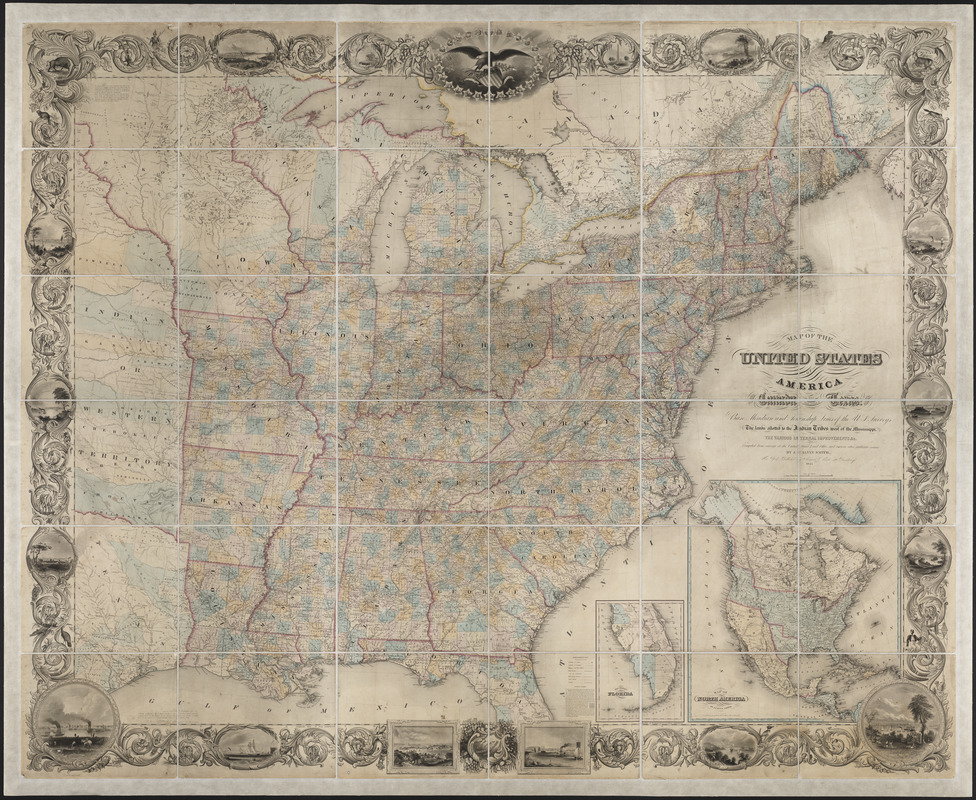
This large wall map focuses on the eastern half of mid-19th century United States. Meanwhile an inset delineates the political geography of North America, with the United States extending to the Pacific Northwest, but not yet including the Republic of Texas or the southwestern territories ceded by Mexico in 1848. The map is decorated with American motifs. In the top center is a vignette of an eagle on a shield of stars and stripes, while the wide decorative border displays sixteen views including one of Boston. A variety of American wildlife (buffalo, deer, beaver, alligator, and turkey) are interwoven into this design.
- Creator:
- Smith, J. Calvin (John Calvin)
- Name on Item:
-
compiled from surveys at the U.S. Land Office by J. Calvin Smith
- Date:
-
1845
- Format:
-
Maps/Atlases
- Location:
- Private Collection
- Collection (local):
-
Mapping Boston Collection
- Subjects:
-
Political geography
Indians of North America--West (U.S.)
United States--Maps
- Places:
-
United States
- Extent:
- 1 map : col. ; 177 x 217 cm.
- Terms of Use:
-
No known copyright restrictions.
This work is licensed for use under a Creative Commons Attribution Non-Commercial Share Alike License (CC BY-NC-SA).

- Publisher:
-
New York :
Sherman & Smith
- Scale:
-
Scale [ca. 1:1,584,000]
- Language:
-
English
- Notes:
-
Relief shown pictorially.
Engraved views of American towns around margins.
Linen-backed.
Includes insets of "Southern part of Florida" and "Map of North America."
- Identifier:
-
06_01_001247
- Barcode:
-
39999052509484


