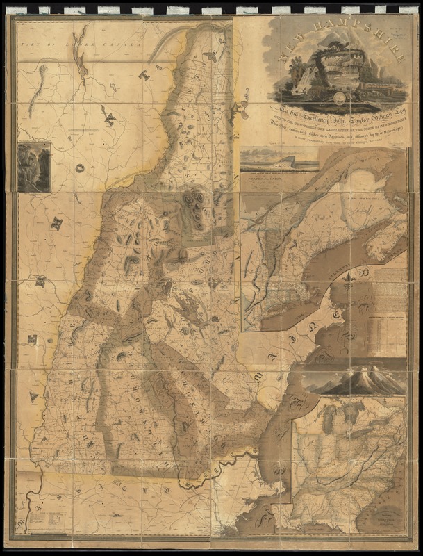
New Hampshire by recent survey : made under the supreme authority and published according to law
Item Information
- Title:
- New Hampshire by recent survey : made under the supreme authority and published according to law
- Creator:
- Carrigain, Philip, 1772-1842
- Name on Item:
-
by Philip Carrigain ; J.J. Barralet del. ; W. Harrison Sct. Philada.
- Date:
-
1816
- Format:
-
Maps/Atlases
- Location:
-
Boston Public Library
Norman B. Leventhal Map & Education Center - Collection (local):
-
Norman B. Leventhal Map & Education Center Collection
- Subjects:
-
New Hampshire--Maps
New England--Maps
United States--Maps
Hampton Beach (N.H.)--Pictorial works
White Mountains (N.H. and Me.)--Pictorial works
- Places:
-
New England (area)
New Hampshire
New HampshireWhite Mountains
New HampshireRockingham (county)Hampton Beach
- Extent:
- 1 map : color ; 152 x 116 cm
- Terms of Use:
-
No known copyright restrictions.
No known restrictions on use.
- Publisher:
-
Concord, [New Hampshire] :
Philip Carrigain,
- Scale:
-
Scale approximately 1:192,000
- Language:
-
English
- Notes:
-
Relief shown pictorially and by hachures.
Inset maps: States of the Union east of the Hudson with the adjacent British colonies. Scale approximately 1:1,920,000 -- The middle, southern and western sections of the United States with the territories. Scale approximately 1:4,900,000.
Inset illustrations: View of the Great Boars Head and Hampton Beach -- The Gap of the White Mountains -- View of the White Mountains from Shelburne.
Prime meridian: Washington.
Originally on 6 sheets. Assembled, dissected and mounted on cloth.
- Identifier:
-
06_01_012301
- Call #:
-
G3740 1816 .C37
- Barcode:
-
39999065697441


