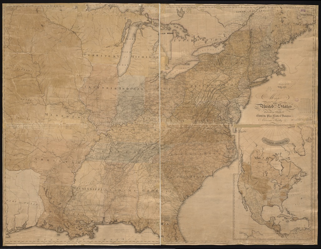
Map of the United States : intending chiefly to exhibit the post roads & distances
Item Information
- Title:
- Map of the United States : intending chiefly to exhibit the post roads & distances
- Creator:
- Bradley, Abraham, 1767-1838
- Name on Item:
-
by Abraham Bradley.
- Date:
-
[1828–1836]
- Format:
-
Maps/Atlases
- Location:
-
Boston Public Library
Norman B. Leventhal Map & Education Center - Collection (local):
-
Norman B. Leventhal Map & Education Center Collection
- Subjects:
-
Counties--United States--Maps
Post roads--United States--Maps
United States--Maps
North America--Maps
- Places:
-
North America (area)
United States
- Extent:
- 1 map : hand col. ; 117 x 154 cm.
- Terms of Use:
-
No known copyright restrictions.
No known restrictions on use.
- Publisher:
-
Philadelphia :
Abraham Bradley
- Scale:
-
Scale [ca. 1:1,760,000]
- Language:
-
English
- Notes:
-
Relief shown by hachures.
Prime meridian: Washington D.C.
Includes inset of North America showing states, territories, and capitals.
Map shows the U.S. ca. 1823, showing Copiah Co., Ala (1823) and not Simpson Co., Ala. (1824).
Inset shows North America between 1828 and 1836, showing Arkansas (1828) and not Wisconsin Territory (1836).
- Notes (date):
-
This date is inferred.
- Identifier:
-
06_01_008567
- Call #:
-
G3700 1828 .B73x
- Barcode:
-
39999065654103


