Toggle navigation
LMEC Home
Exhibitions
Georeferencing
Tools for Teachers
Collections
My Favorites
Sign Up / Log In
Search
Search the map portal
Map Collection
Map Collection
Map Sets
Search
Search
Search for
Search In
All Fields
Creator
Title
Subject
Place
Search All Digital Collections
Advanced Search
480 Results
My Search
Start Over
More Like
commonwealth:q524nk07j
Remove constraint More Like: commonwealth:q524nk07j
Filter your Search
Place
North and Central America
416
United States
293
New York
40
Florida
19
Canada
17
Alabama
15
Chatham (county)
15
Savannah
13
more
Place
»
Topic
Manuscript maps--Early works to 1800
92
Manuscript maps
21
Gulf Coast (U.S.)--Maps, Manuscript--Early works to 1800
12
Fortification--New York (State)--New York--Maps--Early works to 1800
11
New York (N.Y.)--Buildings, structures, etc--Maps, Manuscript--Early works to 1800
9
New York (N.Y.)--Maps, Manuscript--Early works to 1800
8
Saratoga Campaign, N.Y., 1777--Maps, Manuscript--Early works to 1800
8
Coasts--Florida--Maps--Early works to 1800
7
more
Topic
»
Date
Date range begin
–
Date range end
Current results range from
1700
to
1899
View distribution
Creator
Hills, John, (Surveyor)
17
Montrésor, John, 1736-1799
16
Bingham, William, 1752-1804
12
Adlum, John, 1759-1836
10
Washington, George, 1732-1799
9
Faden, William, 1749-1836
7
Wangenheim, Friedrich Adam Julius von
7
Capitaine du Chesnoy, Michel, 1746-1804
6
more
Creator
»
Format
Maps/Atlases
478
Manuscripts
475
Objects/Artifacts
2
Georeferenced
Yes
5
No
475
Collection
American Revolutionary War-Era Maps
480
Library of Congress Collection
480
Maritime Charts and Atlases
31
Urban Maps
15
Available to use
Creative Commons license
480
Search Constraints
Sort by date (asc)
relevance
title
date (asc)
date (desc)
Number of results to display per page
100 per page
10
per page
20
per page
50
per page
100
per page
View results as:
grid view
map view
Search Results
201.
Les marches du corps du Lord Cornwallis de Billinsport jusqu'a Philadelphia au mois de Novembre, 1777
202.
Operations of the British army, from the 25th August to 26th Sept. 1777
203.
Part of a map of the Hudson Highlands showing Forts Clinton and Montgomery
204.
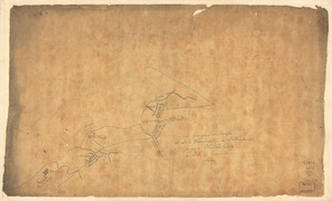
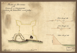
Plan and sections of the redoubt at Billingsfort and plan of the rebel fort marked yellow
205.
Plan de l'affaire de Westfield & du camp de Raway
206.
Plan de notre camp à New Brunswick le 12e. juin : notre marche le 14 à Middlebush, la situation du camp le 15e juin, et cette...
207.
Plan du camp retranchè à Wilmington pour y couvrir notre hospital apres la Battaille de Brandywine
208.
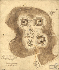
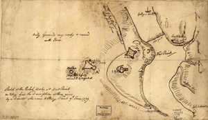
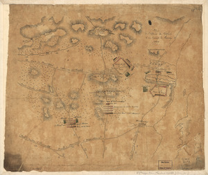
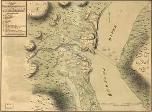
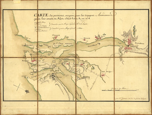
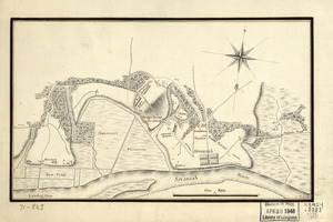
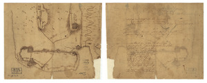
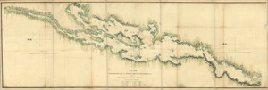
Plan of Carillon ou [sic] Ticonderoga : which was quitted by the Americaines in the night from the 5th to the 6th of July 1777
209.
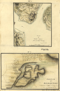
Plan of Perth Amboy from an actual survey. Sketch of Bonham Town
210.
A Plan of that part of the boundary between the states of North and South Carolina : lying between that part of said boundary...
211.
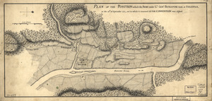
A plan of the attacks against Fort Miflin on Mud Island : which surrendered 16th, November 1777 to the Kings troops under the...
212.
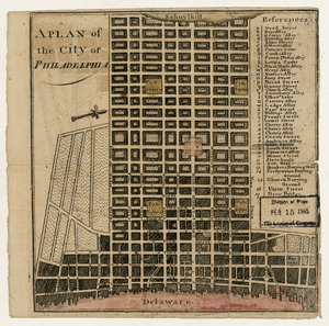
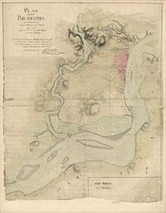
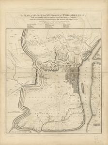
A plan of the city of Philadelphia
213.
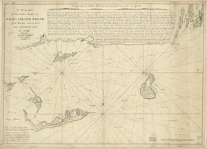
A plan of the east part of Long Island Sound : from remarks made on board His Majesty's ship the Lark, A.D. 1777
214.
Plan of the encampment and position of the army under His Excelly. Lt. General Burgoyne : at Bræmus Heights on Hudson's River...
215.
Plan of the encampment and position of the army under His Excelly. Lt. General Burgoyne : at Swords House on Hudson's River on...
216.
A plan of the Forts Montgomery & Clinton : as taken by His Majesty's forces under the command of Genl. Sr. Henry Clinton the...
217.
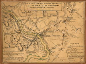
Plan of the operations of General Washington against the King's troops in New Jersey : from the 26th of December 1776 to the 3d...
218.
Plan of the position which the army under Lt. Genl. Burgoyne took at Saratoga : on the 10th of September 1777, and in which it...
219.
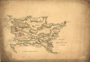
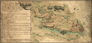
Plan von Rhode Island : und deren dem comando des Herrn General Majors Presgott inf dies-malig befundlichen campements
220.
Position de notre camp le 24 juin 1777 à Perth Amboy
221.
Position of the army on the 8th Octbr. 1777
222.
Position of the detachment under Lieut't Col. Baum & attacks of the enemy on the 16th August at Walmscock near Benington, 1777
223.
Progress of the army from their landing till taking possession of Philadelphia
224.
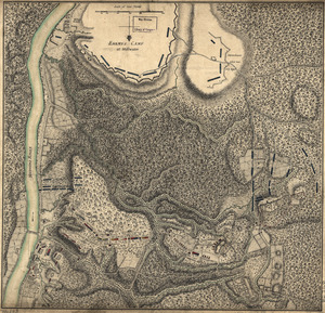
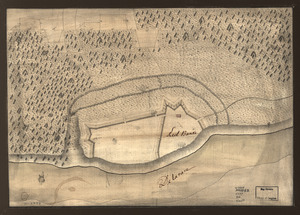
Red Banke
225.
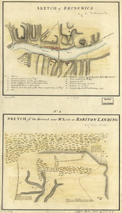
Sketch of Brunswick : Sketch of the ground near Mr. Low's at Rariton Landing
226.
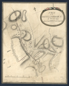
A Sketch of the Battle of German. Tn : 4th. October 1777, where the rebels were repulsed
227.
A Sketch of the Battle of German. Tn : 4th October 1777, where the rebels were repulsed
228.
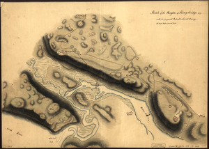
Sketch of the Heights of Kingsbridge 1777, with the proposed redoubts coloured orange : Old rebel works coloured black
229.
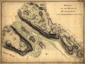
Sketch of the Heights of Kingsbridge, with the proposed redouts couloured yellow
230.
A survey of the city of Philadelphia and its environs : shewing the several works constructed by His Majesty's troops, under...
231.
This is not given as an accurate map, but only to afford an idea of the progress of the army from the landing at Elk to the...
232.
Amboy to Elizabethtown
233.
Attacks upon Rhode Island, Augt. 1778
234.
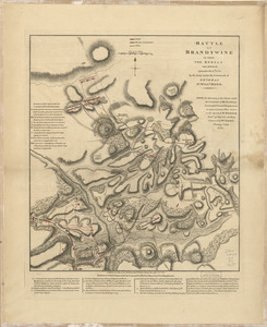
Battle of Brandywine in which the rebels were defeated : September the 11th. 1777, by the army under the command of General Sr....
235.
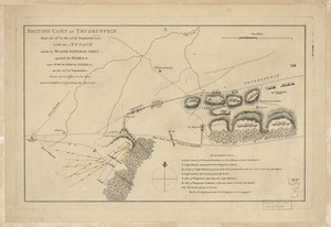
British camp at Trudruffrin from the 18th. to the 21st. of September 1777 : with the attack made by Major General Grey against...
236.
Carte de l'affaire de Montmouth : ou le G'al Washington commandon l'armée américaine et le G'l Clinton l'armée angloise le...
237.
Carte des positions occupeés par les trouppes Américaines apres leur retraite de Rhode Island le 30 Aout 1778
238.
Disposition of British troops, with fortifications north of Fort Knipehausen, i.e. Fort Washington to Fort Independence
239.
L'escadre françoise entrant dans Newport sous le feu des batteries et forcant le passage le 8 Aoust 1778 : jour que les...
240.
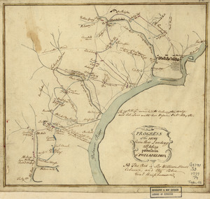
Map of the environs of Camden, N.J
241.
New York Island. Military. Unfinished
242.
Philadelphia and neighborhood
243.
Philadelphia and vicinity. Military
244.
Plan de la retraite de Barren Hill en Pensilvanie : ou un détachement de deux mille deux cent hommes sous le G'al LaFayette...
245.
Plan de Rhode Island et les differentes operations de la flotte-françoises et des troupes americaines : commandées par le...
246.
Plan de Rhode Islande, les differentes operations de la flotte françoise et des trouppes Américaines commandeés par le major...
247.
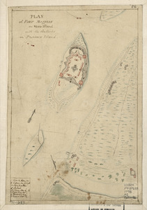
Plan of Fort Mifflin on Mud Island, with the batteries on Province Island
248.
Plan of Genl Du Portail : Plan of the position of Valley Forge after Jany. 1778
249.
Plan of part of the River Delaware from Chester to Philadelphia : in which is mark'd the position of His Majs. ships on the...
250.
Plan of part of western front
251.
Plan of Paulus's Hook and fortifications
252.
Plan of Paulus's Hook and fortifications
253.
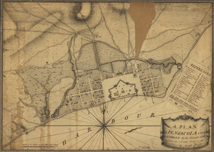
A plan of Pensacola and its environs in its present state : from an actual survey in 1778
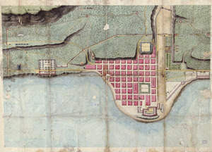
254.
Plan of the city of Philadelphia and its environs shewing its defences during the years 1777 & 1778 : together with the siege...
255.
A Plan of the late Province of Main as far as Kennebeck River
256.
A Plan of the works on Spikendevil Hill with the ground in front, protracted from a scale of 200 feet to an inch
257.
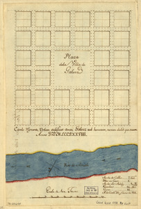
Plaza de la villa de Galvez
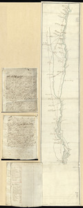
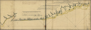
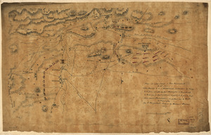
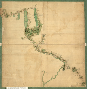
258.
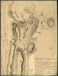
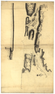
Skecth [sic] of the road from Kings Bridge to White Plains
259.
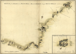
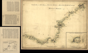
Sketch of Haddonfield, March 1778 : Sketch of the roads from Pennyhill to Black Horse through Mount Holly
260.
Sketch of Haddonfield. Sketch of the road from Penny Hill to Black Horse through Mount Holly, 1778
261.
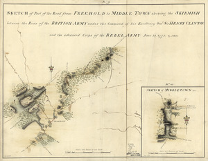
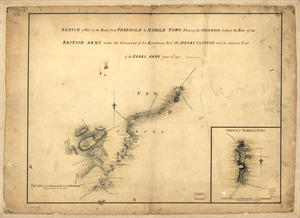
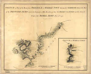
Sketch of part of the road from Freehold to Middle Town : shewing the skirmish between the rear of the British Army under the...
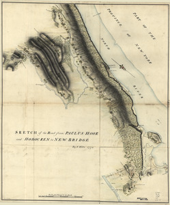
262.
Sketch of part of the road from Freehold to Middle Town : shewing the skirmish between the rear of the British Army under the...
263.
Sketch of part of the road from Freehold to Middle Town : shewing the skirmish between the rear of the British Army under the...
264.
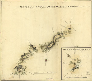
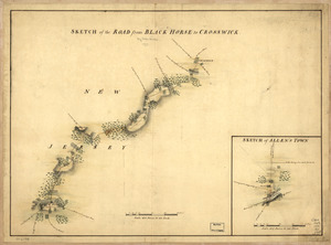
Sketch of the road from Black Horse to Crosswick
265.
Sketch of the road from Black Horse to Crosswick. Sketch of Allen's Town
266.
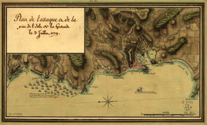
Sketch of the road from Paulus Hook and Hobocken to New Bridge
267.
Taking of Savannah in Dec. 1778
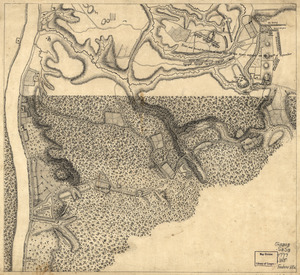
268.
Taking of Savannah in Dec. 1778
269.
Unfinished draught for a topographical map of the northern part of New York Island
270.
Fort La Fayette on Verplancks Point, with British and Hessian troop positions
271.
Map of Gen. Sullivan's march from Easton to the Senaca & Cayuga countries
272.
Map of Orange and Rockland counties area of New York
273.
Map of Stony and Verplanck Points on the Hudson River as fortified by Sir Henry Clinton June 1779
274.
Penobscot River and Bay, with the operations of the English fleet, under Sir George Collyer : against the division of...
275.
Plan de l'attaque et de la prise de l'isle de la Grenade le 3 juillet 1779
276.
Plan, Lake Champlain from Fort St. John's to Ticonderoga : with the soundings, rocks, shoals, and sands, surveyed in the years...
277.
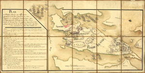
A plan of the city and environs of Philadelphia : with the works and encampments of His Majesty's forces under the command of...
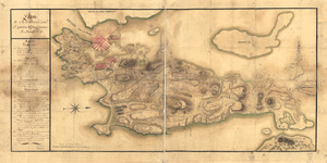
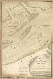
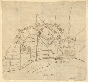
278.
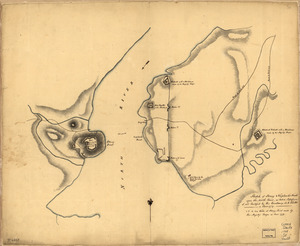
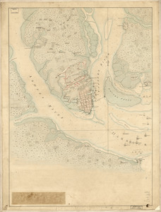
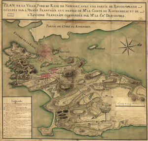
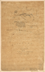
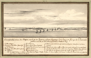
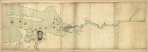
Plan of the French and rebells sieg[e] of Savannah in Georgia, in South [sic] America, deffend : t[h]rough the Br: Gen: August...
279.
Plan of the redoubts at Richmond on Staten Island, 30th October 1779
280.
Roads and country that Col. Campbell marched thro'--Ebenezer to Augusta in Georgia
281.
Savannah and its environs
282.
Sketch of Stoney & Verplank's Points upon the North River : as taken possession of, and fortified by His Excellency Sir H:...
283.
Sketch of the rebel works at West Point : as taken from the description of them given by a deserter who came to Stoney Point,...
284.
The Above is a plan of the town of Cabot, State of Vermont
285.
Carte de l'entrée du port et rade de Pensacola
286.
Costa de Cuba desde Cabo de San Antonio a la bahía de Cardenas
287.
The Investiture of Charleston, S.C. by the English army, in 1780 : With the position of each corps
288.
Map of coast from southern Florida to central New Jersey
289.
Map of the coast of Georgia, bordering on Camden and Glynn counties : showing also the course and soundings of the Alatamaha,...
290.
A map of the land abt. Red Stone and Fort Pitt
291.
Map showing coast in the regions of Aguadilla, Añasco, and Mayagüez
292.
Map showing coast in the regions of Aguadilla, Añasco, and Mayagüez
293.
Operations in America : No. 2
294.
Plan de la position de l'armée françoise autour de Newport et du mouillage de l'escadre dans la rade de cette ville
295.
Plan de la ville de Charlestown, de ses retranchements et du siege faits par les Anglois en 1780
296.
Plan de la ville, du port, et de la rade de New-port et Rhode Island : Debarquement en 1780
297.
Plan de la ville, port, et rade de Newport : avec une partie de Rhode-Island occupée par l'armée française aux ordres de Mr....
298.
Plan de Rhodes-Island, et position de l'armée françoise a Newport
299.
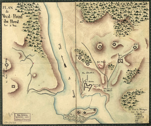
Plan de West-Point du nord, levé a vue
300.
Plan du Môle St. Nicolas
‹ Prev
Next ›
1
2
3
4
5
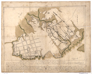
![Plan of Carillon ou [sic] Ticonderoga](https://bpldcassets.blob.core.windows.net/derivatives/images/commonwealth:q524nk513/image_thumbnail_300.jpg)


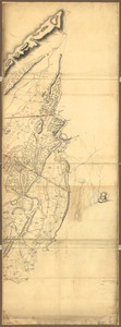
![Skecth [sic] of the road from Kings Bridge to White Plains](https://bpldcassets.blob.core.windows.net/derivatives/images/commonwealth:q524n8895/image_thumbnail_300.jpg)

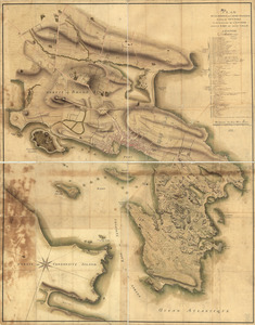
![Plan of the French and rebells sieg[e] of Savannah in Georgia, in South [sic] America, deffend](https://bpldcassets.blob.core.windows.net/derivatives/images/commonwealth:q524nc699/image_thumbnail_300.jpg)