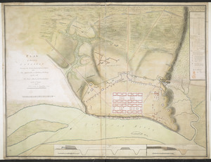
Savannah and its environs
This map is also available in American Revolutionary Geographies Online (ARGO), a collections portal especially built for material relating to the American Revolutionary War Era. Visit ARGO to learn more about this item and explore the historical geography of North America in the late eighteenth century.
Item Information
- Title:
- Savannah and its environs
- Date:
-
[1779]
- Format:
-
Maps/Atlases
Manuscripts
- Location:
- Library of Congress Geography and Map Division
- Collection (local):
-
Library of Congress Collection
- Subjects:
-
Savannah (Ga.)--History--Siege, 1779--Maps, Manuscript--Early works to 1800
- Places:
-
Chatham (county)Savannah
- Extent:
- 1 manuscript map : hand color; 26 x 44 cm.
- Terms of Use:
-
No known copyright restrictions.
This work is licensed for use under a Creative Commons Attribution Non-Commercial Share Alike License (CC BY-NC-SA).

- Scale:
-
Scale ca. 1:24,000
- Language:
-
English
- Catalog Record:
-
https://lccn.loc.gov/gm71000880
- Notes:
-
Title from manuscript catalog of Peter Force map collection.
Manuscript, pen-and-ink and watercolor.
Oriented with north toward the lower left.
Relief shown by hachures.
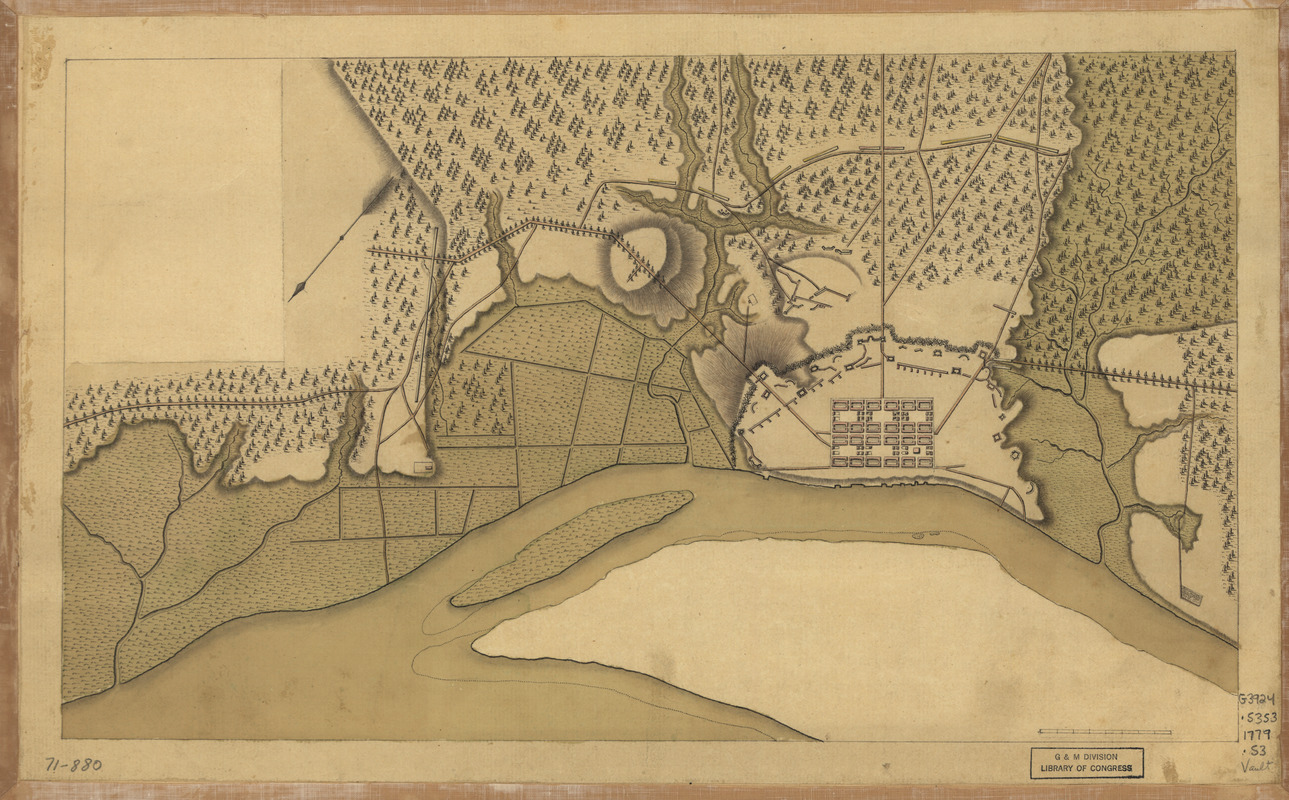
Shows the siege of Savannah, 1779.
- Notes (date):
-
This date is inferred.
- Notes (citation):
-
LC Maps of North America, 1750-1789, 1579
- Identifier:
-
ar157900

![Plan of the French and rebells sieg[e] of Savannah in Georgia, in South [sic] America, deffend](https://bpldcassets.blob.core.windows.net/derivatives/images/commonwealth:q524nc699/image_thumbnail_300.jpg)
![[Map of the operations at the seige of Savannah in 1779, by the French and American forces]](https://bpldcassets.blob.core.windows.net/derivatives/images/commonwealth:9s161g724/image_thumbnail_300.jpg)