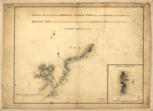
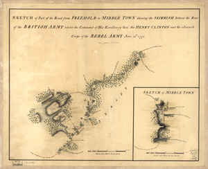
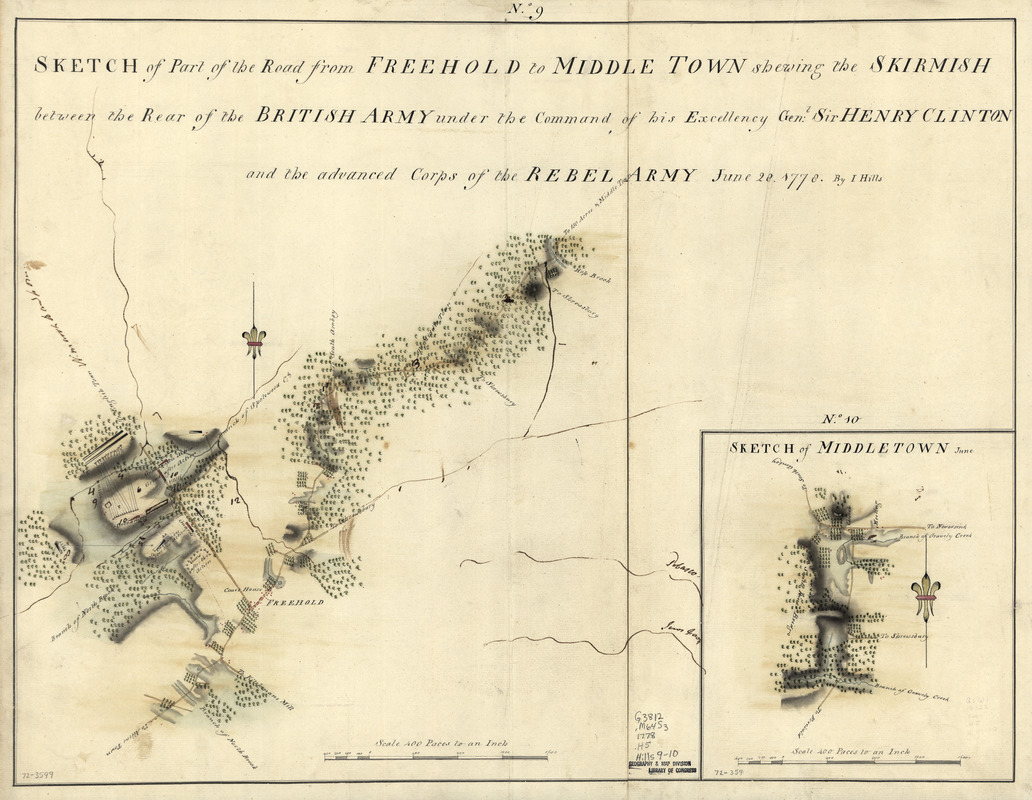
Sketch of part of the road from Freehold to Middle Town : shewing the skirmish between the rear of the British Army under the command of His Excellency Genl: Sir Henry Clinton and the advance corps of the rebel army, June 28, 1778
This map is also available in American Revolutionary Geographies Online (ARGO), a collections portal especially built for material relating to the American Revolutionary War Era. Visit ARGO to learn more about this item and explore the historical geography of North America in the late eighteenth century.
Item Information
- Title:
- Sketch of part of the road from Freehold to Middle Town : shewing the skirmish between the rear of the British Army under the command of His Excellency Genl: Sir Henry Clinton and the advance corps of the rebel army, June 28, 1778
- Title (alt.):
-
Freehold to Middle Town
- Creator:
- Hills, John, (Surveyor)
- Contributor:
- Clinton, Henry, Sir, 1738?-1795
- Name on Item:
-
by I. Hills. Sketch of Middletown, June
- Date:
-
[1778]
- Format:
-
Maps/Atlases
Manuscripts
- Location:
- Library of Congress Geography and Map Division
- Collection (local):
-
Library of Congress Collection
- Subjects:
-
Monmouth, Battle of, Freehold, N.J., 1778--Maps, Manuscript--Early works to 1800
Freehold Region (N.J.)--History--Revolution, 1775-1783--Maps, Manuscript--Early works to 1800
Middletown (N.J.)--Maps, Manuscript--Early works to 1800
- Places:
-
Monmouth (county)Freehold
Monmouth (county)Middletown
- Extent:
- 2 col. maps ; on sheet 44 x 58 cm.
- Terms of Use:
-
No known copyright restrictions.
This work is licensed for use under a Creative Commons Attribution Non-Commercial Share Alike License (CC BY-NC-SA).

- Scale:
-
Scale ca. 1:12,000
- Language:
-
English
- Catalog Record:
-
https://lccn.loc.gov/gm72003599
- Notes:
-
Manuscript, pen-and-ink and watercolor.
Has watermarks.
Relief shown by shading.
No. 9 shows positions of grenadiers and guns before and after the action.
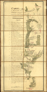
Accompanied by Hills map collection title page and table of contents.
- Notes (date):
-
This date is inferred.
- Notes (citation):
-
LC Maps of North America, 1750-1789, 1281
- Identifier:
-
ar128100