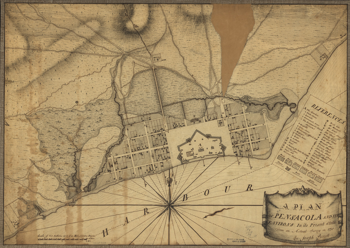
A plan of Pensacola and its environs in its present state : from an actual survey in 1778
This map is also available in American Revolutionary Geographies Online (ARGO), a collections portal especially built for material relating to the American Revolutionary War Era. Visit ARGO to learn more about this item and explore the historical geography of North America in the late eighteenth century.
Item Information
- Title:
- A plan of Pensacola and its environs in its present state : from an actual survey in 1778
- Creator:
- Purcell, Joseph
- Date:
-
[1778]
- Format:
-
Maps/Atlases
Manuscripts
- Location:
- Library of Congress Geography and Map Division
- Collection (local):
-
Library of Congress Collection
- Subjects:
-
Pensacola (Fla.)--Maps, Manuscript--Early works to 1800
Manuscript maps--Early works to 1800
- Places:
-
Escambia (county)Pensacola
- Extent:
- 1 manuscript map, 51 x 72 cm.
- Terms of Use:
-
No known copyright restrictions.
This work is licensed for use under a Creative Commons Attribution Non-Commercial Share Alike License (CC BY-NC-SA).

- Scale:
-
Scale ca. 1:4,000
- Language:
-
English
- Catalog Record:
-
https://lccn.loc.gov/73691620
- Notes:
-
Manuscript, pen-and-ink.
Has watermarks.
Relief shown by hachures.
Cadastral map.
Indexed.
Imperfect; part of upper right corner torn out.
- Notes (date):
-
This date is inferred.
- Notes (citation):
-
LC Maps of North America, 1750-1789, 1661
- Identifier:
-
ar166100