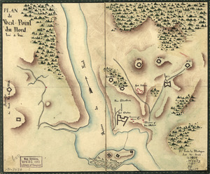
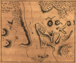
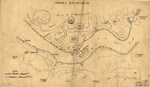
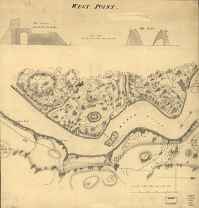
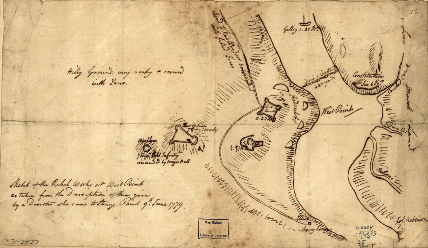
Sketch of the rebel works at West Point : as taken from the description of them given by a deserter who came to Stoney Point, 9th June, 1779
This map is also available in American Revolutionary Geographies Online (ARGO), a collections portal especially built for material relating to the American Revolutionary War Era. Visit ARGO to learn more about this item and explore the historical geography of North America in the late eighteenth century.
Item Information
- Title:
- Sketch of the rebel works at West Point : as taken from the description of them given by a deserter who came to Stoney Point, 9th June, 1779
- Date:
-
[1779]
- Format:
-
Maps/Atlases
Manuscripts
- Location:
- Library of Congress Geography and Map Division
- Collection (local):
-
Library of Congress Collection
- Subjects:
-
Fortification--New York (State)--West Point--Maps--Early works to 1800
West Point (N.Y.)--Buildings, structures, etc--Maps, Manuscript--Early works to 1800
- Places:
-
Orange (county)West Point
- Extent:
- 1 manuscript map, 22 x 38 cm.
- Terms of Use:
-
No known copyright restrictions.
This work is licensed for use under a Creative Commons Attribution Non-Commercial Share Alike License (CC BY-NC-SA).

- Scale:
-
Scale ca. 1:11,000
- Language:
-
English
- Catalog Record:
-
https://lccn.loc.gov/gm71005427
- Notes:
-
Manuscript, pen-and-ink.
Has watermarks.
Relief shown by hachures.
Shows fortifications and amounts of ordnance.
- Notes (date):
-
This date is inferred.
- Notes (citation):
-
LC Maps of North America, 1750-1789, 1203
- Identifier:
-
ar120300