Toggle navigation
LMEC Home
Exhibitions
Georeferencing
Tools for Teachers
Collections
My Favorites
Sign Up / Log In
Search
Search the map portal
Map Collection
Map Collection
Map Sets
Search
Search
Search for
Search In
All Fields
Creator
Title
Subject
Place
Search All Digital Collections
Advanced Search
484 Results
My Search
Start Over
More Like
commonwealth:q524nj64z
Remove constraint More Like: commonwealth:q524nj64z
Filter your Search
Place
North and Central America
420
United States
297
New York
42
Florida
19
Canada
17
Alabama
15
Chatham (county)
15
Savannah
13
more
Place
»
Topic
Manuscript maps--Early works to 1800
92
Manuscript maps
21
Gulf Coast (U.S.)--Maps, Manuscript--Early works to 1800
12
Fortification--New York (State)--New York--Maps--Early works to 1800
11
New York (N.Y.)--Maps, Manuscript--Early works to 1800
11
New York (N.Y.)--Buildings, structures, etc--Maps, Manuscript--Early works to 1800
9
Saratoga Campaign, N.Y., 1777--Maps, Manuscript--Early works to 1800
8
Coasts--Florida--Maps--Early works to 1800
7
more
Topic
»
Date
Date range begin
–
Date range end
Current results range from
1664
to
1899
View distribution
Creator
Hills, John, (Surveyor)
18
Montrésor, John, 1736-1799
16
Bingham, William, 1752-1804
12
Adlum, John, 1759-1836
10
Washington, George, 1732-1799
9
Faden, William, 1749-1836
7
Morgan, Benjamin, (Draftsman)
7
Wangenheim, Friedrich Adam Julius von
7
more
Creator
»
Format
Maps/Atlases
482
Manuscripts
478
Objects/Artifacts
2
Georeferenced
Yes
5
No
479
Collection
American Revolutionary War-Era Maps
483
Library of Congress Collection
480
Maritime Charts and Atlases
31
Urban Maps
16
British Library Collection
3
Norman B. Leventhal Map Center Collection
1
Available to use
Creative Commons license
483
No known restrictions
1
Search Constraints
Sort by relevance
relevance
title
date (asc)
date (desc)
Number of results to display per page
100 per page
10
per page
20
per page
50
per page
100
per page
View results as:
grid view
map view
Search Results
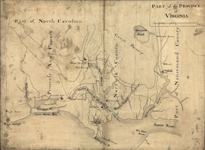
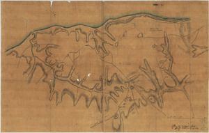
201.
Part of the Province of Virginia
202.
Penobscot River and Bay, with the operations of the English fleet, under Sir George Collyer : against the division of...
203.
Philadelphia and neighborhood
204.
Philadelphia and vicinity. Military
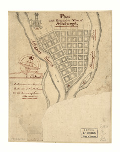
205.
Plan and perspective view of Pittsburgh
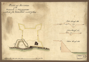
206.
Plan and sections of the redoubt at Billingsfort and plan of the rebel fort marked yellow
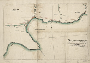
207.
Plan de la Baye de Baynet : situeé a hiut leiues sous le vent de celle de Jacmel, levé suivant les ordres de Mr. d'Estaing le...
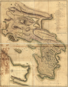
208.
Plan de la position de l'armée françoise autour de Newport et du mouillage de l'escadre dans la rade de cette ville
209.
Plan de la retraite de Barren Hill en Pensilvanie : ou un détachement de deux mille deux cent hommes sous le G'al LaFayette...
210.
Plan de la ville de Charlestown, de ses retranchements et du siege faits par les Anglois en 1780
211.
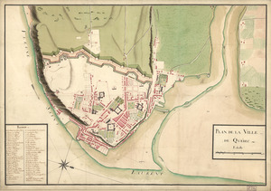
Plan de la ville de Québec
212.
Plan de la ville, du port, et de la rade de New-port et Rhode Island : Debarquement en 1780
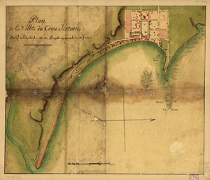
213.
Plan de la ville du Trou Jéremie : rélatif à l'article 13 du projet géneral de défense
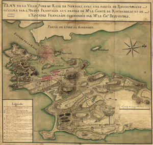
214.
Plan de la ville, port, et rade de Newport : avec une partie de Rhode-Island occupée par l'armée française aux ordres de Mr....
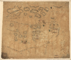
215.
Plan de l'affaire de Westfield & du camp de Raway
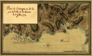
216.
Plan de l'attaque et de la prise de l'isle de la Grenade le 3 juillet 1779
217.
Plan de notre camp à New Brunswick le 12e. juin : notre marche le 14 à Middlebush, la situation du camp le 15e juin, et cette...
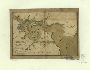
218.
Plan de Portsmouth en Virginie
219.
Plan de Rhode Island et les differentes operations de la flotte-françoises et des troupes americaines : commandées par le...
220.
Plan de Rhode Islande, les differentes operations de la flotte françoise et des trouppes Américaines commandeés par le major...
221.
Plan de Rhodes-Island, et position de l'armée françoise a Newport
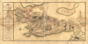
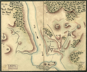
222.
Plan de West-Point du nord, levé a vue
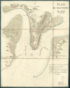
223.
Plan de West-Point du Sud
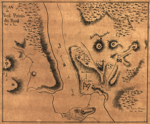
224.
Plan de West-Pointe du nord levé a vue
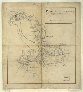
225.
Plan des environs de Williamsburg, York, Hampton, et Portsmouth
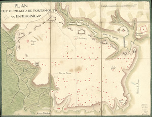
226.
Plan des ouvrages de Portsmouth en Virginie
227.
Plan des ouvrages de Portsmouth en Virginie
228.
Plan des ouvrages faits à York-town en Virginie
229.
Plan du camp retranchè à Wilmington pour y couvrir notre hospital apres la Battaille de Brandywine
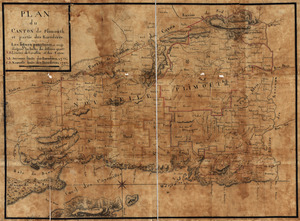
230.
Plan du canton de Plimouth et partie des Baradéres
231.
Plan du Cap Breton, dit Louisbovrg avec ces environs pries
232.
Plan du Môle St. Nicolas
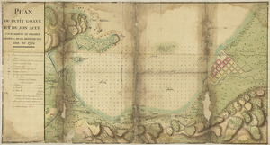
233.
Plan du Petit Goâve et de son acul pour servir au projet général de sa défense par mer en 1752
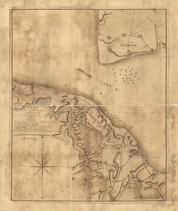
234.
Plan du port de Portsmouth levé à vue
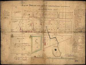
235.
Plan du terrain sur le cap appartenant à la paroise de cette uille 1756
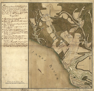
236.
Plan du terrein à la rive gauche de la rivière de James vis-à-vis Jamestown en Virginie : ou s'est livré le combat du 6...
237.
Plan d'York en Virginie avec les attaques faites par les Armées françoise et américaine en 8bre. 1781
238.
Plan general des operations de l'Armée Britanique contre les rebelles dans l'Amerique : depuis l'arrivée des troupes...
239.
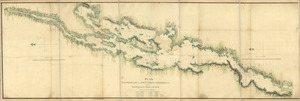
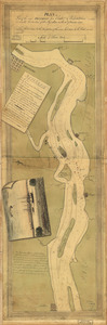
Plan, Lake Champlain from Fort St. John's to Ticonderoga : with the soundings, rocks, shoals, and sands, surveyed in the years...
240.
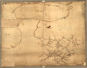
Plan of a rout undertaken in winter, Jany. 26th : from Quebec, the capital of Canada, to the frontier settlements of the...
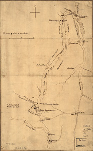
241.
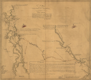
A plan of a survey made to explore the country for a road between Connecticut River & St. Francis
242.
A Plan of Albany, as it was in the year 1758
243.
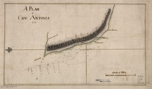
A Plan of Cape Antonia
244.
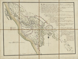
Plan of Carillon ou [sic] Ticonderoga : which was quitted by the Americaines in the night from the 5th to the 6th of July 1777
245.
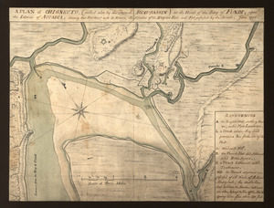
A plan of Chignecto (called also by the French Beau-Bassin) at the head of the Bay of Fundi upon the Istmus of Accadia shewing...
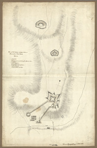
246.
Plan of Fort George and adjacent works at Pensacola in West Florida
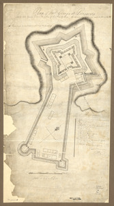
247.
Plan of Fort George at Pensacola
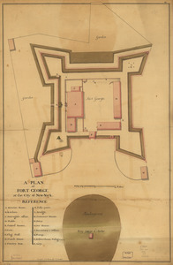
248.
A plan of Fort George at the city of New-York
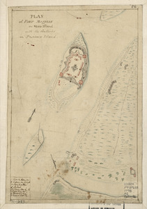
249.
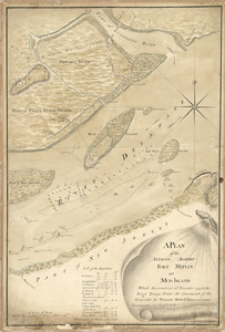
Plan of Fort Mifflin on Mud Island, with the batteries on Province Island
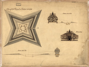
250.
Plan of Fort Pownal at Penobscot built 1759
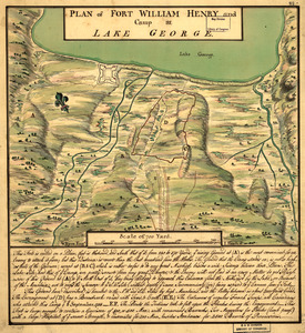
251.
Plan of Fort William Henry and camp at Lake George
252.
Plan of Genl Du Portail : Plan of the position of Valley Forge after Jany. 1778
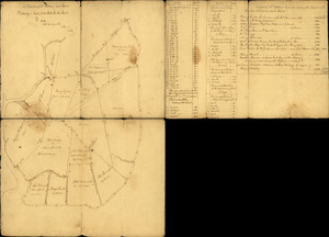
253.
A plan of Mr. Clifton's neck land platted by a scale of 50 poles to the inch : recto
254.
A plan of Mr. Clifton's neck land platted by a scale of 50 poles to the inch : verso
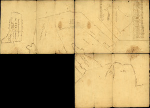
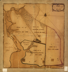
255.
A plan of my farm on Little Huntg. Creek & Potomk. R
256.
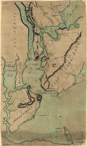
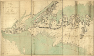
Plan of New York and Staten Islands with part of Long Island
257.
Plan of New York and Staten Islands with part of Long Island, survey'd in the years 1781, & 82
258.
Plan of part of the city of Washington : on which is shewn the squares, lots, &c., divided between William Prout Esq'r and the...
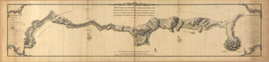
259.
Plan of part of the River Delaware from Chester to Philadelphia : in which is mark'd the position of His Majs. ships on the...
260.
A plan of part of the rivers Tombecbe, Alabama, Tensa, Perdido, & Scambia in the province of West Florida : with a sketch of...
261.
Plan of part of western front
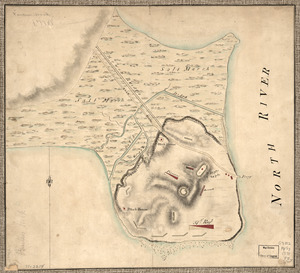
262.
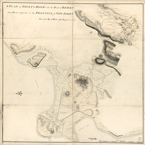
A plan of Paulus Hook with the road to Bergen and parts adjacent in the province of New Jersey
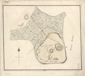
263.
Plan of Paulus's Hook and fortifications
264.
Plan of Paulus's Hook and fortifications
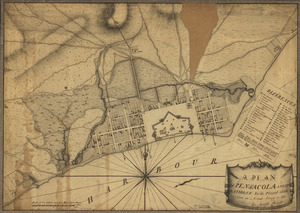
265.
A plan of Pensacola and its environs in its present state : from an actual survey in 1778
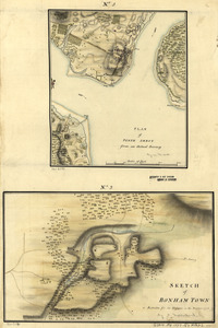
266.
Plan of Perth Amboy from an actual survey. Sketch of Bonham Town
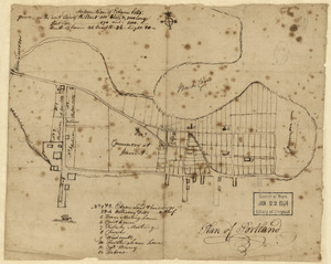
267.
Plan of Portland
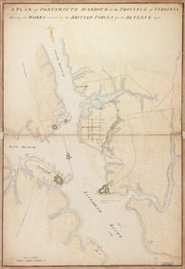
268.
A plan of Portsmouth Harbour in the province of Virginia : shewing the works erected by the British forces for its defence, 1781
269.
Plan of Princeton, Dec. 31, 1776
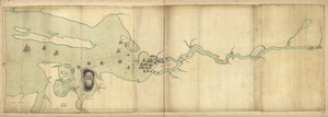
270.
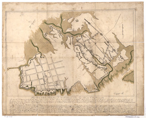
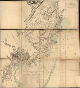
Plan of Quebec, the capital of Canada in North America, with the bason and part of the adjacent contry [sic] shewing the...
271.
Plan of Quebec, the capital of Canada in North America, with the bason and part of the adjacent contry [sic] shewing the...
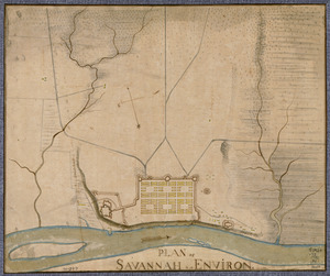
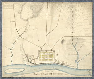
272.
Plan of Savannah & its environs in 1782
273.
Plan of Savannah and its environs in 1782
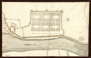
274.
Plan of Savannah and its fortifications in 1782
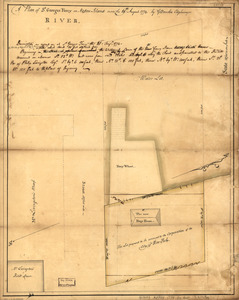
275.
A plan of St. Georges Ferry on Nassau-Island made the 10th August 1774
276.
A Plan of that part of the boundary between the states of North and South Carolina : lying between that part of said boundary...
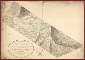
277.
A plan of that part of the Rosalij Estate call'd New-Found-Land : the property of His Excellcy. Chas. O'Harra, the Hon. Lt....
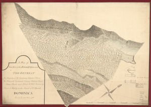
278.
A plan of that part of the Rosalij Estate call'd the Retreat : the property of His Excellency Charles O'Harra, the Honorable...
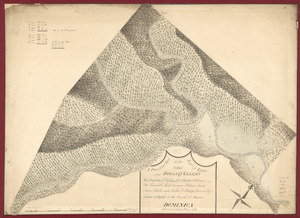
279.
A plan of that part of the Rosalij Estate called Rosalij Valley : the property of His Excellcy. Charles O'Harra, The Honorable...
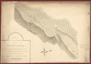
280.
A plan of that part of the Rosalij Estate called the Grand Fonds : the property of His Excellency Charles O'Harra, the Honble....
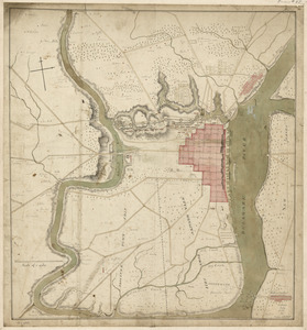
281.
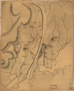
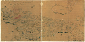
Plan of the attack of Fort Clinton and Montgomery which where [sic] stormed by His Majesty's forces : under the command of Sr....
282.
A plan of the attack of Fort Sulivan : near Charles Town in South Carolina by a squadron of His Majesty's ships on the 28th day...
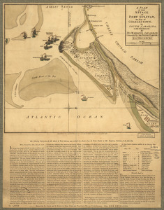
283.
A Plan of the attack of Fort Sulivan : the key of Charlestown, in South Carolina, on the 28th. of June 1776. By His Majesty's...
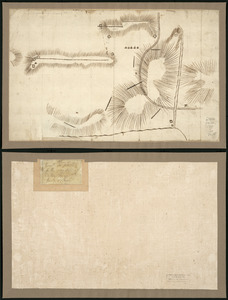
284.
Plan of the attack on Fort William Henry and Ticonderoga : showing the road from Fort Edward, Montcalm's camp and wharf of...
285.
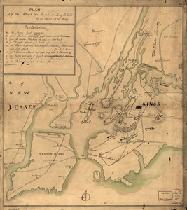
Plan of the attack the rebels on Long Island, by an officer of the Army
286.
A plan of the attacks against Fort Miflin on Mud Island : which surrendered 16th, November 1777 to the Kings troops under the...
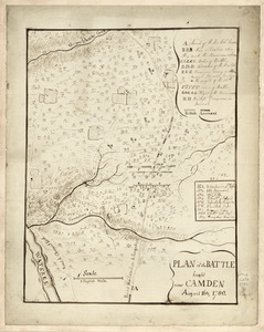
287.
Plan of the battle fought near Camden, August 16th, 1780
288.
A Plan of the Battle of Bunker Hill
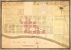
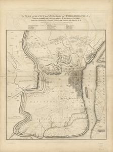
289.
A plan of the city and environs of Philadelphia : with the works and encampments of His Majesty's forces under the command of...
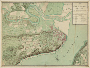
290.
Plan of the city and environs of Quebec, with its siege and blockade by the Americans : from the 8th of December, 1775 to the...
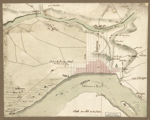
291.
Plan of the city intended for the permanent seat of the government of t[he] United States : projected agreeable to the...
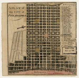
292.
A plan of the city of Philadelphia
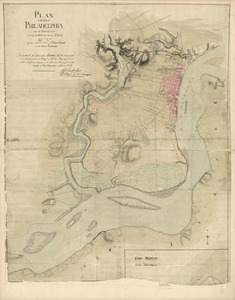
293.
Plan of the city of Philadelphia and its environs shewing its defences during the years 1777 & 1778 : together with the siege...
294.
A plan of the city of Savannah : with a drawing of the part of the city burnt in the dreadful fires of the 26 November & 6...
295.
A plan of the coast of Gabarus Bay from the west end of Kennington Cove to White Point shewing the several batteries and...
296.
Plan of the country at and in the vicinity of Forts Lee and Independency, showing the position of the British Army
297.
A plan of the division line between the provinces of New-York and Quebec : In the 45th degree of north latitude. Survey'd in...
298.
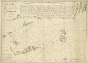
A plan of the east part of Long Island Sound : from remarks made on board His Majesty's ship the Lark, A.D. 1777
299.
Plan of the encampment and position of the army under His Excelly. Lt. General Burgoyne : at Bræmus Heights on Hudson's River...
300.
Plan of the encampment and position of the army under His Excelly. Lt. General Burgoyne : at Swords House on Hudson's River on...
‹ Prev
Next ›
1
2
3
4
5


![Plan of Carillon ou [sic] Ticonderoga](https://bpldcassets.blob.core.windows.net/derivatives/images/commonwealth:q524nk513/image_thumbnail_300.jpg)

![Plan of Quebec, the capital of Canada in North America, with the bason and part of the adjacent contry [sic] shewing the principal encampments and works of the British Army commanded by Maior General Wolfe and those of the French Army commanded by Lieut. General, the Marquis of Mont Calm during the siege of that place in 1759 [overlay down]](https://bpldcassets.blob.core.windows.net/derivatives/images/commonwealth:q524nd83b/image_thumbnail_300.jpg)
![Plan of Quebec, the capital of Canada in North America, with the bason and part of the adjacent contry [sic] shewing the principal encampments and works of the British Army commanded by Maior General Wolfe and those of the French Army commanded by Lieut. General, the Marquis of Mont Calm during the siege of that place in 1759 [overlay up]](https://bpldcassets.blob.core.windows.net/derivatives/images/commonwealth:q524nd81s/image_thumbnail_300.jpg)

![Plan of the attack of Fort Clinton and Montgomery which where [sic] stormed by His Majesty's forces](https://bpldcassets.blob.core.windows.net/derivatives/images/commonwealth:q524nj90k/image_thumbnail_300.jpg)

![Plan of the city intended for the permanent seat of the government of t[he] United States](https://bpldcassets.blob.core.windows.net/derivatives/images/commonwealth:q524nf917/image_thumbnail_300.jpg)