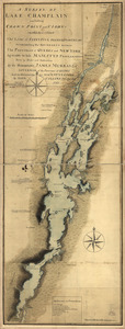
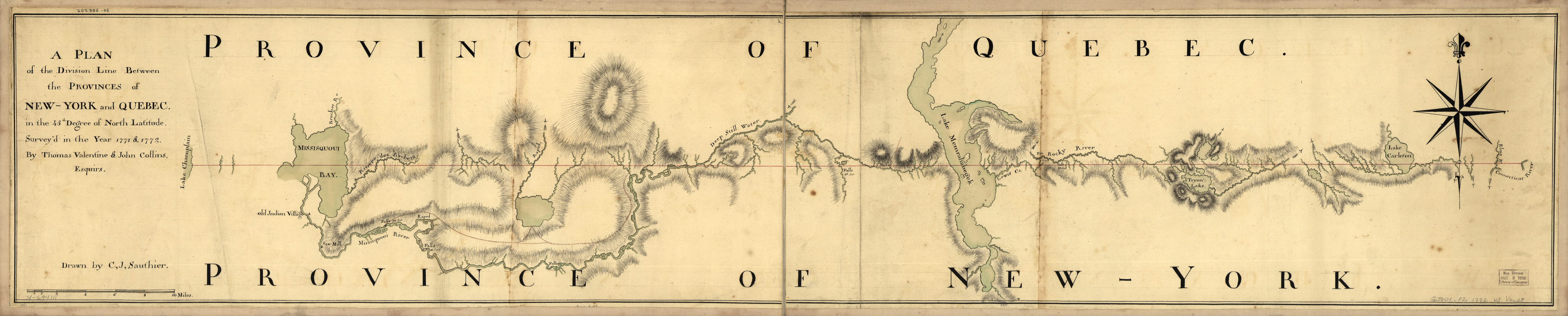
A plan of the division line between the provinces of New-York and Quebec : In the 45th degree of north latitude. Survey'd in the year 1771 & 1772
This map is also available in American Revolutionary Geographies Online (ARGO), a collections portal especially built for material relating to the American Revolutionary War Era. Visit ARGO to learn more about this item and explore the historical geography of North America in the late eighteenth century.
Item Information
- Title:
- A plan of the division line between the provinces of New-York and Quebec : In the 45th degree of north latitude. Survey'd in the year 1771 & 1772
- Creator:
- Valentine, Thomas
- Contributor:
- Sauthier, Claude Joseph
- Contributor:
- Collins, John, -1795
- Name on Item:
-
By Thomas Valentine & John Collins, esquirs. Drawn by C. J. Sauthier
- Date:
-
[1772]
- Format:
-
Maps/Atlases
Manuscripts
- Location:
- Library of Congress Geography and Map Division
- Collection (local):
-
Library of Congress Collection
- Subjects:
-
Vermont--Boundaries--Québec (Province)--Maps--Early works to 1800
Québec (Province)--Boundaries--Vermont--Maps--Early works to 1800
Québec (Province)--Boundaries--New York (State)--Maps--Early works to 1800
New York (State)--Boundaries--Québec (Province)--Maps--Early works to 1800
Manuscript maps--Early works to 1800
- Places:
-
CanadaQuebec (province)
New York
Vermont
- Extent:
- 1 manuscript map : hand color, 25 x 133 cm.
- Terms of Use:
-
No known copyright restrictions.
This work is licensed for use under a Creative Commons Attribution Non-Commercial Share Alike License (CC BY-NC-SA).

- Scale:
-
Scale ca. 1:125,000
- Language:
-
English
- Catalog Record:
-
https://lccn.loc.gov/74694111
- Notes:
-
Manuscript, black and red ink and watercolor.
Relief shown by hachures.
Map shows primarily Vermont with Québec (Province) and New York (State)
- Notes (date):
-
This date is inferred.
- Notes (citation):
-
LC Maps of North America, 1750-1789, 1071
- Identifier:
-
ar107100z