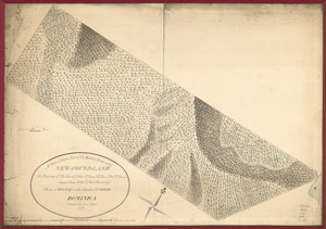
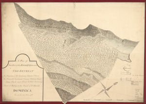
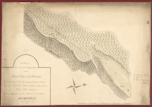
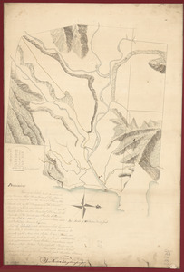
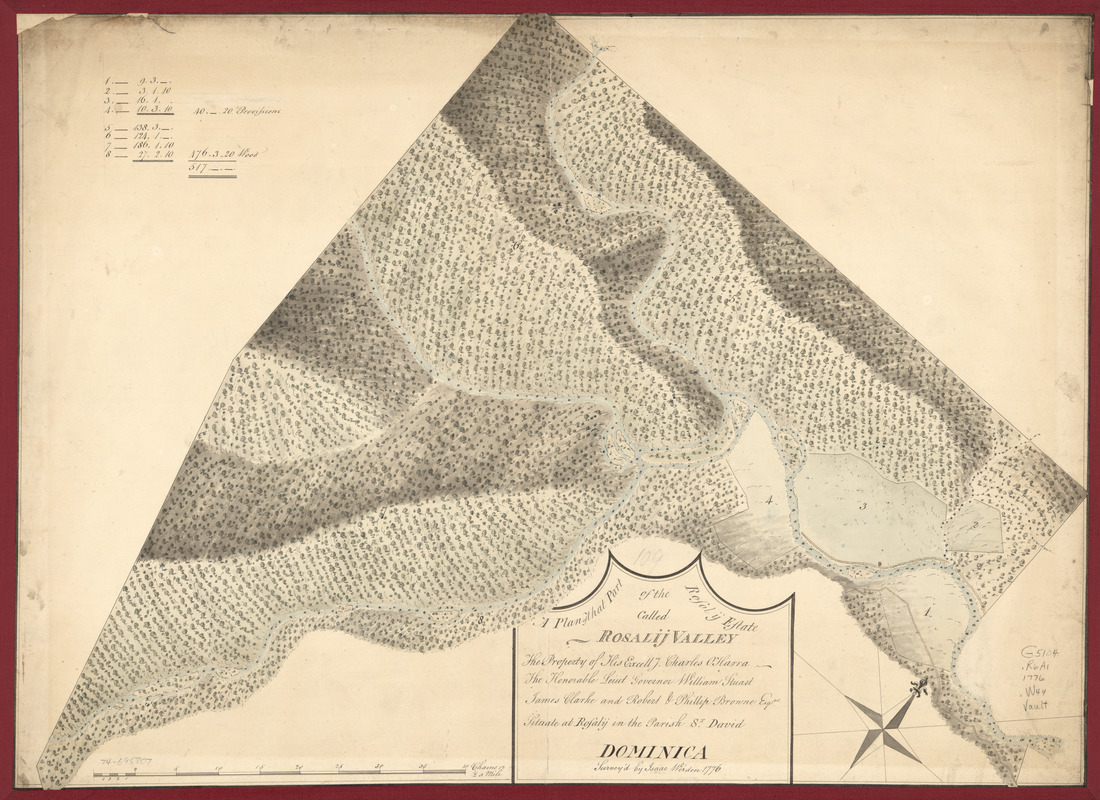
A plan of that part of the Rosalij Estate called Rosalij Valley : the property of His Excellcy. Charles O'Harra, The Honorable Leiut. Governor William Stuart, James Clarke and Robert & Phillip Browne, Esqrs., situate at Rosalij in the parish St. David, Dominica
This map is also available in American Revolutionary Geographies Online (ARGO), a collections portal especially built for material relating to the American Revolutionary War Era. Visit ARGO to learn more about this item and explore the historical geography of North America in the late eighteenth century.
Item Information
- Title:
- A plan of that part of the Rosalij Estate called Rosalij Valley : the property of His Excellcy. Charles O'Harra, The Honorable Leiut. Governor William Stuart, James Clarke and Robert & Phillip Browne, Esqrs., situate at Rosalij in the parish St. David, Dominica
- Title (alt.):
-
Rosalij Estate
- Creator:
- Werden, Isaac
- Name on Item:
-
Survey'd by Isaac Werden. 1776
- Date:
-
[1776]
- Format:
-
Maps/Atlases
Manuscripts
- Location:
- Library of Congress Geography and Map Division
- Collection (local):
-
Library of Congress Collection
- Subjects:
-
Rosalie (Dominica)--Maps, Manuscript--Early works to 1800
Rosalie Valley, Dominica--Maps, Manuscript--Early works to 1800
- Places:
-
Rosalie
- Extent:
- 1 manuscript map : hand color 50 x 69 cm.
- Terms of Use:
-
No known copyright restrictions.
This work is licensed for use under a Creative Commons Attribution Non-Commercial Share Alike License (CC BY-NC-SA).

- Scale:
-
Scale 1:3,960
- Language:
-
English
- Catalog Record:
-
https://lccn.loc.gov/74695807
- Notes:
-
Manuscript, pen-and-ink and watercolor.
Watermark: J. Whatman: C. [and fleur-de-lis on a crowned shield, over the letters GR]
Relief shown by shading.
Annotated over title: 109.
Indexed.
- Notes (date):
-
This date is inferred.
- Identifier:
-
ar203700