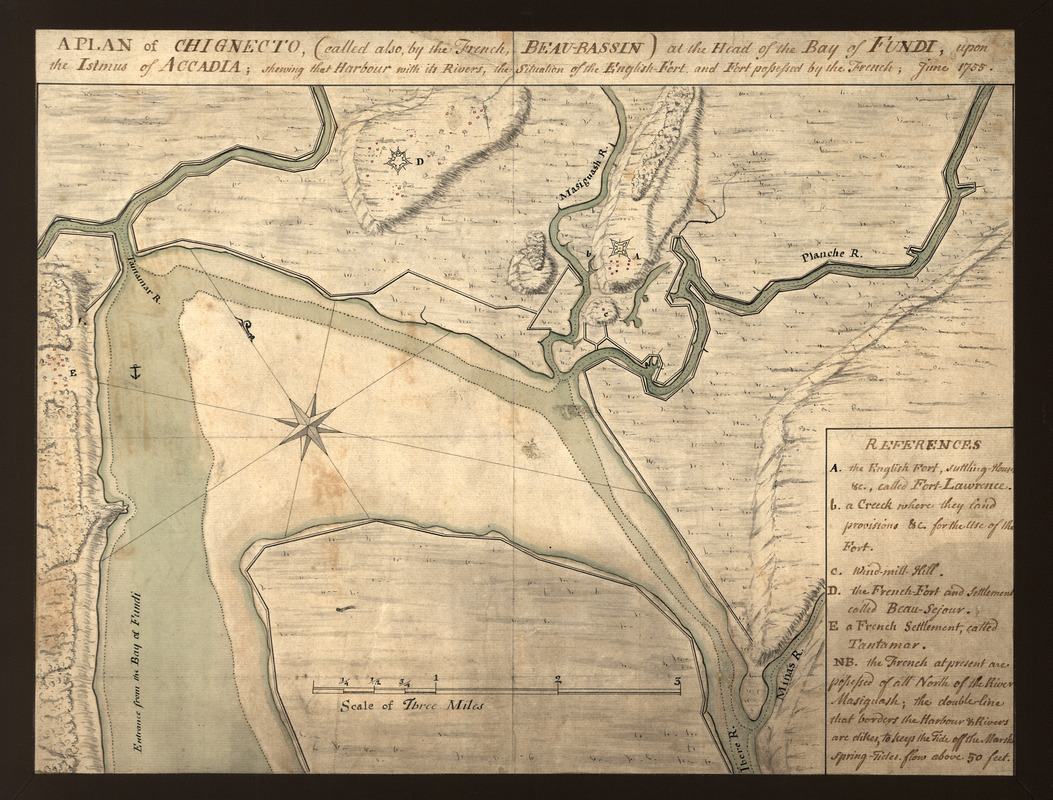
A plan of Chignecto (called also by the French Beau-Bassin) at the head of the Bay of Fundi upon the Istmus of Accadia shewing that harbour with its rivers, the situation of the English fort and fort possessed by the French, June 1755
This map is also available in American Revolutionary Geographies Online (ARGO), a collections portal especially built for material relating to the American Revolutionary War Era. Visit ARGO to learn more about this item and explore the historical geography of North America in the late eighteenth century.
Item Information
- Title:
- A plan of Chignecto (called also by the French Beau-Bassin) at the head of the Bay of Fundi upon the Istmus of Accadia shewing that harbour with its rivers, the situation of the English fort and fort possessed by the French, June 1755
- Date:
-
1755
- Format:
-
Maps/Atlases
Manuscripts
- Location:
- Library of Congress Geography and Map Division
- Collection (local):
-
Library of Congress Collection
- Subjects:
-
Chignecto Isthmus (N.B. and N.S.)--Maps, Manuscript--Early works to 1800
- Places:
-
Isthmus of Chignecto
- Extent:
- 1 ms. map : col. ; 27 x 38 cm.
- Terms of Use:
-
No known copyright restrictions.
This work is licensed for use under a Creative Commons Attribution Non-Commercial Share Alike License (CC BY-NC-SA).

- Scale:
-
Scale [ca. 1:34,500]
- Language:
-
English
- Catalog Record:
-
https://lccn.loc.gov/2005630145
- Notes:
-
Shows region of Fort Lawrence and Fort Beauséjour in Chignecto Isthmus.
Relief shown by hachures.
Pen-and-ink and watercolor.
Includes index.
- Identifier:
-
ct001306

![[Map showing neck of land between 'Baye francaise' and 'Baye verte']](https://bpldcassets.blob.core.windows.net/derivatives/images/commonwealth:hx11z035j/image_thumbnail_300.jpg)


