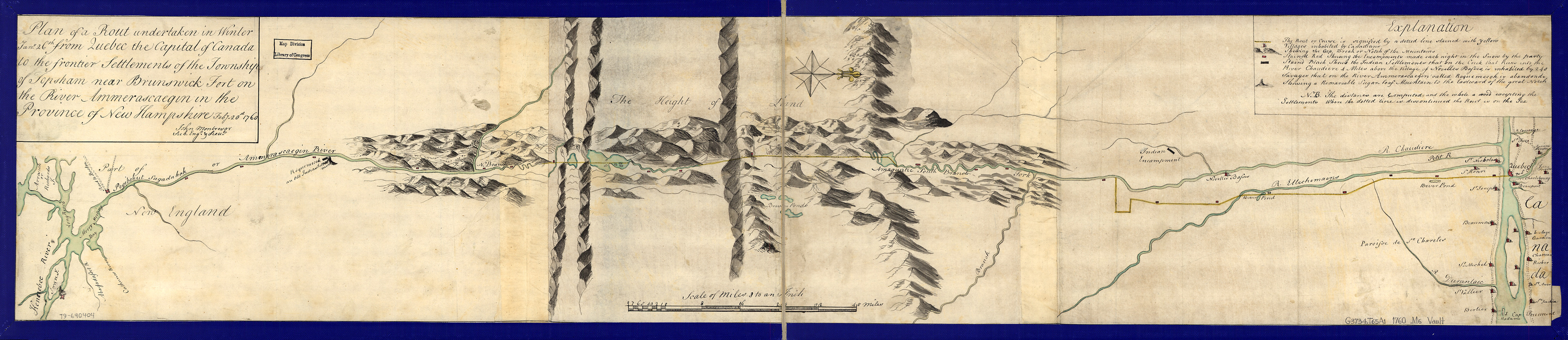
Plan of a rout undertaken in winter, Jany. 26th : from Quebec, the capital of Canada, to the frontier settlements of the Township of Topsham near Brunswick Fort on the River Ammerascaegun in the Province of New Hampshire, Feby. 20th 1760
This map is also available in American Revolutionary Geographies Online (ARGO), a collections portal especially built for material relating to the American Revolutionary War Era. Visit ARGO to learn more about this item and explore the historical geography of North America in the late eighteenth century.
Item Information
- Title:
- Plan of a rout undertaken in winter, Jany. 26th : from Quebec, the capital of Canada, to the frontier settlements of the Township of Topsham near Brunswick Fort on the River Ammerascaegun in the Province of New Hampshire, Feby. 20th 1760
- Creator:
- Montrésor, John, 1736-1799
- Name on Item:
-
John Montresor, sub. engr. & lieut.
- Date:
-
[1760?]
- Format:
-
Maps/Atlases
Manuscripts
- Location:
- Library of Congress Geography and Map Division
- Collection (local):
-
Library of Congress Collection
- Subjects:
-
Topsham (Me. : Town)--Early works to 1800
Québec (Québec)--Early works to 1800
Manuscript maps--Early works to 1800
- Places:
-
CanadaQuébec
Sagadahoc (county)Topsham
- Extent:
- 1 map : col. ; 21 x 104 cm.
- Terms of Use:
-
No known copyright restrictions.
This work is licensed for use under a Creative Commons Attribution Non-Commercial Share Alike License (CC BY-NC-SA).

- Scale:
-
Scale 1:506,880
- Language:
-
English
- Catalog Record:
-
https://lccn.loc.gov/79690404
- Notes:
-
Manuscript; pen-and-ink and watercolor.
Oriented with north to the right.
Relief shown pictorially.
- Notes (citation):
-
LC Maps of North America, 1750-1789, 808
- Identifier:
-
ar080800z


