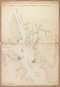
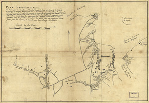
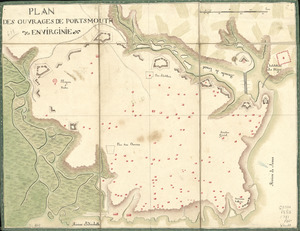
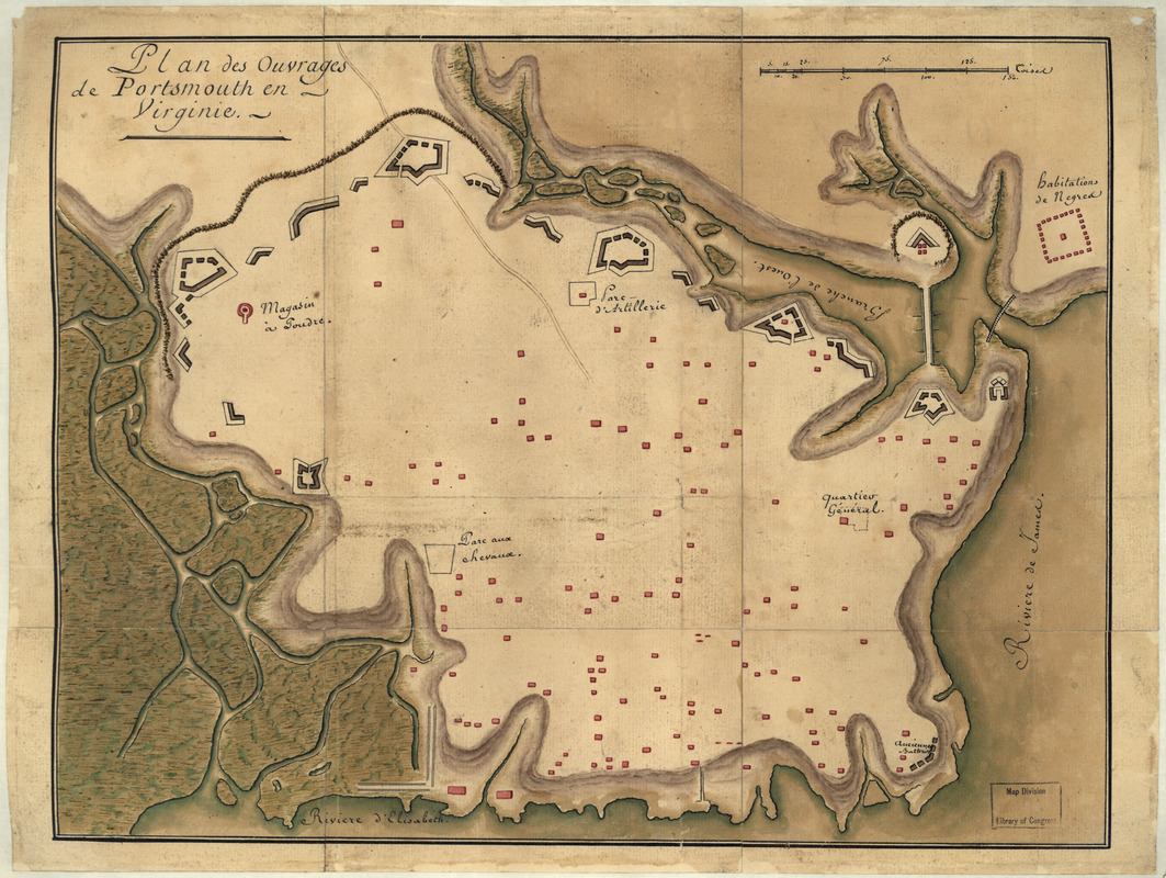
Plan des ouvrages de Portsmouth en Virginie
This map is also available in American Revolutionary Geographies Online (ARGO), a collections portal especially built for material relating to the American Revolutionary War Era. Visit ARGO to learn more about this item and explore the historical geography of North America in the late eighteenth century.
Item Information
- Title:
- Plan des ouvrages de Portsmouth en Virginie
- Date:
-
[1781]
- Format:
-
Maps/Atlases
Manuscripts
- Location:
- Library of Congress Geography and Map Division
- Collection (local):
-
Library of Congress Collection
- Subjects:
-
Portsmouth (Va.)--History--Revolution, 1775-1783--Maps, Manuscript--Early works to 1800
Fortification--Virginia--Portsmouth--Maps--Early works to 1800
Portsmouth (Va.)--Buildings, structures, etc--Maps, Manuscript--Early works to 1800
- Places:
-
Portsmouth (independent city)
- Extent:
- 1 manuscript map : hand color 31 x 41 cm.
- Terms of Use:
-
No known copyright restrictions.
This work is licensed for use under a Creative Commons Attribution Non-Commercial Share Alike License (CC BY-NC-SA).

- Scale:
-
Scale ca. 1:3,220
- Language:
-
French
- Catalog Record:
-
https://lccn.loc.gov/gm71002170
- Notes:
-
Title on verso: Ouvrages faits à Portsmouth en Virginie par les Anglais, et rasé en 1781 par les François.
Manuscript, pen-and-ink and watercolor.
Oriented with north to the right.
Relief shown by shading.
- Notes (date):
-
This date is inferred.
- Notes (citation):
-
LC Maps of North America, 1750-1789, 1455
- Identifier:
-
ar145500