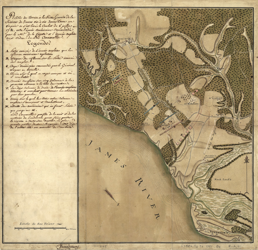
Plan du terrein à la rive gauche de la rivière de James vis-à-vis Jamestown en Virginie : ou s'est livré le combat du 6 juillet 1781 entre l'armée américaine commandée par le Mis. de La Fayette el l'armée angloise aux ordres du Lord Cornwallis
This map is also available in American Revolutionary Geographies Online (ARGO), a collections portal especially built for material relating to the American Revolutionary War Era. Visit ARGO to learn more about this item and explore the historical geography of North America in the late eighteenth century.
Item Information
- Title:
- Plan du terrein à la rive gauche de la rivière de James vis-à-vis Jamestown en Virginie : ou s'est livré le combat du 6 juillet 1781 entre l'armée américaine commandée par le Mis. de La Fayette el l'armée angloise aux ordres du Lord Cornwallis
- Creator:
- Desandroüins, Jean Nicolas, 1729-1792
- Name on Item:
-
[Signé:] Desandroüins
- Date:
-
[1781]
- Format:
-
Maps/Atlases
Manuscripts
- Location:
- Library of Congress Geography and Map Division
- Collection (local):
-
Library of Congress Collection
- Subjects:
-
Green Spring Plantation, Battle of, Va., 1781--Maps, Manuscript--Early works to 1800
Green Spring Plantation (Va.)--Maps--Early works to 1800
- Places:
-
Colonial National Historical Park
- Extent:
- 1 manuscript map : hand color 45 x 49 cm.
- Terms of Use:
-
No known copyright restrictions.
This work is licensed for use under a Creative Commons Attribution Non-Commercial Share Alike License (CC BY-NC-SA).

- Scale:
-
Scale ca. 1:16,000
- Language:
-
French
- Catalog Record:
-
https://lccn.loc.gov/gm71002168
- Notes:
-
Manuscript, pen-and-ink and watercolor.
Has watermark.
Relief shown by hachures.
Includes index to points of military interest.
- Notes (date):
-
This date is inferred.
- Notes (citation):
-
LC Maps of North America, 1750-1789, 1451
- Identifier:
-
ar145100


