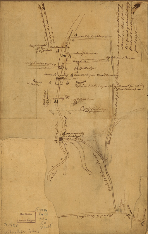
Plan of Princeton, Dec. 31, 1776
This map is also available in American Revolutionary Geographies Online (ARGO), a collections portal especially built for material relating to the American Revolutionary War Era. Visit ARGO to learn more about this item and explore the historical geography of North America in the late eighteenth century.
Item Information
- Title:
- Plan of Princeton, Dec. 31, 1776
- Creator:
- Cadwalader, John, 1742-1786
- Date:
-
[1776]
- Format:
-
Maps/Atlases
Manuscripts
- Location:
- Library of Congress Geography and Map Division
- Collection (local):
-
Library of Congress Collection
- Subjects:
-
Princeton (N.J.)--History--Revolution, 1775-1783--Maps, Manuscript--Early works to 1800
- Places:
-
Mercer (county)Princeton
- Extent:
- 1 manuscript map on sheet 33 x 21 cm.
- Terms of Use:
-
No known copyright restrictions.
This work is licensed for use under a Creative Commons Attribution Non-Commercial Share Alike License (CC BY-NC-SA).

- Scale:
-
Scale not given
- Language:
-
English
- Catalog Record:
-
https://lccn.loc.gov/gm71000925
- Notes:
-
Title on verso.
Manuscript, pen-and-ink.
Reconnaissance map showing "Gen Lesley, or headquarters" position with entrenchments near Princeton on December 31, 1776.
Apparently the map referred to by General Cadwalader in his letter to General Washington, dated Crosswicks, Dec. 31, 1776.
Includes descriptive notes.
- Notes (date):
-
This date is inferred.
- Notes (citation):
-
LC Maps of North America, 1750-1789, 1271
- Identifier:
-
ct000076z


