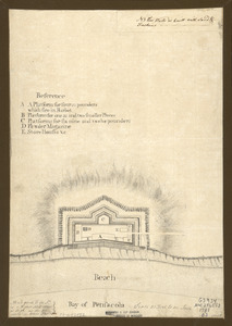
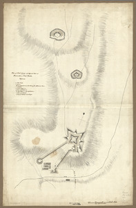
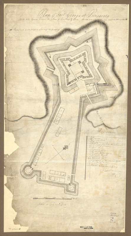
Plan of Fort George at Pensacola
This map is also available in American Revolutionary Geographies Online (ARGO), a collections portal especially built for material relating to the American Revolutionary War Era. Visit ARGO to learn more about this item and explore the historical geography of North America in the late eighteenth century.
Item Information
- Title:
- Plan of Fort George at Pensacola
- Creator:
- Towne, C.
- Date:
-
[1781]
- Format:
-
Maps/Atlases
Manuscripts
- Location:
- Library of Congress Geography and Map Division
- Collection (local):
-
Library of Congress Collection
- Subjects:
-
Fort George (Fla. : Fort)--Maps, Manuscript--Early works to 1800
- Places:
-
Escambia (county)Pensacola
- Extent:
- 1 manuscript map on sheet 67 x 37 cm.
- Terms of Use:
-
No known copyright restrictions.
This work is licensed for use under a Creative Commons Attribution Non-Commercial Share Alike License (CC BY-NC-SA).

- Scale:
-
Scale 1:1,600
- Language:
-
English
- Catalog Record:
-
https://lccn.loc.gov/74692220
- Notes:
-
Manuscript, pen-and-ink and watercolor.
Deteriorated along left edge.
Oriented with north toward the right.
Includes index to areas within fort, signed "C. Towne, 9th. October 1781" with "WW" below.
- Notes (date):
-
This date is inferred.
- Notes (citation):
-
LC Maps of North America, 1750-1789, 1666
- Identifier:
-
ar166600