Toggle navigation
LMEC Home
Exhibitions
Georeferencing
Tools for Teachers
Collections
My Favorites
Sign Up / Log In
Search
Search the map portal
Map Collection
Map Collection
Map Sets
Search
Search
Search for
Search In
All Fields
Creator
Title
Subject
Place
Search All Digital Collections
Advanced Search
8259 Results
My Search
Start Over
More Like
commonwealth:cj82m439q
Remove constraint More Like: commonwealth:cj82m439q
Filter your Search
Place
North and Central America
4,927
United States
3,759
Suffolk (county)
1,026
Boston
999
Europe
963
Canada
432
North America
307
Massachusetts
294
more
Place
»
Topic
Boston (Mass.)--Maps
574
United States--Maps
270
North America--Maps--Early works to 1800
180
Real property--Massachusetts--Boston--Maps
174
Massachusetts--Maps
160
Landowners--Massachusetts--Boston--Maps
132
New England--Maps
99
Europe--Maps
78
more
Topic
»
Date
Date range begin
–
Date range end
Current results range from
1482
to
2023
View distribution
Creator
United States. Hydrographic Office
357
O.H. Bailey & Co
148
Des Barres, Joseph F. W. (Joseph Frederick Wallet), 1722-1824
123
United States. Post Office Dept
120
Ptolemy, 2nd cent
100
Walling, Henry Francis, 1825-1888
94
Jefferys, Thomas, -1771
91
Sayer, Robert, 1725-1794
84
more
Creator
»
Format
Maps/Atlases
8,200
Manuscripts
217
Prints
51
Books
36
Objects/Artifacts
10
Drawings/Illustrations
8
Posters
4
Georeferenced
Yes
872
No
7,387
Collection
Norman B. Leventhal Map Center Collection
8,174
Boston and New England Maps
2,185
Urban Maps
1,925
Maritime Charts and Atlases
750
American Revolutionary War-Era Maps
686
Boston Redevelopment Authority Collection
86
New York Public Library Collection
36
Richard H. Brown Revolutionary War Map Collection at Mount Vernon
21
more
Collection
»
Available to use
No known restrictions
8,024
Creative Commons license
120
Search Constraints
Sort by relevance
relevance
title
date (asc)
date (desc)
Number of results to display per page
100 per page
10
per page
20
per page
50
per page
100
per page
View results as:
grid view
map view
Search Results
1.
Noua et accurata totius Americae tabula
2.
Novissima et accuratissima totius Americae descriptio
3.
America sive novvs orbis respectv Evropaeorvm inferior globi terrestris pars
4.
America sive novvs orbis respectv Evropaeorvm inferior globi terrestris pars
5.
L'Amerique divisée en septentrionale et méridionale, subdivisée en ses principales parties, dressée sur les relations les...
6.
Carte tres curieuse de la Mer du Sud, contenant des remarques nouvelles et tres utiles non seulement sur les ports et iles de...
7.
LʼAmérique Septentrionale et Méridionale divisée suivant ses différens pays
8.
America meridionalis
9.
America Meridionalis concinata juxta observationes Dun Acad. Regalis Scientiarum et nonnullorum aliorum
10.
Americae pars meridionalis
11.
Americae pars meridionalis
12.
Americae pars meridionalis
13.
L'Amerique meridionale
14.
L'Amerique Meridionale : dressée sur les observations de Mrs. de L'Academie Royale des Sciences & quelques autres, & sur les...
15.
L'Amerique Meridionale divisée en ses principales parties
16.
Amerique meridionale divisée en ses principales parties ou sont distingués les vns des autres les estats suivant qu'ils...
17.
L'Amerique meridionale divisée en ses principaux etats
18.
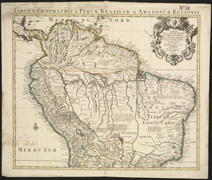
Carte de la Terre Ferme, du Perou, du Bresil et du Pays des Amazones : dressée sur les descriptions de Herrera, de Laet, et...
19.
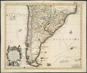
Carte du Paraguay, du Chili, du Detroit de Magellan &c
20.
Chart of South America, comprehending the West Indies, with the adjacent islands, in the Southern Ocean, and South Sea
21.
A chart of the sea coast of Brazil from Cape St. Augustine to the straights of Magellan, & in the South Sea, from the latitud...
22.
Corso del fiume dell Amazon
23.
Guiana sive Amazonum regio
24.
A map of Chili, Patagonia, La Plata and ye south part of Brasil
25.
A map of South America with all the European settlements & whatever else is remarkable, from the latest & best observations
26.
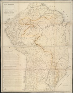
A map of Terra Firma Peru, Amazone-land, Brasil & the north p[art] of La Plata
27.
Mapa geográfico de América Meridional
28.
Mapa geográfico de la mayor parte de la América Meridional que contiene los paises por donde debe trazarse la línia...
29.
A new & exact map of the coast, countries and islands within ye limits of ye South Sea Company, from ye river Aranoca to Terra...
30.
A new & exact map of the coast, countries and islands within ye limits of ye South Sea Company, from ye river Aranoca to Terra...
31.
A new map of South America : shewing it's general divisions, chief cities & towns, rivers, mountains &c
32.
A new map of the southern parts of America taken from manuscript maps made in the country and a survey of the eastern coast...
33.
Le Paraguayr, Le Chili, La Terre, et les Isles Magellanicques : tirées de diverses rélations
34.
Paraquaria vulgo Paraguay : cum adjacentibus
35.
Pascaerte van Nova Hispania, Chili, Peru, en Guatimala
36.
Le Perou : et le cours de la rivière Amazone, depuis ses sources jusques à la mer
37.
South America : performed under the patronage of Louis Duke of Orleans, First Prince of the Blood
38.
South America
39.
South America : corrected from the observation communicated to the Royal Societys of London & Paris
40.
South America
41.
South America
42.
South America divided into its IIII principall parts : I Spanish part: vizt. Firmland, Guiana, Peru, Chili, pt of the country...
43.
Terra Firma and the Caribbé Islands &c
44.
This map of South America, according to the newest and most exact observations
45.
To the Right Honourable, Charles Earl of Sunderland, and Baron Spencer of Wormleighton, one of Her Majesty's principal...
46.
America
47.
America
48.
America in praecipuas ipsius partes distributa ad observationes Academiae regiae scientiarum : et exquisitissimas tabulas quae...
49.
America nouiter delineata
50.
America noviter delineata
51.
America noviter delineata
52.
America Septentrionalis novissima : America Meridionalis accuratissima
53.
America, siue, India Nova : ad magnae Gerardi Mercatoris aui vniversalis imitationem in compendium redacta
54.
America with those known parts in that unknowne worlde both people and manner of buildings
55.
America with those known parts in that unknowne worlde both people and manner of buildings
56.
Americae
57.
Americae
58.
Americae mappa generalis : secundum legitimas projectionis stereographicae regulas relationesque recentissimas et observationes...
59.
Americae nova descriptio
60.
Americae nova discriptio
61.
Americae nova tabula
62.
Americae nova tabula
63.
Americae sive Indiae Occidentalis : tabula generalis
64.
Americae tam septentrionalis quam meridionalis in mappa geographica delineatio
65.
L'Amérique
66.
L'Amerique divisée par grand etats
67.
L'Amerique, meridionale, et septentrionale
68.
L'Amérique Septentrionale & Meridionale divisée en ses principales parties, ou sont distingués les vns des autres les estats...
69.
L'Amérique suivant le R.P. Charlevoix Jte, Mr. de La Condamine et plusieurs autres nouvle. observations
70.
Carte d'Amerique : dressée pour l'usage du Roy
71.
Carte d'Amerique : dressée pour l'usage du roy
72.
Carte d'Amerique divisées en ses principales parties
73.
Carte du Gouvernement de l'Amerique
74.
Chart of the track of the Dolphin, Tamar, Swallow & Endeavour through the South Seas ; & of the track of M. Bougainville round...
75.
The Earth's Western planisphere
76.
La Florida
77.
Mappa fluxus et refluxus rationes in isthmo Americano, in Freto Magellanico, cæterisque Americæ litoribus exhibens
78.
Maris Pacifici (quod vulgo Mar del Zur) cum regionibus circumiacentibus, insulisque in eodem passim sparsis, novissima descriptio
79.
A new general map of America
80.
A new map containing the English Empire Golf of Mexico Caribes Islands Granada Guiana Amazone and Peru
81.
A new map of America from the latest observations
82.
A new map of the whole continent of America, divided into North and South and West Indies : wherein are exactly described the...
83.
A new mapp of America devided according to the best and latest observations and discoveries wherein are described by thear...
84.
A new, plaine, and exact map of America : described by N.I. Visscher, and don into English, enlarged, and corrected, according...
85.
Nieuwe kaart van America uitgegeven te Amsterdam
86.
Nieuwe kaart van het westelykste deel der weereld, dienende tot aanwyzing van de scheepstogten der Nederlanderen naar Westindie...
87.
Nouvelle carte de l'Amerique : avec tous ses royaumes, etats, iles, ports, bayes et rivieres, dressée suivant les plus...
88.
Nova totivs Americae descriptio
89.
Novissima et accuratissima totius Americae descriptio
90.
Novissima et accuratissima totius Americae descriptio
91.
Novus orbis sive America Meridionalis et Septentrionalis, per sua regna, provincias et insulas iuxta observationes et...
92.
Nov[us] orbis sive America septentrionalis, divisa per sua regna provinc. et insul : cura et opera
93.
Oceani occidetalis seu terre nove tabula
94.
Recentissima novi orbis sive Americae septentrionalis et meridionalis tabula
95.
Recentissima novi orbis sive Americae septentrionalis et meridionalis tabula
96.
Recentissima novi orbis, sive Americae Septentrionalis et Meridionalis tabula
97.
Totius Americae septentrionalis et meridionalis novissima repræsentatio quam ex singulis recantium geographorum tabulis...
98.
An accurate map of North America : describing and distinguishing the British and Spanish dominions on this great continent :...
99.
An accurate map of North America : describing and distinguishing the British and Spanish dominions of this great continent;...
100.
An accurate map of North America : describing and distinguishing the British, Spanish and French dominions on this great...
‹ Prev
Next ›
1
2
3
4
5
…
82
83


![A map of Terra Firma Peru, Amazone-land, Brasil & the north p[art] of La Plata](https://bpldcassets.blob.core.windows.net/derivatives/images/commonwealth:xg94j123n/image_thumbnail_300.jpg)


![Nov[us] orbis sive America septentrionalis, divisa per sua regna provinc. et insul](https://bpldcassets.blob.core.windows.net/derivatives/images/commonwealth:wd376505f/image_thumbnail_300.jpg)


