Mappa fluxus et refluxus rationes in isthmo Americano, in Freto Magellanico, cæterisque Americæ litoribus exhibens
Item Information
- Title:
- Mappa fluxus et refluxus rationes in isthmo Americano, in Freto Magellanico, cæterisque Americæ litoribus exhibens
- Description:
-
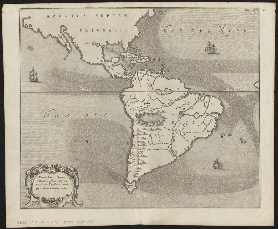
Regions and Seasons: Mariners have charted the oceans since the late 13th century. However, the 1670 map here is not a general sea chart, but is one of the first thematic maps produced. Thematic maps illustrate phenomena and related patterns, rather than locations or geographical features. When originally developed, thematic maps required mapmakers to create new techniques to display data. This map depicting ocean currents in the western hemisphere is by Athanasius Kircher, a Jesuit scholar, mathematician and mapmaker. Circulation of ocean waters and winds was one of the earliest subjects of thematic mapping, due to their navigational and commercial value to mariners.
- Creator:
- Kircher, Athanasius, 1602-1680
- Cartographer:
- Kircher, Athanasius, 1602-1680
- Publisher:
- Jansson, Jan, 1588-1664
- Publisher:
- Weyerstraten, Elizaeus, -1667?
- Date:
-
[1665–1678]
- Format:
-
Maps/Atlases
- Location:
-
Boston Public Library
Norman B. Leventhal Map & Education Center - Collection (local):
-
Norman B. Leventhal Map & Education Center Collection
- Subjects:
-
Ocean currents--America--Maps--Early works to 1800
America--Maps--Early works to 1800
- Places:
-
South America
South America
Atlantic Ocean
South Pacific
- Extent:
- 1 map ; 34 x 41 cm
- Terms of Use:
-
No known copyright restrictions.
No known restrictions on use.
- Publisher:
-
[Amsterdam] :
[Jan Jansson and Elizaeus Weyerstraten]
- Scale:
-
Not drawn to scale
- Language:
-
Latin
- Notes:
-
Map showing ocean currents around the Americas and some geographic features.
Relief shown pictorially.
From Kircher's "Mundus subterraneus," published in 1665, 1668 and 1678.
"Tomus I 155"--Upper right corner.
Includes illustrations of ships.
- Notes (date):
-
This date is inferred.
- Notes (citation):
-
Burden, 382
- Notes (exhibitions):
-
Exhibited: "Regions and Seasons: Mapping Climate through History" organized by the Norman B. Leventhal Map Center at the Boston Public Library, 2017.
- Identifier:
-
06_01_015946
- Call #:
-
G3291.C75 1665 .K57
- Barcode:
-
39999085942470


