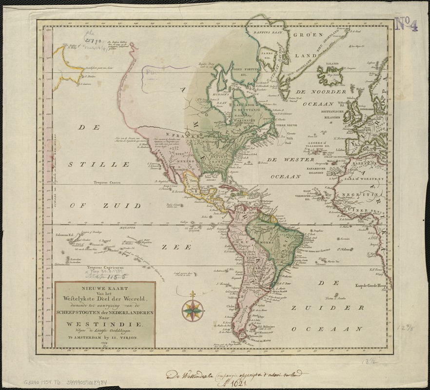
Nieuwe kaart van het westelykste deel der weereld, dienende tot aanwyzing van de scheepstogten der Nederlanderen naar Westindie : volgens de laatste ontdekkingen
This map is also available in American Revolutionary Geographies Online (ARGO), a collections portal especially built for material relating to the American Revolutionary War Era. Visit ARGO to learn more about this item and explore the historical geography of North America in the late eighteenth century.
Item Information
- Title:
- Nieuwe kaart van het westelykste deel der weereld, dienende tot aanwyzing van de scheepstogten der Nederlanderen naar Westindie : volgens de laatste ontdekkingen
- Creator:
- Tirion, Isaak.
- Date:
-
1754
- Format:
-
Maps/Atlases
- Location:
-
Boston Public Library
Norman B. Leventhal Map & Education Center - Collection (local):
-
Norman B. Leventhal Map & Education Center Collection
- Subjects:
-
America--Maps--Early works to 1800
Western Hemisphere--Maps--Early works to 1800
- Places:
-
North and Central America
South America
Mesoamerica (area)
North America (area)
South America
America
- Extent:
- 1 map : col. ; 34 x 35 cm.
- Terms of Use:
-
No known copyright restrictions.
No known restrictions on use.
- Publisher:
-
Amsterdam :
Is. Tirion
- Scale:
-
Scale [ca. 1:65,000,000. At equator]
- Language:
-
Dutch
- Notes:
-
Relief shown pictorially.
Appears in Tirion's Nieuwe en beknopte hand-atlas, 1744-[1769].
Includes notes.
- Identifier:
-
06_01_006000
- Call #:
-
G3290 1754 .T6
- Barcode:
-
39999059018984


