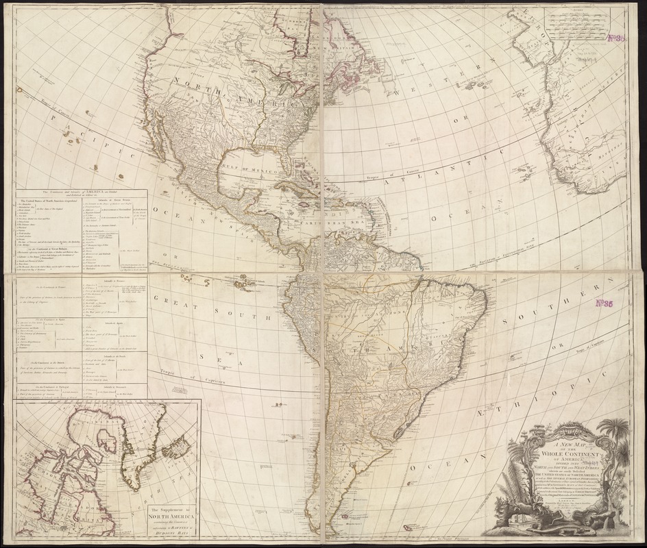
A new map of the whole continent of America, divided into North and South and West Indies : wherein are exactly described the United States of North America as well as the several European possessions according to the preliminaries of peace signed at Versailles Jan. 20, 1783
Item Information
- Title:
- A new map of the whole continent of America, divided into North and South and West Indies : wherein are exactly described the United States of North America as well as the several European possessions according to the preliminaries of peace signed at Versailles Jan. 20, 1783
- Creator:
- Sayer, Robert, 1725-1794
- Name on Item:
-
compiled from Mr. D'Anville's maps of that continent, with the addition of the Spanish discoveries in 1775 to the north of California & corrected in the several parts belonging to Great Britain, from the original materials of Governor Pownall, M.P.
- Date:
-
1786
- Format:
-
Maps/Atlases
- Location:
-
Boston Public Library
Norman B. Leventhal Map & Education Center - Collection (local):
-
Norman B. Leventhal Map & Education Center Collection
- Subjects:
-
America--Maps--Early works to 1800
Western Hemisphere--Maps--Early works to 1800
- Places:
-
North and Central America
South America
Mesoamerica (area)
North America (area)
South America
America
- Extent:
- 1 map : col. ; 104 x 119 cm.
- Terms of Use:
-
No known copyright restrictions.
No known restrictions on use.
- Publisher:
-
London :
Printed for Robt. Sayer
- Scale:
-
Scale ca. 1:11,500,000.
- Language:
-
English
- Notes:
-
Relief shown pictorially.
Hand colored outlines.
Mounted on linen.
Prime meridian: Ferro Island.
From Thomas Kitchin's a general atlas describing the whole universe. [1793].
Includes inset "The supplement to North America containing the countries adjoining to Baffins & Hudson bays" and tables showing European possessions.
- Identifier:
-
06_01_005971
- Call #:
-
G3290 1786 .S3
- Barcode:
-
39999059029155
- LCCN:
-
74693287


