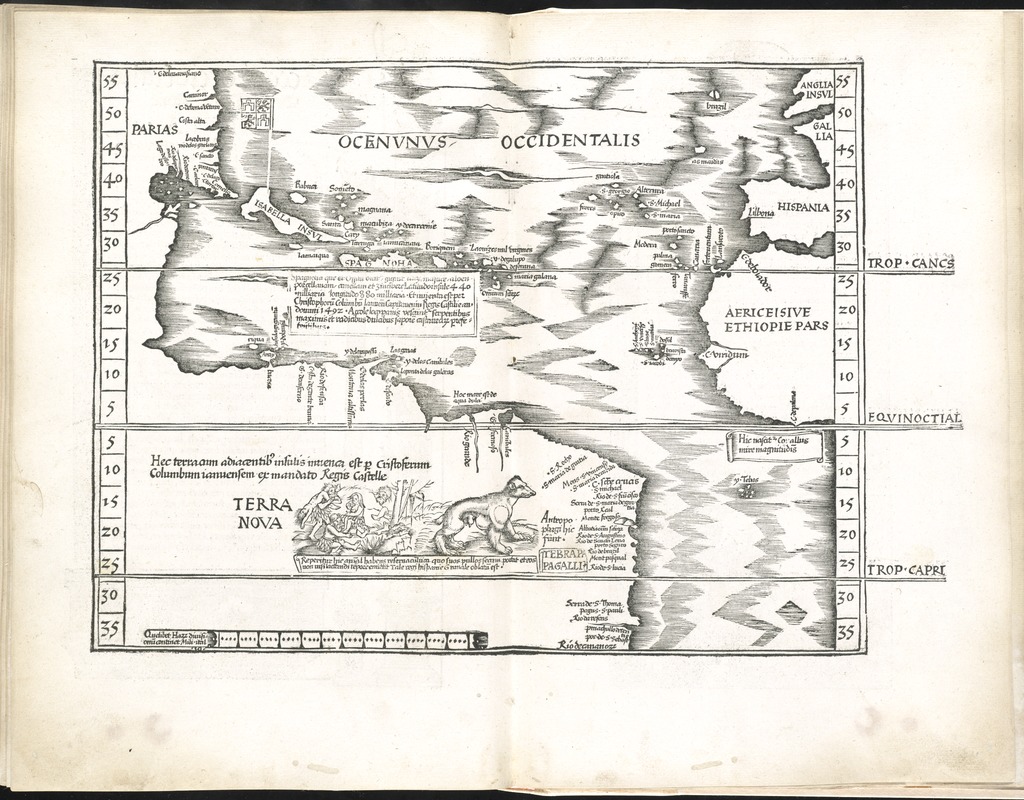
Oceani occidetalis seu terre nove tabula
Item Information
- Title:
- Oceani occidetalis seu terre nove tabula
- Title (alt.):
-
Ocenunus occidentalis
- Creator:
- Ptolemy, 2nd cent
- Date:
-
1525
- Format:
-
Maps/Atlases
- Location:
-
Boston Public Library
Norman B. Leventhal Map & Education Center - Collection (local):
-
Norman B. Leventhal Map & Education Center Collection
- Subjects:
-
Atlantic Ocean--Maps--Early works to 1800
America--Maps--Early works to 1800
- Places:
-
North and Central America
Mesoamerica (area)
North America (area)
Atlantic Ocean
South America
America
- Extent:
- 1 map ; 29 x 36 cm.
- Terms of Use:
-
No known copyright restrictions.
No known restrictions on use.
- Publisher:
-
Argentoragi [i.e. Strasbourg] :
Iohannes Grieningerus
- Scale:
-
Scale [ca. 1:40,000,000]
- Language:
-
Latin
- Notes:
-
Map of the Atlantic Ocean and the New World. This map shows the newly discovered islands in the Caribbean and the northern coastline of South America, since the first voyage of Columbus some 40 or so years earlier.
Relief shown pictorially.
Includes names of places and natural features.
Descriptive text within ornamental borders on verso.
Appears in the author's Geographia, translated by Willibald Pirckheimer, with annotations by Joannes Regiomontanus. Argentoragi [i.e. Strasbourg] : Iohannes Grieningerus, communibus Iohannis Koberger impensis excudebat, anno a Christi Natiuitate 1525 tertio Kal[endas] Apriles.
Text in Latin.
Cataloging, conservation, and digitization made possible in part by The National Endowment for the Humanities: Exploring the human endeavor.
Atlas scanned by Internet Archive http://archive.org/details/claudiiptolemaei00ptol
- Identifier:
-
06_01_007999
- Call #:
-
G1005 .P7 1525
- Barcode:
-
30000003787866