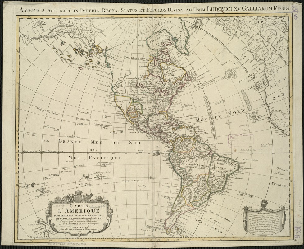
Carte d'Amerique divisées en ses principales parties
Item Information
- Title:
- Carte d'Amerique divisées en ses principales parties
- Creator:
- L'Isle, Guillaume de, 1675-1726
- Name on Item:
-
par G. Delisle, premier Geographe du Roy, rectifiée apres les nouvelles observations du Sr. d'Anville et autres Geographes.
- Date:
-
1774
- Format:
-
Maps/Atlases
- Location:
-
Boston Public Library
Norman B. Leventhal Map & Education Center - Collection (local):
-
Norman B. Leventhal Map & Education Center Collection
- Subjects:
-
America--Maps--Early works to 1800
Western Hemisphere--Maps--Early works to 1800
1774
- Places:
-
North and Central America
South America
Mesoamerica (area)
North America (area)
South America
America
- Extent:
- 1 map : col. ; 47 x 59 cm.
- Terms of Use:
-
No known copyright restrictions.
No known restrictions on use.
- Publisher:
-
Amsterdam :
Chez Covens & Mortier & Covens Junior
- Scale:
-
Scale [ca. 1:20,000,000].
- Language:
-
French
- Notes:
-
Map of North and South America showing line of demarcation of Pope Alexander VI in A.D. 1493 and Prime meridian fixed on Ferro, Canary Islands by declaration of Louis XIII. Relief shown pictorially.
In upper margin: America accurate in imperia, regna, status et populos divisa, ad usum Ludovici XV galliarum regis.
In lower right margin: J. Condet. sc.
In French.
- Identifier:
-
06_01_005970
- Call #:
-
G3290 1774 .L5
- Barcode:
-
39999059018935


