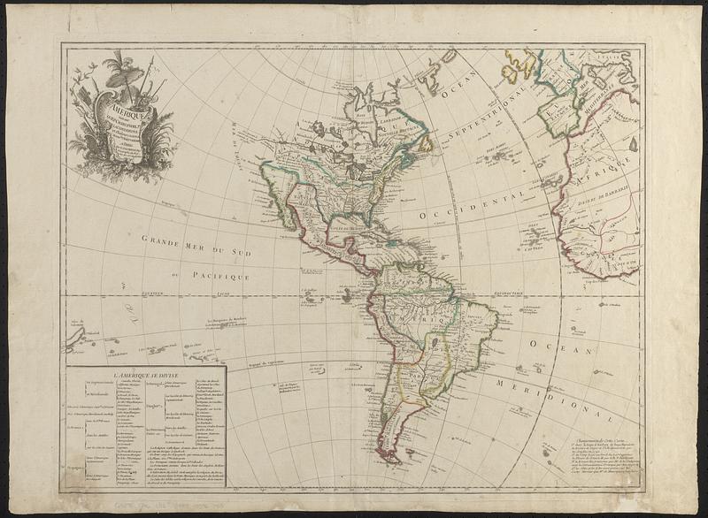
L'Amérique suivant le R.P. Charlevoix Jte, Mr. de La Condamine et plusieurs autres nouvle. observations
Item Information
- Title:
- L'Amérique suivant le R.P. Charlevoix Jte, Mr. de La Condamine et plusieurs autres nouvle. observations
- Cartographer:
- Le Rouge, Georges-Louis
- Contributor:
- Charlevoix, Pierre-François-Xavier de, 1682-1761
- Contributor:
- La Condamine, Charles-Marie de, 1701-1774
- Name on Item:
-
par le Sr. Le Rouge ing. géographe du roy
- Date:
-
1746
- Format:
-
Maps/Atlases
- Location:
-
Boston Public Library
Norman B. Leventhal Map & Education Center - Collection (local):
-
Norman B. Leventhal Map & Education Center Collection
- Subjects:
-
America--Maps--Early works to 1800
Western Hemisphere--Maps--Early works to 1800
Africa, West--Maps--Early works to 1800
Europe, Western--Maps--Early works to 1800
- Places:
-
Americas (area)
- Extent:
- 1 map : hand color ; 48 x 63 cm
- Terms of Use:
-
No known copyright restrictions.
No known restrictions on use.
- Publisher:
-
Paris :
Sr. Le Rouge ing., géographe du roy, rue des Grs. Augustines
- Scale:
-
Scale approximately 1:19,000,000 -- 1:40,000,000
- Language:
-
French
- Notes:
-
Prime meridian: Ferro.
State with "Changements de cette carte" in lower right but without Tchirikow's discoveries in the northwest.
Shows "Ligne de Demarcation Selon la Bulle du Pape Alexandre VI."
Table at lower left identifies American possessions of various European powers.
Extends westward to the Isle de Salomon and eastward to western Africa and Italy.
Decorative title cartouche depicting tools and vegetation in upper left.
- Identifier:
-
06_01_018482
- Call #:
-
G3290 1746 .L42
- Barcode:
-
39999085967915


